
Walking Volunteers Map Greater Sydney
The Walking Volunteers (WV) were formed in 2004 when the North Sydney Walking Volunteers and the Hunters Hill Walkers came together to walk and map a continuous walking route around Sydney Harbour and along the coast from Barrenjoey to Port Hacking. You can see most recent maps here.
The group worked with the Department of Planning, councils, community groups and the Sydway Mapping Division to prepare nine brochures for this continuous walking route. Over 400,000 of these were printed and distributed. The brochures were also available as a download from the Sydney Coastal Councils Group web site which received over 30,000 visitors a month including 2,300 from overseas. The Sydney Harbour & Coast maps were also available as a free App (Sydway Walker) and over 270 of these apps were downloaded every month.
Barrenjoey to Parramatta
Maintaining a supply of up-to-date printed maps has proved difficult so the Walking Volunteers decided to adopt a ‘digital’ solution. Since 2014 they have been re-walking their routes, mapping them on GPS, ‘normalising’ them with Google Earth and loading onto GoogleMyMaps to provide walkers with an online, scalable walking map of the Sydney metropolitan area.
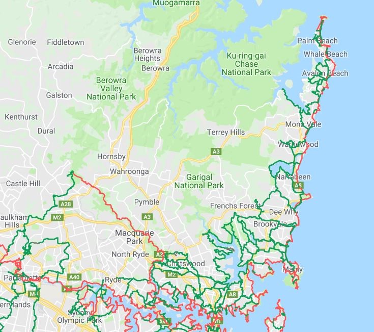
The WV maps are now structured to feature the main continuous walking routes (shown in red) focussing on the coast, harbour and river with links to the Great North Walk and the Federation Track. Their most recent project has been the establishment of the Great West Walk from Parramatta to Penrith and Katoomba that links major green spaces like Parramatta Park, Western Sydney Parklands and Wianamatta Regional Park with Blue Mountains National Park and provides one-day walks from station to station on the Western Railway Line.
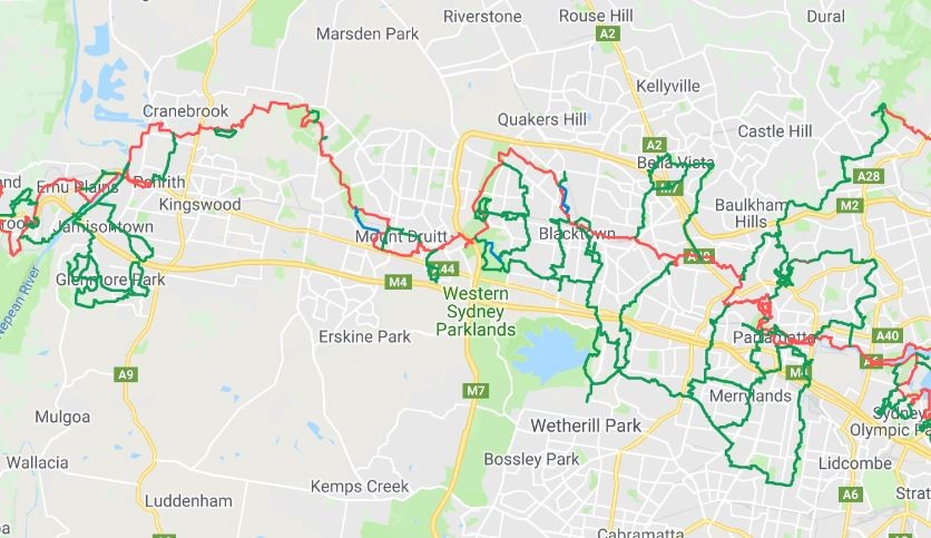
Parramatta to Penrith
Complementing these main red routes are loops and links, shown in green, spreading into adjacent neighbourhoods for shorter local walks and connections to transport, community nodes and points of interest.
Whenever possible. the routes identified are existing walking tracks or paths built by councils, National Parks and other land managers. In places the maps indicate future projected routes and these are indicated in blue.
The project is ongoing with the aim of providing a metropolitan-wide walking network in line with the government’s concept of a Green Grid linking the city’s green spaces.
Using the Maps
You can zoom in to whatever scale you wish and print off whatever area you are interested in, using the Snipping Tool. The map may also be downloaded onto your smartphone or tablet.
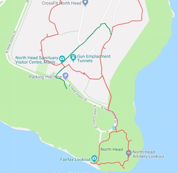
North Head
Download
To download the map just click on this link:-
https://drive.google.com/open?id=1WPb6QnNn9Wfgr61qiv6dPVKW2SI&usp=sharing
Personal Computer
Just click on this link and it will open. Use the +/- button in the bottom LH corner of the map to zoom into any scale that suits you. If you want to view the map in Satellite mode, use the slide on the LH panel and slide down to the satellite button in the LH corner of this panel.
The red lines on the map are the main walking routes. The green lines are the local links and loops that are so important to local walkers. The blue lines are future walking routes. There are also layers for:
- Toilets/water fountains
- B-line Bus Stops on the Northern Beaches
- T-way Bus Stops in Western Sydney
Just click the box on these layers when you need them.
Smartphone/Tablet
You can also download the link onto a smartphone or tablet:-
On an Android phone (Google, Samsung, LG, Sony, HPC, Huawei, Xiaomi, Acer and Motorola) click on this link. You may be asked if you want to open the map in Google Maps. If so, enter ”Y”. If it doesn’t ask you, close the direct link and:-.
Click on the Google Maps app .
Tap Menu Your Places Maps.
Tap the map “Sydney Walking Tracks” which should now be on the Maps menu
You will now be able to follow any walking route as it will show you your location on the map,
On an Iphone or Ipad just click on this link and the map will open but it will not show your location on the map.
Feedback
We would appreciate any feedback on the app or the walking routes. Also, please feel free to pass on the link to anyone who might use it.
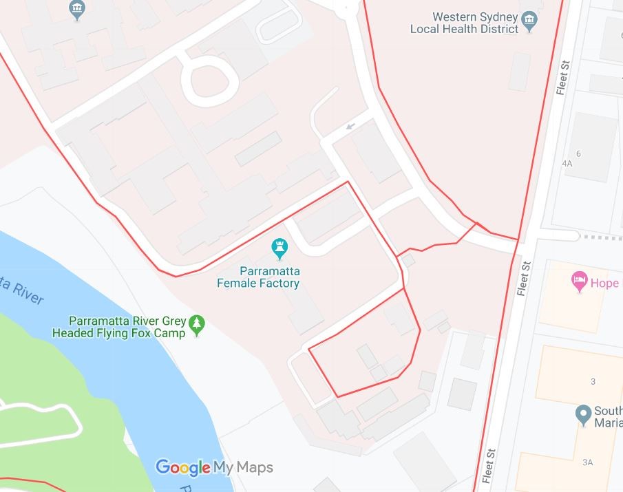
Parramatta Female Factory