main

Tag Archives | Warragamba Dam

Floods Ignite Raising Warragamba Dam Wall Debate

In late March 2021 an extreme rain event on the Australian East Coast caused serious flooding which endangered people and property in many areas including the Hawkesbury-Nepean Valley on Sydney’s outskirts. The Hawkesbury-Nepean Valley flood highlighted the dangers of urban development in flood-prone areas given the high likelihood of more climate change-induced flood events in future.

The rain event and resulting floods have intensified debate on the controversial proposed 14 metre raising of Warragamba Dam Wall.  Many experts and conservationists contend that the most extreme floods are unlikely to be stopped by raising Warragamba Dam wall. Flooding in the Hawkesbury-Nepean Valley comes from other river/creek sources in addition to water flowing over Warragamba Dam wall. In addition the geography of the Hawkesbury-Nepean area restricts the amount of water that can flow out of the Valley.

The Colong Foundation for Wilderness states that the raised dam wall proposal is being driven by pressure from developers.  As part of the Warragamba Dam wall raising proposal, Infrastructure NSW plans to house an additional 134,000 people on the Hawkesbury-Nepean floodplain in coming decades. The Foundation states that people in new and existing residential developments in the Valley will not be safe from future extreme floods even if the Warragamba Dam wall were to be raised.

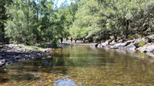
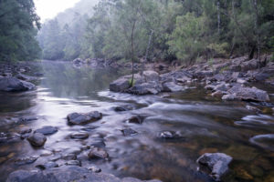
The Foundation states that the proposed dam wall raising will lead to flood water inundation of World Heritage listed Blue Mountains National Parks and wilderness streams and desecration of rare and ancient natural heritage and Indigenous cultural sites.

Adding weight to arguments against the raised dam wall proposal, the Australian Insurance Industry recently withdrew their support for the Proposal due to concerns over the probable loss of important cultural sites and natural habitat. The Industry suggested that the State Government should investigate alternative measures to mitigate flood risk in the Hawkesbury-Nepean Valley.

Alternative flood mitigation actions available to the State Government include improving floodplain evacuation routes such as the Castlereagh Connection, pre-emptive dam-water release water and relocating people in the most flood-prone areas. NSW Deputy Premier John Barilaro recently stated that alternatives to the dam wall raising need to be considered including lower water levels and building desalination plants for water supply.


0

Raising Warrangamba Dam Wall Impacts

The NSW Nature Conservation Council (NCC) says that up to 1000 hectares of world heritage area and 3700 hectares of national park will be inundated for up to two weeks by raising Warragamba Dam wall.

The NCC is very concerned about 58 threatened species within the area already impacted by  recent bushfires including the koala, critically-endangered regent honeyeater, greater glider, broad-headed snake, brushtail rock wallaby, eucalyptus benthamii and eucalyptus glaucina.

In January 2020 the World Heritage Centre asked the Commonwealth Government to provide an update on the state of conservation of the Blue Mountains heritage area after more than 80 per cent was ravaged by fire last summer.

In response, the Commonwealth Government said Water NSW would re-assess bushfire impacts and include them in the pending environmental impact statement (EIS).  However, to date the draft EIS states Water NSW has no intention of re-assessing the area impacted by fire.

Ornithologist Martin Schulz said last summer’s Green Wattle Creek blaze burnt most of the southern Blue Mountains leaving only a small unburnt section which will likely be flooded by the Dam. “The ecosystems are different and parts will be in recovery for decades. How can an assessment done before the fires be valid? Dr Schulz asked. The fires changed so many things,” he said.

The draft EIS shows before the bushfires only 15 hours of spotlight searches were conducted for the koala, greater glider and squirrel glider in the inundation area, despite a 61 hour recommendation. Dr Schulz says this is “bafflingly low” especially for koalas given the area is so vast and how hard they are to find.

The time spent gathering sample collections of the squirrel glider and brush-tailed phascogale also didn’t meet the guidelines with only 1820 nights completed but 3224 nights recommended. The assessment of the large-eared pied bat was 11 times less the suggested amount with traps laid for 78 nights yet 864 recommended. “The low survey effort for the large-eared pied bat is particularly disappointing,” Dr Schulz said.

Community group Give a Dam spokesman Harry Burkitt has called on the Federal Government to intervene.

“The barrow-loads of leaked material now in the public domain show (Western Sydney) Minister Stuart Ayres and Infrastructure NSW haven’t even bothered following NSW guidelines, let alone those required under federal law or by UNESCO,” he said.

Infrastructure NSW, which oversees the project, says feedback from state and federal governments on the draft EIS is important in developing the final version. “The final decision on the dam raising proposal will only be made after all environmental, cultural, financial and planning assessments are complete,” a spokeswoman said.

The World Heritage Committee, which selects sites for UNESCO’s world heritage list, has expressed concerns over the project and will review the EIS before the Federal Government’s decision.

Give a Dam about World Heritage Wilderness

The Colong Foundation for Wilderness is concerned that the insurance industry and developers are lobbying politicians to raise Warragamba Dam wall [1]. The Foundation believes that they are primarily doing this because raising the dam wall would generate 40,000 additional home insurance policies in the Hawkesbury-Nepean Valley resulting from new floodplain developments [2].

In response, the Foundation is lodging a shareholder resolution to QBE’s Annual General Meeting (AGM) requiring them to protect our Blue Mountains World Heritage listing.

The Foundation plans to submit the following resolution to QBE:

“Shareholders request that the company develop a policy which guarantees QBE does not invest in, insure or advocate for any projects or works that could result in negative impacts occurring within the boundaries of a World Heritage or Ramsar property.”

The Foundation states that to get world heritage protection on the agenda, they need 100 QBE shareholders to sign on to our resolution on world heritage before Friday.

The Foundation believes they are so close to reaching 100, and are asking that if you own QBE shares could you please sign on to this form to help get them across the line. If you experience any trouble during sign on, or have any questions, please contact the Foundation at hello@giveadam.org.au

[1] Insurance Council of Australia
[2] Infrastructure NSW

Warragamba Dam wall

If the Warragamba Dam wall is raised by 14 metres, the dam will hold over two additional Sydney Harbours, 4,700 hectares of World Heritage listed National Parks, 1,800 hectares of declared Wilderness Areas and 65 kilometres of Blue Mountains’ wild rivers would be inundated and destroyed.

It is arguably the most protected natural landscape in Australia. The Coxs, Kowmung, Kedumba, Natti, Wollondilly and Little Rivers would be flooded for months at a time.

Many of our Club members throughout NSW visit these areas.

Without our support, internationally significant environments that are recognised in the Blue Mountains World Heritage listing would die from sedimentation, erosion and invasion of exotic plants.

There are 48 threatened plant and animal species which inhabit the proposed inundation area.

Species such as the vulnerable Camden White Gum and the Kowmung Hakea are predominantly found within the inundation area, with the dam raising likely pushing many species close to extinction.


The area of proposed inundation is home to hundreds of Indigenous heritage sites.

Delicate rock art and marker sites will be forever destroyed if they are flooded by the raised dam for any length of time.

“Our history and our stories are in the landscape that surrounds Lake Burragorang. When Warragamba Dam flooded the valley in 1960, our lands and cultural sites were flooded. We do not want to see this story repeated with the remaining sites. Each time we lose a site, we lose part of our identity.”

– Kazan Brown

Gundungurra traditional owner and Warragamba resident


Information and photos courtesy of the Colong Foundation for Wilderness.

For more information, visit their website.