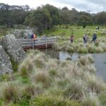
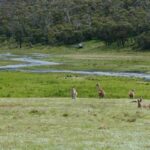
Settlers Track Walk, Namadgi National Park, 1 November 2020 walk report by Luke Mulders, Brindabella Bushwalking Club
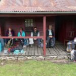
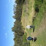
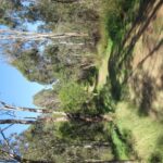
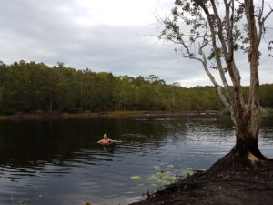
Setters Track was an utterly delightful walk led by Bill Gibson in southern Namadgi NP. The weather was cool with fresh wind and no rain. After a drive of 90 minutes from Kambah and a short car shuffle, our group of 12 happy walkers was underway on the 16 km round trip exploring the delightful huts in this totally stunning, unburnt section of Namadgi NP.
The walk was mostly on management trails which enabled side to side walking and lots of socialising. Recent heavy rains provided flowing creeks and waterlogged flats. There were some early wildflowers (billy buttons) and multiple pockets of sprouting mushrooms.
At the walk end, to cap off the beautiful surroundings, we were all treated to delicious banana/passionfruit cake and scrumptious fruit-mince tart. What a way to finish!!
Our club of the month: Brindabella Bushwalking Club
The Brindabella Bushwalking Club (aka. BBC), is based in Canberra, ACT, has around 400 members, and offers a wide range of walking opportunities. These include half-day and full day walks on Wednesdays, and full day walks on Saturdays and Sundays to suit all standards of walkers.
Bushwalks suitable for families with young children are also offered. Day walks usually take place in Canberra, rural areas of the ACT including Namadgi National Park, and nearby New South Wales. The club is a member of Bushwalking NSW and supports our Policy on Natural Areas.
Contact the BBC today to try out a walk, and discover the pleasures of walks around the ACT. You might also get some cake as a reward! Brindabella Bushwalking Club
While walking volunteers mapped the northern section of Western Sydney Parklands a few years ago, they have recently mapped the Parklands southern section from Prospect Reservoir to West Hoxton. Walking routes are now available on their “Sydney Walking Tracks” online map.
If you haven’t walked the Parklands before, you are in for a welcome surprise!
South of Prospect Reservoir, the Parklands run along Devils Back Ridge with some wonderful views east to the City and west to the Blue Mountains including one of the best ridgetop panoramas in Sydney at The Beauty Spot.
Since 2008 the Parklands Trust have re-generated 13 square kilometres of Cumberland Plain bushland with 350,000 native trees and plants. Many of these plantings have matured into wonderful treescapes that provide shade on the bitumen shared paths network and walker-friendly slashed paths. The Trust has signposted several walking loops but the walking volunteers map will keep you on track if you want to venture further afield and stay off the shared paths.
Now is the perfect time to walk this brilliant parkland!
If you have already downloaded “Sydney Walking Tracks” map onto your smartphone, tablet or PC these routes will automatically appear. If you haven’t downloaded the map yet, it is available on the Walking Volunteer’s website .
The Parklands Trust is running a “Get Back on Track Challenge” in conjunction with NAB Runwest. See here for details.
Have you been feeling unmotivated to bushwalk this summer due to hot weather? To help you find some inspiration we have put together a list of cool walks for a hot day. Make sure you take lots of water and maybe choose a walk with a waterhole or beach along the way for a refreshing swim. You could also consider leaving for your walk early to beat the heat of the day or choosing a shorter, shady walk.
Burbie Canyon Walking Track – Warrumbungle National Park
Burbie Canyon Walking Track in Warrumbungle National Park is an easy 2km walk past a creek and through a sandstone gorge and is great for bird watchers. Read more.
Cape Byron Walking Track – Cape Byron State Conservation Area
You can enjoy spectacular views on the Cape Byron Walking Track which takes you to the lighthouse through rainforest, beach, grassland and clifftop. It is a fairly hard 3.7km loop track with lots of stairs and steep sections. If you prefer a shorter walk the track can be accessed at multiple locations. Cool off along the way with a refreshing swim in the ocean. Read more.
Dammerels History Walk – Moonee Beach Nature Reserve
Dammerels history walk is an easy 1.9km return walk where you can learn about the history of South Solitary Island and enjoy the scenic views. Keep an eye out for native wildlife as the reserve is home to eastern grey kangaroos, swamp wallabies and many bird species. Read more.
Fairfax Heritage walking track – Blue Mountains National Park
The Fairfax Heritage walking track is an easy 1.8km (one way) walk that is great for families and is wheelchair friendly. Enjoy spectacular views, majestic gum trees and beautiful wild flowers along the way. Read more.
Banks-Solander track – Kurnell area, Kamay Botany Bay National Park
The Banks-Solander track offers an easy 0.7km loop walk and the chance to observe native plants that were first recorded by Captain Cook’s botanists in 1770. If you prefer a longer walk the Banks-Solander track links to Cape Baily track and Yena trail. Read more.
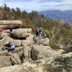
Bald Rock Summit Walking Track, Bald Rock National Park
Bald Rock National Park is located near Tenterfield and features granite outcrops, walks and amazing scenery. The Bald Rock Summit Walking Track takes you up the largest granite rock in Australia and you will be rewarded with spectacular views across the park. You can choose either Bungoona walk which is medium difficulty or the harder option Rockface walk. More info here
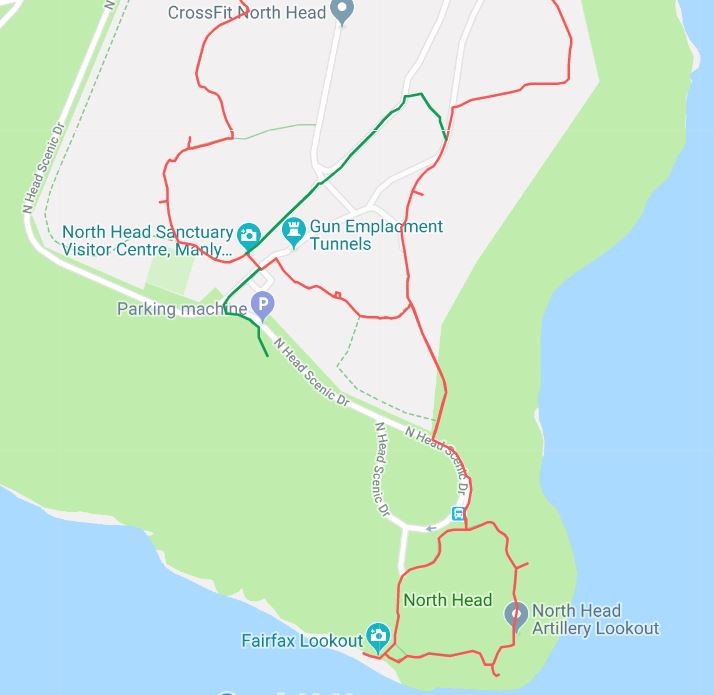
Tomaree Head Summit Walk, Tomaree National Park
Tomaree Head Summit Walk is a 2.2km return walk that offers fantastic views to nearby Cabbage Tree and Boondelbah islands and the opportunity to view historic WW2 gun emplacements. More info here.
Grove Creek Falls Walking Track, Abercrombie Karst Conservation Reserve
Grove Creek Falls Walking Track is a 6km walk along Grove Creek to a lookout across the spectacular Grove Creek Falls. Highlights include birdwatching along the track including colourful parrots and rosellas. More info here.
Gap Beach Walking Track, Hat Head National Park
Gap Beach walking track is a challenging 6km walk with highlights including birdwatching, swimming and scenic views. Hat Head National Park is located near South West Rocks. More info here.
Minyon Falls Walking Track, Nightcap National Park
Minyon Falls Walking Track is a challenging 13km return walk through World Heritage listed rainforest in Nightcap National Park, Northern NSW, to the spectacular Minyon Falls with scenic views of the dramatic cliffs. Look here for more details.
Have a look here for more ideas for NSW day walks.
29 December 2019 – 5 January 2020 Trip Report by Anne Turner – for joint SPAN OUTDOOR CLUB and NSW NORDIC SKI CLUB walk
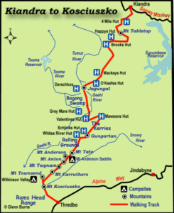
In October I planned a New Year Snowy Mountains adventure walk. What about Paddy Pallin’s famous K2K route? Kiandra to Kosciuszko? After contacting SPAN Bushwalking Club and Nordic Ski Club I quickly got 3 willing partners in crime.
We studied maps and websites and John Chapman’s great Australian Alpine Walking Track (AAWT) book (which goes from south to north rather than north to south). We decided on seven nights, the last night camping just out of Dead Horse Gap, with a short walk the next day then drive to Thredbo for breakfast (proper breakfast, muesli would be banned!)
We would start at Kiandra and mostly follow the AAWT to Dead Horse Gap. After Mackay’s Hut we would go off track (a break from fire trails), around the eastern side of Jugungal along Bogong Creek and Jugungal Saddle then up Jagungal. We would then go south to Mawsons Hut, and camp near water somewhere. Then along the Kerries and to Gungartan, across to the Rolling Grounds over Consett Stephen Pass and along the main range finishing with Rams Heads. What a plan – I got excited every time we looked at the maps!
The weather looked clear but bushfires were a worry as it had been very hot and we were in an extended drought. We discussed whether or not to go and decided to proceed as the park was open and we would keep our wits about us.
We didn’t have suitable car so would drive a hire car, leave it at Dead Horse Gap, and take a transfer from Dead Horse Gap to Kiandra on Sunday 29th December. We left Sydney on 28th December and on Sunday morning were on track by 11.30am walking towards 9 Mile Creek. There was water in the creeks which was good news. The march flies were around, not too bad at the beginning, but worse as it heated up.
Sue had given us a challenge to make up a limerick or haiku about each member of the walk. We were not particularly successful but there were some very funny conversations. The downsides were our heavy packs, overshooting 9 Mile Creek and walking up a horrible hill just to turn around and go straight back down. I’m not sure if singing ‘The Grand Old Duke of York’ helped anyone’s spirits at that point or not!
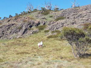
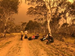
Day 2 saw us climbing Tabletop Mountain (sans packs) with the outline of Jagungal visible though smoke haze to the south. A pair of walkers we knew were going our way and joined our group. We got to Happy’s Hut in the afternoon and enjoyed its shady veranda while overhead was smoke and the red sun. During the afternoon we were joined by Catherine, walking solo, and later Ryan and his father in law Peter.
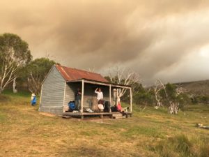
New Year’s Eve, 31 December 2019, was very warm and concerningly there were burnt leaves falling from the sky. While the sky overhead had a big billow of high smoke coming from the north east, the air around us was pretty clear. We decided to walk to Mackay’s Hut where we could exit the park if things deteriorated.
Catherine headed out before us and Ryan and Peter left shortly after us. As we walked on Tolbar Road and Grey Mare Fire Trail the light changed from clear to red then dark and at times there was a surreal brightness without shadows. The smoke cloud got bigger and darker and burnt leaves kept falling. We all started looking at each other and wondering if we were doing the right thing. We planned to walk past Mackay’s Hut to O’Keefes Hut and access Farm Ridge or Round Mountain fire trails if necessary.
As we rested Catherine came striding towards us having turned around after making contact with the outside world at a high point. She told us that there were fires to the west of us and Bega was on fire. She had decided it was time to go east and not leave it until things went wrong and she become a burden on emergency services. As we had been considering the same thing we quickly decided to join her.
We walked back to the Grey Mare Trail and Tolbar Road crossroads and the sky kept getting darker with occasional rain showers, an eerie silence and smoke haze affecting visibility. After we had been walking for about 30 minutes we ran into Ryan and Peter.
We drew heavily on Catherine’s local knowledge of the park as we discussed our options and looked at maps. Walking back towards Kiandra to Broken Dam Hut then to the highway was one option but it would take us north west towards the smoke cloud so we decided against it. We decided to go down to Eucumbene Cove was too far and instead settled on walking north east down the Tolbar Road to Providence Portal (a little cabin community on the northern arm of Lake Eucumbene). It was close to Adaminaby and we thought it should have people there and up to date information.
The afternoon was now cool and breezy – nice walking weather if there had not been a raging bushfire nearby! We had enough rain at two points for raincoats and rolling thunder all afternoon. We heard a chopper at one point but we were in trees so couldn’t see it and it couldn’t see us. We saw a burst of new smoke on the skyline behind us and to the north and another way south of us. It must be lightning strikes we theorised and were glad to be getting out of there.
We walked about 35kms on our third and final day. Fortunately the end of Lake Eucumbene wasn’t a lake anymore as there was not enough water. Peter gave us directions and the river was so shallow and divided into tributaries that we would be able to easily wade across. This was great news as none as us had enough in the tank to do the huge walk around. It was a beautiful flood plain with lots of birds, kangaroos and white daisies. We all breathed a sigh of relief as the cabins of Providence Portal grew closer.
At about 7.30pm we were greeted by the park owner Hans riding out on his quad bike greeting us with ‘Where the bloody hell did you guys come from?’ We discovered the SES had evacuated the park an hour before. Hans got on the blower and we overheard him saying, ‘I’ve got 9 walkers that have just walked out of the bush – what am I going to do with them?’ He didn’t get an answer immediately, so we camped there the night.
We woke up to a plan. Some park residents and Hans would drive us to Adaminaby. It was New Year’s Day and the town was deserted. We then managed to get rides to Cooma evacuation centre. Ryan and Peter got a ride from Cooma back to Wagga with a friend.
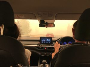
Cooma was very busy with lots of smoke and traffic as everyone holidaying south of Bateman’s Bay were leaving the fire zones through Cooma.
Catherine had organised for our drivers to be taken to the cars so they could collect the rest of us. Finally at 5pm we left Cooma and got back to Sydney around 11.30pm relieved to see home and a bed.
Today, the 9th January 2020, Fires Near Me advises the fires have cut through the northern section of the park – the area we were walking. Happy’s Hut looks like it is gone, the historic Kiandra Court House is gone and Providence Portal is surrounded by fire. Watching the horror of the fires spread over the coast and alpine areas we are so glad to be out. I was very glad to be with a calm level headed group who carefully considered the situation and our options and pooled their knowledge – thank you Catherine, Phil, Sonia, Sue, Paul, Sandra, Ryan and Peter.
Some other points we reflected on afterwards:
The superior phone coverage of Telstra in isolated areas
Between the group of 9 we had 4 PLBs
The Roof Top Map gave us a bigger area in one view than looking at several toppos to make decisions
Our phone batteries ran out – write your key phone numbers, personal and things like SES and National Parks down in your first aid kit
Ryan had a battery pack to refresh his phone – a weight consideration, but very useful
Where we had signal, we used Telstra phones to let contacts and the SPAN president know we were OK and what our plan was. We also contacted National Parks with the same news and told them where our cars were so they were not concerned for their owners. And then of course we followed up once we were ‘out’.
Next time I would lodge a National Parks Trip Intention form. While it isn’t a requirement, it would have helped.
As we all know during November and December 2019 prolonged drought and hot dry conditions lead to devastating bushfires along the east coast of Australia. The scale of the ongoing climate emergency has been unprecedented with disastrous consequences for the environment and native animals, people living in the bush, volunteer firefighters defending our communities and air quality in our cities and towns.
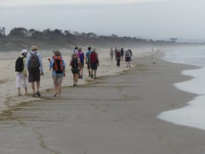
The resulting closure of National Parks has also meant lean times for those of us wanting a bushwalk! A quick glance at the Northern Rivers Bushwalkers (NRBC) calendar in November 2019 revealed a list of walks cancelled due to fire. Given this it seemed that beach walks provided the perfect alternative walk solution. So when Michelle from the NRBC organised a summer celebratory walk from Belongil Beach to Tyagarah Tea Tree Lake my sister and I were really keen to participate.
We were assured that the Tyagarah Tea Tree Lake was ‘safe’ with all visitors once again clothed and decent thanks to the Byron Shire Council cracking down on nudity and inappropriate behaviour in the area. Read hereabout the Lake’s controversial history.
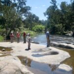
Our walk started early atthe Treehouse on Belongil near Byron Bay. After a quick coffee we headed up the beach for the walk to Tyagarah Beach and the Lake. Along the way we passed the opening to Belongil Creek and were told that before the drought this section of beach was often a creek crossing. Sadly this was no longer the case with water at very low levels and a great expanse of firm sand across the mouth of the creek.
Eventually we reached Grays Lane, a dirt road which leads to the Lake through Tyagarah Nature Reserve. The Reserve protects a number of coastal endangered ecological communities and threatened plant species which you can read more about here. After a short break in the picnic area we proceeded through the Reserve to the Tyagarah Tea Tree Lake.
On reaching the Lake our breaths were taken away by its stunning beauty and peaceful serenity. The Lake is framed by picturesque native coastal bushland with its cool waters stained by the healing oils of the surrounding tea trees. We settled down next to the Lake for a picnic lunch with many of us declaring we would wait to swim in the ocean on the return journey despite being hot after our walk. However once one person started swimming in the lake its appealing coolness was impossible to resist and soon enough many of us were gliding and relaxing in the water.
My sister Michele enjoying a cool swim in Tyagarah Tea Tree Lake
As we started the walk back along the clothing optional section of Tyagarah Beach the nudist visitors were in their full glory basking in the hot sun. My sister and I couldn’t help but notice with amusement the stark contrast of our bushwalking posse outfitted from head to toe in protective gear trudging dutifully through the assortment of cavorting naked sun worshippers!
Our walk was approximately 9km in distance once we had returned to the Treehouse on Belongil. Overall it was a very enjoyable morning out with a satisfying walk punctuated by a refreshing swim and the opportunity to visit new areas along the way. Thanks very much to Michelle from NRBC for organising this alternative beach walk event. Click here to find out more about the NRBC and what activities are on.
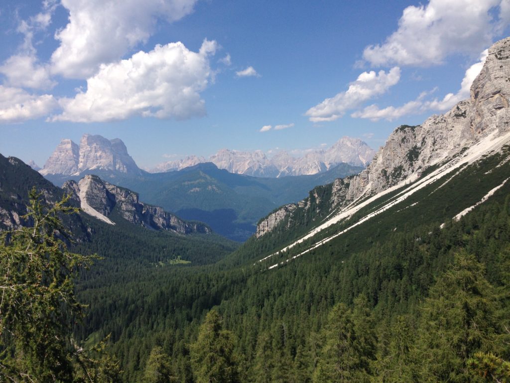
One of the wonderful things about walking in Europe is the accommodation available to walkers. Amazingly, this remote mountain refuge (Rifugio Pramparet), on stage 9 of the most beautiful walk in Europe, had the most interesting and delicious food of all rifugios on the trip!
Local communities and mountaineers have been walking these routes for generations. So to make it all a lot easier, they have built places to stay called rifugios (refuges). Rifugios provide bunkbed accommodation, a cooked breakfast and dinner, alcoholic beverages, cakes, and a packed lunch. To top it off you can often even get a shower … though some of them are cold!
All this in a cozy hut, high in the mountains surrounded by amazing beauty. The speck in the middle of this incredibly steep forest is Rifugio Vassoler:
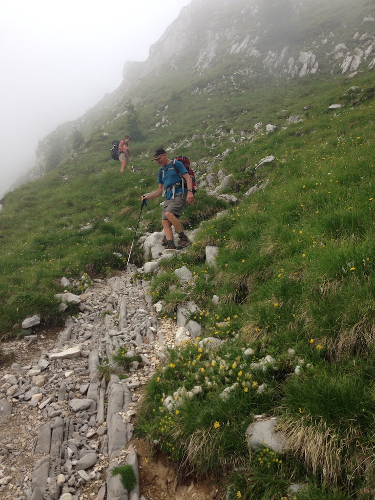
All of these luxuries can reduce the weight of your pack to a sleeping sheet, towel, your walking snacks, toiletries, and the gear you will need for the wide range of weather and track conditions you can encounter in the mountains. But don’t forget your walking sticks – they are essential equipment for the Alta Via 1 walk which is unbelievable steep in places:
The best way to learn how to lighten your pack is by joining a bushwalking club like the Coast and Mountain Walkers (CMW) and heading out on some overnight walks with them. Super-experienced bushwalking club members, like those from CMW, have so many tips and tricks for keeping you comfortable and happy in all conditions out in nature 🙂
Having that kind of experience behind you means you’ll enjoy your trip so much more. Nothing beats knowing how to thrive in the wild. It’s like opening a doorway to a world of adventure.
The other thing you can learn in a bushwalking club, is how to pack a light meal and save yourself some money for more trips like this! Then lunch can be a picnic spread out in the middle of all that beauty!
Here is where you can find a club near you that will help you discover the most beautiful places to walk in NSW, the ACT and the world: our clubs.
The Walking Volunteers (WV) were formed in 2004 when the North Sydney Walking Volunteers and the Hunters Hill Walkers came together to walk and map a continuous walking route around Sydney Harbour and along the coast from Barrenjoey to Port Hacking. You can see most recent maps here.
The group worked with the Department of Planning, councils, community groups and the Sydway Mapping Division to prepare nine brochures for this continuous walking route. Over 400,000 of these were printed and distributed. The brochures were also available as a download from the Sydney Coastal Councils Group web site which received over 30,000 visitors a month including 2,300 from overseas. The Sydney Harbour & Coast maps were also available as a free App (Sydway Walker) and over 270 of these apps were downloaded every month.
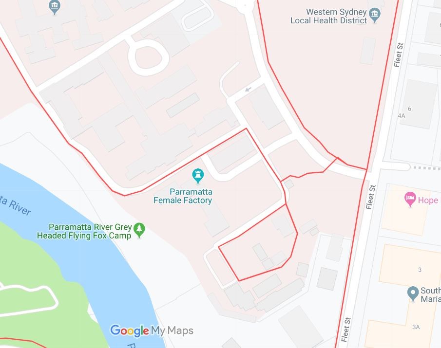
Barrenjoey to Parramatta
Maintaining a supply of up-to-date printed maps has proved difficult so the Walking Volunteers decided to adopt a ‘digital’ solution. Since 2014 they have been re-walking their routes, mapping them on GPS, ‘normalising’ them with Google Earth and loading onto GoogleMyMaps to provide walkers with an online, scalable walking map of the Sydney metropolitan area.
The WV maps are now structured to feature the main continuous walking routes (shown in red) focussing on the coast, harbour and river with links to the Great North Walk and the Federation Track. Their most recent project has been the establishment of the Great West Walk from Parramatta to Penrith and Katoomba that links major green spaces like Parramatta Park, Western Sydney Parklands and Wianamatta Regional Park with Blue Mountains National Park and provides one-day walks from station to station on the Western Railway Line.
Parramatta to Penrith
Complementing these main red routes are loops and links, shown in green, spreading into adjacent neighbourhoods for shorter local walks and connections to transport, community nodes and points of interest.
Whenever possible. the routes identified are existing walking tracks or paths built by councils, National Parks and other land managers. In places the maps indicate future projected routes and these are indicated in blue.
The project is ongoing with the aim of providing a metropolitan-wide walking network in line with the government’s concept of a Green Grid linking the city’s green spaces.
Using the Maps
You can zoom in to whatever scale you wish and print off whatever area you are interested in, using the Snipping Tool. The map may also be downloaded onto your smartphone or tablet.
Just click on this link and it will open. Use the +/- button in the bottom LH corner of the map to zoom into any scale that suits you. If you want to view the map in Satellite mode, use the slide on the LH panel and slide down to the satellite button in the LH corner of this panel.
The red lines on the map are the main walking routes. The green lines are the local links and loops that are so important to local walkers. The blue lines are future walking routes. There are also layers for:
Toilets/water fountains
B-line Bus Stops on the Northern Beaches
T-way Bus Stops in Western Sydney
Just click the box on these layers when you need them.
Smartphone/Tablet
You can also download the link onto a smartphone or tablet:-
On an Android phone (Google, Samsung, LG, Sony, HPC, Huawei, Xiaomi, Acer and Motorola) click on this link. You may be asked if you want to open the map in Google Maps. If so, enter ”Y”. If it doesn’t ask you, close the direct link and:-.
Click on the Google Maps app .
Tap Menu Your Places Maps.
Tap the map “Sydney Walking Tracks” which should now be on the Maps menu
You will now be able to follow any walking route as it will show you your location on the map,
On an Iphone or Ipad just click on this link and the map will open but it will not show your location on the map.
Feedback
We would appreciate any feedback on the app or the walking routes. Also, please feel free to pass on the link to anyone who might use it.
One of the awesome aspects of being a member of a bushwalking club is discovering new places to walk and knowing what are the most beautiful and amazing places to explore. By joining a club walk, you often save yourself weeks of time researching destinations, maps, routes, access logistics, weather conditions and all other trip details. Amazingly, the trip leaders do this mountain of work for you – for free!
When I joined the Coast and Mountain Walkers (CMW), a Sydney-based bushwalking club specialising in overnight walks, I was looking forward to discovering fabulous new adventures within NSW. The CMW certainly didn’t let me down. They took me on stunning walks in NSW and across Australia. I was amazed and impressed. I learnt so much about how to walk, how to camp with the lightest-weight gear, as well as, of course, where to walk!
But my amazement didn’t end there, because what I wasn’t counting on was the CMW members’ amazing knowledge of walks in Europe. CMW members have walked in so many places in Europe and can tell you so much about the walks, how to get there, and how to have the best time while you are there.
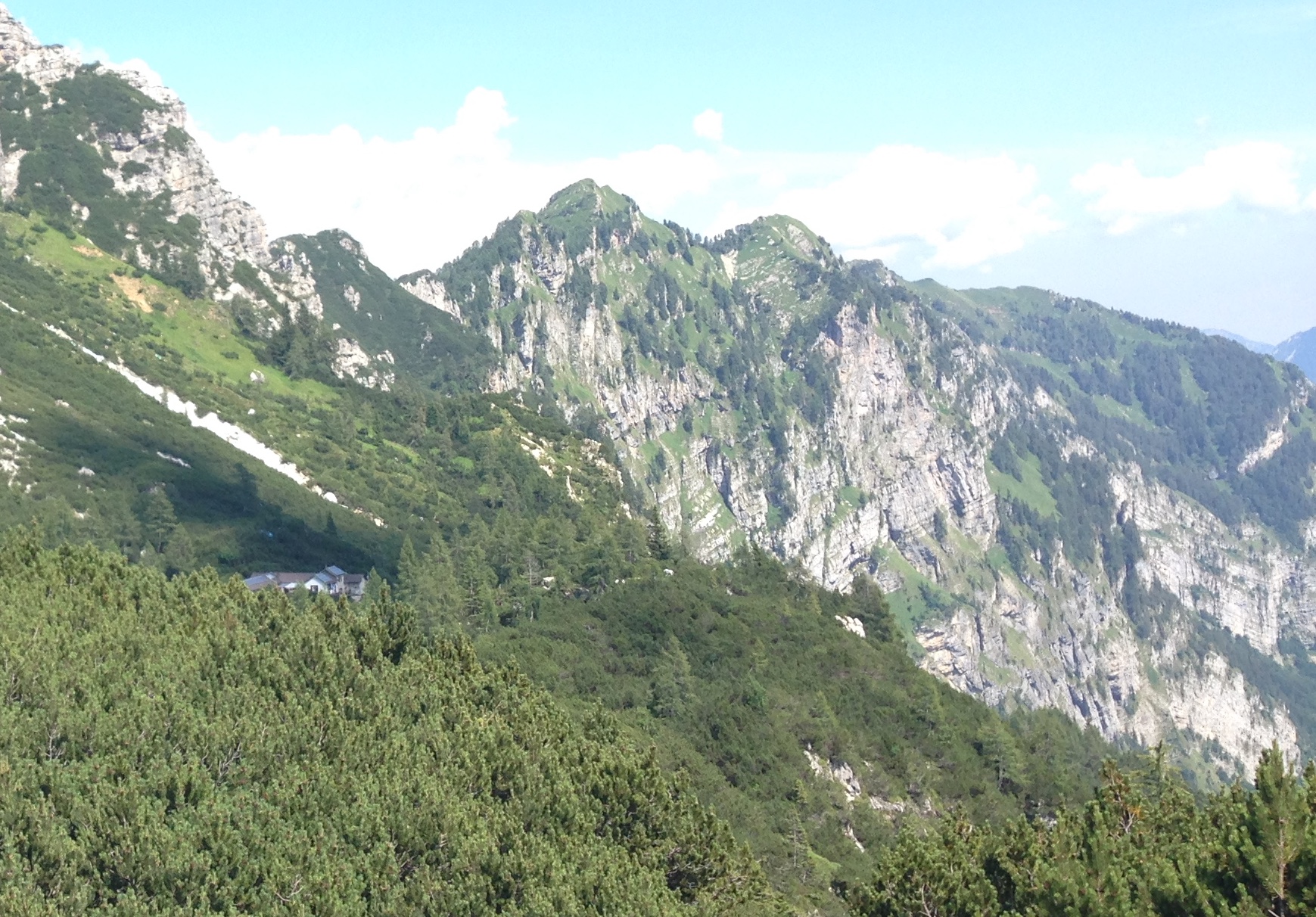
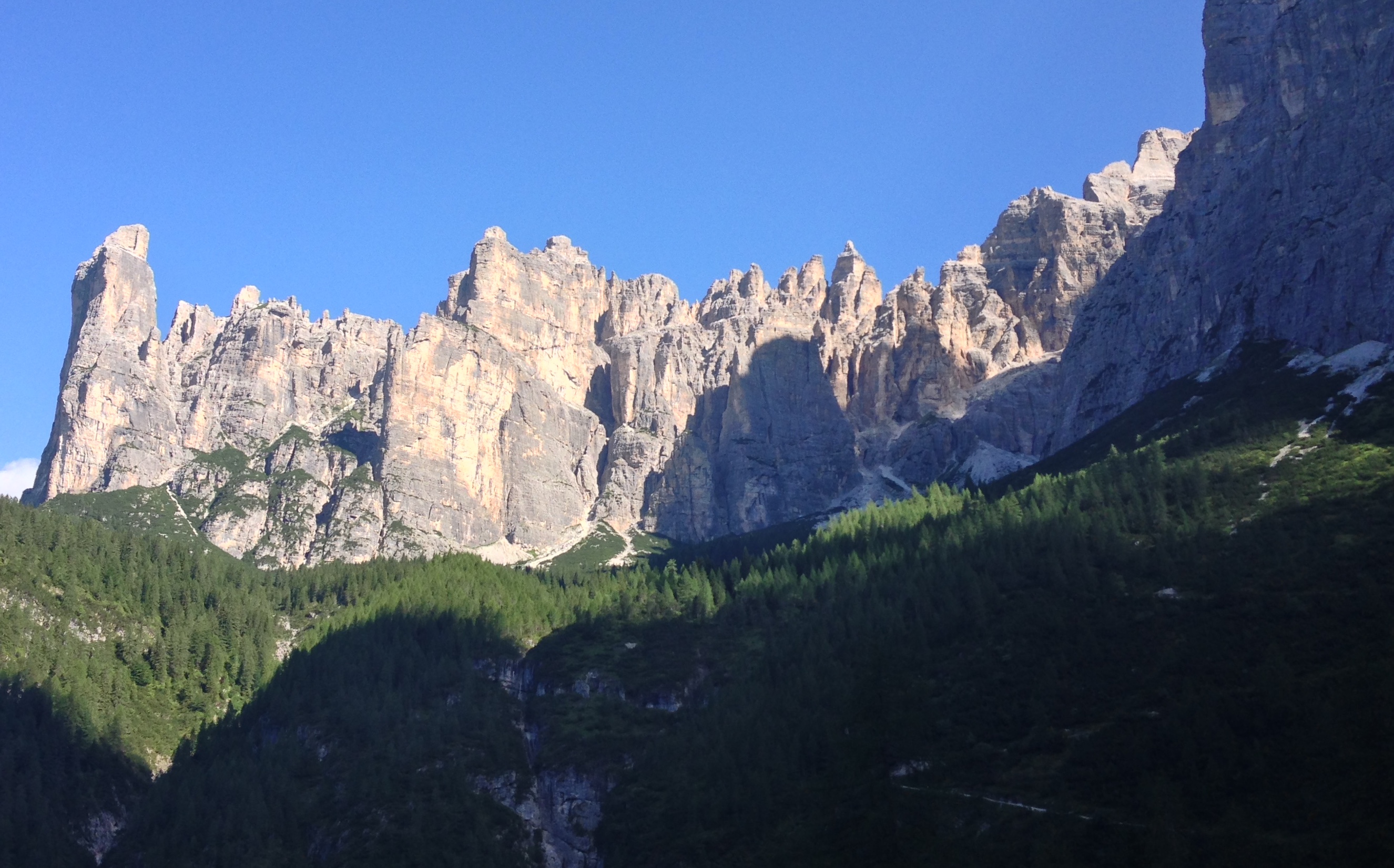
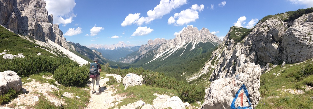
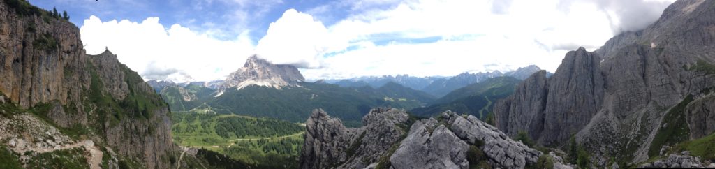
Of all those fabulous walks in Europe their trips to the Dolomites, in northern Italy always seemed the most stunning. So, when I finally got the chance to go to Europe last (European) summer, a walk in the Dolomites was a must. But knowing the region doesn’t necessarily make it easier to be sure you’re going to get the absolute best walk for those precious few days you have in Europe.
To start my planning for this very special trip, I called a friend from CMW! I asked him for walks he would recommend and he kindly shared loads of knowledge with me. He told me the best guide book to use, how to get around there using local transport, when was the best time to go, what the accommodation and food was like, what I needed to pack (and not pack), and what it was actually like being there.
I took his guidance and planned our walk. I choose to do the last six days of the Alta Via 1. These photos give you just a peek of that stunningly beautiful walk.
On the walk I ran into an old neighbour from Tasmania who had done the full Alta Via 1. She exclaimed how the scenery just keep getting better every day. I was delighted with yet more confirmation that my CMW guidance had paid off!
Stay tuned for more details of this amazing walk in our next newsletter! And in the meantime, find a club near you that will help you discover the most beautiful places to walk in NSW, the ACT and the world in our map of our clubs.
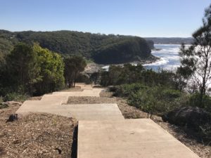
Central Coast Council approved a Master Plan for a permanent Walkway in March 2012 to provide a fully signposted concrete path which provides a safe route from Copacabana to Winney Bay, including a new north-facing and wheelchair accessible lookout at Captain Cook Lookout.
Concerned local Joy Cooper reached out to us recently concerning the concreting of the 5 Lands Walk in Winney Bay. She is not the only walker. Local residents are concerned about the damage done to ecological and cultural heritage of what was once a bushwalk track, now an 8 metre wide footpath that Joy Cooper describes as a ‘concreted coast’ that appeals more to tourists than walkers. As local walkers, bushwalking enthusiasts and trailblazers is there a line we draw when suggesting maintaining and improving tracks? We know it’s certainly something walkers can’t help wondering when seeing drastic changes on their favourite walk. Joy’s concerns below:
What a wonderful announcement from Adam Crouch with the huge sum of $4.6 million for his electorate, and for the Bulbararang cliff top walk.
What a shame the original plan for the walk had veered so far off the original plan. Having a bush-walk which makes it safer for walkers is wonderful and to link the two seaside village communities of Copacabana and Avoca Beach is superb. However to clear large areas of bushland to put in the walk way and concrete it, is a travesty and not needed, nor good practice.
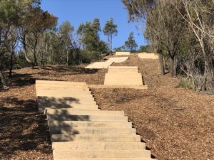
If the current stairwell nearing completion is any indication residents will not be pleased. While residents were told in a community meeting the stairs were only 2 metres wide, the clearing of bushland has been more than 8 metres for more than 720 metres, and each week it is easy to see the clearing gets wider with more trees being damaged.
While machinery and fuel were to be kept in a compound on the old farm house site, sadly both were stored in bushland resulting in even more bush being cleared and damage occurring.
More than 60 trees were removed for this ‘nature walk’ for all to enjoy and remaining trees near the path were to have special protection to prevent any damage while construction was occurring, yet that did not happen and there have been numerous trees with damage and limbs torn off and thrown into the bush.
While the damage has occurred with the stairway to nowhere, despite numerous requests for it to stop before it was started, there was insistence by council for the stairs to be built, so the funding wasn’t lost. The cliff top ‘nature walk’ along Bulbararing is still to start. Residents should be concerned once again little or no information is made public until it is too late and the destruction has occurred.
While the original 2012 master-plan clearly shows the walk way through Winney Bay and along the Bulbarang cliff top is to be bush track and even shows images with no concrete to be seen, the current plans are nothing like that. The current plans are for a concrete pathway and vehicular access to market stalls, cantilevered cliff top platform for destination weddings along with a whale carcass shaped bridgeover a huge ravine which has very sorrowful memories for some in the community.
The original master plan mentions ‘existing areas of unique, intact native vegetation which high aesthetic appeal’ in Winney Bay and along the Bulbararing Headlands and there is mention of the need to keep the infrastructure ‘simple and discreet’. However the current plans in my opinion are nothing like that.
So, while we have a huge divergence from the original intention of the upgrade of the bush track and no consultation with the community, we also have the state government/Central Coast Regional Plan 2036/. With the second goal being to ‘Protect the natural environment and manage the use of agriculture and resource lands’. How we can do this and remove bushland by concreting vehicular access and concrete paths with large areas of batter doesn’t correlate for me.
Additionally, we have the recently adopted/ONE-Central Coast/adopted by Central Coast Council and the numerous mention of the need to protect our natural environment which is ‘cherished’. There is even mention of ‘expanding of the Costal Open Space System COSS’. Ironically, this Winney Bay area and Bulbararing cliff top are already part of COSS and there are numerous endangered ecological communities in the area.
What use are these documents if the powers that be can’t follow their own plans? What hope do we have of preserving bushland if it is degraded, neglected and then concreted? How can we connect to a place if it is all concreted?
Winney Bay and Bulbararing headland deserve the $4.6 million dollars which should be spent on employing trained people to rehabilitate the area and remove the bitou bush and harvest and grow local provenance vegetation, bringing back the natural beauty of the areaand providing the ‘bush track’ as originally intended. Not concrete creep and destruction.
Trekking the incredible Larapinta Trail is an adventure on many people’s bucket lists.
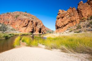
Simpsons Gap, Northen Territory, Australia
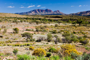
Standing on ancient escarpments and gazing out upon the ochre-coloured landscapes of Central Australia, following Aboriginal Dreaming tracks and trekking beside one of the world’s oldest river systems is surely an adventure of a lifetime.
Our friends at Melanoma Institute Australia would like to invite you on their Outback Trek adventure in September 2018.
Not only will you experience a trek along one of Australia’s premier walking tracks, but you will be supporting life-saving research at Melanoma Institute Australia.
A view of Glen Helen Gorge on a clear winter’s day in Northern Territory, Australia
Australia has one of the highest rates of melanoma in the world. The good news is that 90% of melanomas can be successfully treated if detected early.
However, in the other 10% of cases, life-threatening spread will have already occurred.
More than 1,800 Australians will die from melanoma this year alone and it kills more young Australians (20-39 year olds) than any other single cancer.
Research at Melanoma Institute Australia has made significant progress in developing life-saving treatments, but support is still needed as there is still no cure. No-one should die from melanoma, and you can help make a difference while doing something that you love.
Mt. Sonder, West MacDonnell National Park, Northern Territory, Australia
By taking part in this unique adventure you’ll pave the way for new research to improve melanoma treatment, and ultimately find a cure.