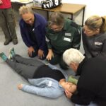
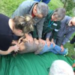
Volunteer St John Ambulance trainer, Belinda Keir, has been instructing First Aid at Senior level since before 2000. Belinda’s practical teaching methods have helped to raise the level of First Aid knowledge within bushwalking clubs. Belinda was recently awarded the Bushwalking NSW 2020 Chardon Award.
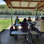
St John Ambulance first aid courses have recently changed so it is recommended that Clubs check course codes on the Bushwalking NSW First Aid Training page. The course code for Provide First Aid is now HLTAID011 instead of HLTAID003 and for Provide First Aid in a Remote or Isolated Situation is now HLTAID013 instead of HLTAID005. The change in course codes mean that all class ID numbers have been revised. You will need to quote the correct class ID to book any course. As our next Remote course is only a few weeks away, we would be grateful if this could be done as soon as possible.
People who have a less than 12 months old HLTAID003 or HLTAID011 Provide First Aid certificate can request a credit transfer for Provide First Aid in a Remote or Isolated Situation. This gets a discount in time (you don’t need to attend day one) but not a price discount. Credit transfers can take time to arrange and need to be organised well before the course. Please request a credit transfer form when you enrol and return it with evidence of your current HLTAID003 or HLTAID011 certificate. This will be verified by St John and if a credit transfer is granted it will be attached to the class roll.
Please note that while class size limits are currently 18, this could change due to COVID. While the two remote courses are put on our calendar for bushwalkers, there is usually space in other Provide First Aid courses which are offered to members of Scouts NSW.
In 2022 it is anticipated that Provide First Aid in a Remote or Isolated Situation HLTAID013 courses for bushwalkers and Scouts will run at Barra Brui (St Ives) over two weekends in February, July and November.
Keith Maxwell has stated:
“I have always thought that an important role for Search and Rescue/Bushwalking NSW was to encourage the spread of First Aid knowledge throughout the bushwalking clubs. For example, the Bush Club runs its own stream of First Aid training. Training for their Club walks leaders is fully subsidised by the club”.
Kirsten Mayer, Executive Officer of Bushwalking NSW Inc said:
“First Aid training is important for our clubs and we are so grateful to the entire team of Scouts and St John Ambulance volunteers who facilitate and deliver this training. All of this volunteer effort keeps the price very low for our bushwalkers. We encourage our club members to undertake this training. We also encourage our clubs to consider subsidising First Aid training for walks’ leaders.”
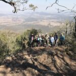
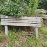
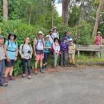
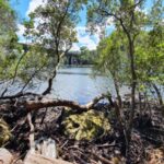
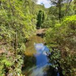
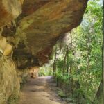
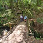
Marie Byles Commemorative Walks , The Bush Club, Walks Report by Astrid van Blerk & Kevin Yeats, Images by Astrid van Blerk and Ian Evans
The Bush Club is one of the major walking clubs in Sydney, which offers its currently over 850 members a huge variety of activities such as day and pack walks, cycles, and multi-day trips to explore areas further away. It is often referred to as “the friendly club” – its culture is supportive and inclusive, walks range from relatively easy to challenging and adventurous so everyone can find something that suits them individually, and there is a special focus on encouraging new leaders which allows interested members to try out new skills and share their favourite walks with others. Whenever you meet a Bush Club group on the track you will notice that the atmosphere is happy, open and relaxed – we sure have mastered the art of having fun outdoors! Another telltale sign that the club is healthy and thriving is how much resilience and optimism it showed in these challenging times of the pandemic. For example, during the 2019/20 financial year despite the Covid shutdown which prevented group walking for several weeks, the club managed to complete an astonishing 446 activities – predominantly weekday day walks with an average number of 9.5 paricipants each. What a wonderful way to keep moving and breathing fresh air, and to maintain one’s sanity and social contacts at the same time…!
One of the many interesting collaborative projects that the club offered to its members recently was created to commemorate its co-founder Marie Byles, who together with Paddy Pallin brought the club into existence in 1939.
Marie Byles (1900 – 1979) was the first woman to practice law in NSW, a mountaineer, explorer and avid bushwalker, a committed conservationist, feminist, author and an original member of the Buddhist Society in NSW. As a teenager at her parent’s holiday retreat at Palm Beach, she would look through her telescope across Broken Bay to the bushland on the Central Coast. She would later campaign successfully to place the former coal reserve on the Bouddi Peninsula under public ownership and in 1935 Bouddi Natural (later National) Park was formed, with Marie being elected a trustee of the board that managed the park. By 1938, she had built the house she called ‘Ahimsa’ (nonviolence), on her 3½ acre bushland property at Cheltenham, which she later bequeathed to the National Trust.
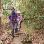
To honour Marie Byles’ achievements and contributions to the club, a series of 7 walks, ‘From Buddha to Bouddi’, were held, starting on Marie’s birthday (8th April), from ‘Ahimsa’, Cheltenham and finishing at Marie Byles Lookout in Bouddi. The walks passed through 5 National Parks, numerous council parks and reserves, as well as beaches and important wetlands, and all were suitable for public transport. Walks ranged from an ‘octogenarian friendly’ grade 2 to a more demanding grade 4, as follows:
1. Cheltenham to Lindfield via ‘Ahimsa’, GNW along Lane Cove River to Fullers Bridge, Little Blue Gum Creek, Primula Oval, Paddy Pallin Reserve, Lindfield (19km grade 3).
2. Lindfield to Seaforth Oval via Seven Little Australians Park, Two Creeks Track, Flat Rock Beach, Magazine Track, Natural Bridge, The Bluff and Bantry Bay (21km grade 4 – actual walk reversed for transport convenience).
3. Seaforth Oval to Manly via Manly Dam Reserve, Burnt Bridge Creek, Clontarf Beach, Harbour Walk to Manly (19km grade 3).
4. Manly to Collaroy via Queenscliff with side trip to the wormhole, Freshwater, Curl Curl, Dee Why, Long Reef (11km grade 2)
5. Collaroy to Avalon via Warriewood, Mona Vale, Newport, Crown of Newport Reserve, Bilgola and Avalon Beaches (17km grade 3).
6. Avalon to Palm Beach via Angophora Reserve, Clareville Beach, Bangalley, Whale Beach, Palm Beach and Barrenjoey Head (20km grade 3).
7. Palm Beach to Wagstaffe by ferry, then circuit walk in Bouddi NP visiting Hardy Bay, Allen Strom Lookout, Rocky Point trail, Mt Bouddi, Maitland Bay, Marie Byles Lookout and Pretty Beach (19km grade 3).
This walks series was a great success overall, and there are already calls to repeat the whole lot again next year. A special thanks goes to our wonderful thoughtful and innovative leaders who each led a section, in order: Jenny Donoghoe, Fiona Sonntag, John Hungerford, Bob Taffel, Astrid van Blerk, Joy Bell and Carole Beales-Evans. Also, to quote Carole, thanks to the amazing walkers who made it so special!
To find out more about the Bush Club, please see here. Membership is open to those over 18. To be part of The Bush Club, sign up as a prospective member. Our leaders will help you select activities which will suit you and your fitness. After completing three membership qualifying walks, you can apply to become a full member. We are always looking forward to welcome new members – see you on the track!
Notwithstanding reports that hiking and outdoor adventure has become fashionable for millennials, bushwalking clubs continue to seek ways to attract younger people. An experienced young bushwalker keen to help clubs address this issue is National Parks Association of the ACT Committee Member Stef De Montis – age 32. Stef bush camps regularly in Australia’s high country and is also a keen runner, cyclist, skier and photographer.
Stef is interviewed in the June 2021 NPA Bulletin. He is passionate about helping clubs to attract younger members and believes this is needed to provide future club leaders and members. He highlights the importance of attracting young people to clubs to gain valuable life skills and an awareness of the importance of environmental protection.
Stef feels that many young people may be missing a sense of community in our modern world and that building friendships in a group setting will enhance young people’s ability to maintain their commitment to important causes.
To attract younger people Stef suggests that clubs hold social events aimed at, and run by, younger people. Clubs can also harness the skills of experienced members by promoting informal mentorship programs to make young people feel welcome and develop their skills. He also believes that initiatives such as photography competitions and maintaining a strong online presence are ways clubs can encourage young people to get involved.
If you would like to read further, Bushwalking NSW has previously discussed similar ideas for clubs to consider, such as:
Consideration of the current average age of club members and if there is a need to appeal to a younger demographic
Identifying the potential reasons young people are not engaging with clubs
Identifying the skills and benefits clubs can provide to young people and the best way they can be be made aware of them
How to harness and pass on the skills of experienced members, for example, through mentoring opportunities
Consideration of how walks can be scheduled around young people’s work and or study commitments
Available opportunities to partner with local training organisations
What is the current demographic of your club and how successful have you been in attracting younger members? Let us know your experience and views – we would love to hear from you! – feel free to email Justine Bourke at newsletter@bushwalkingnsw.org.au
Like many, Armidale Bushwalkers 2020 walks program got off to a very slow start.
The Club held a one day walk in January around Point Lookout with five members. The smoke from fires still lingered in the valley below Wrights Lookout although where we walked had not been burnt.
In February the Club held a one day walk in the Sunnyside area with five members present while the Secretary was away in Tasmania.
During March the Club had two day walks with dates swapped and the outcome that neither walk went ahead. A weekend walk was organized for a Friday and Saturday later in March which meant that a number of members including the Secretary were unable to participate in the walk. The walk was to be the last for many months as the COVID crisis forced everyone into lock down. Walks were cancelled and the garden never looked better when the lockdown ended in late May.
The Club got together at Gara Gorge at the end of May and discussed walks for the winter months. A short walk along the Threlfall Track helped everyone shake off the lockdown blues and get back into shape for the winter walks. The first walk for the winter was to the summit of Mount Duval and camping near the trig with twelve participants. A wet start on the Sunday meant we were back at the cars and home for lunch.
On the following Sunday twelve members enjoyed a day walk traversing the summit of Mount Yarrowyck.
July saw quite a few walks cancelled due to weather and leaders having other commitments. Four members joined an unscheduled half day walk on the first Sunday in July in the Long Point area. See remainder of walks report here.
Our Club of the Month: Armidale Bushwalking Club
Armidale Bushwalking Club was formed in late 2004 and has approximately 50 members. The Club run walks once a fortnight – usually there’s one or two day trips and a more challenging backpack walk once a month. The Club also brings people together to organise their own trips – from an afternoon stroll to extended overseas backpack trip.
The Club is developing a loose association between clubs surrounding Guy Fawkes river- a kind of “Fawkes Fraternity” to share programs, ideas and trips including with Inverell Bushwalking Club, Clarence Valley Bushwalkers and Ulitarra Conservation Society.
Joining a group such as Armidale Bushwalking Club is a good way to get started in bushwalking as you can borrow gear from the Club’s store, find out about great places to walk, share costs and ideas and, most importantly, walk safely with experienced walkers. Club membership gives you access to walks with all of the NSW Confederation of Bushwalking Clubs, and excellent Public Liability and Personal Accident insurance.
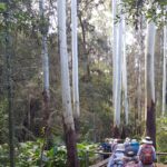
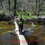
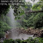
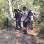
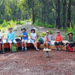
LITTLE DIGGER AND TWO CREEKS TRACK RAMBLE, 21 February 2021, Walk Report by Dee McCallum, All Nations Bushwalkers
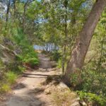
Parts of this track were known to me but not all, so I was pleased Leah had put this walk on. We met at Roseville Station where several of the group started with a morning coffee, then headed off through the delightful Roseville streets with many fine Federation houses, beautifully renovated with lovely gardens. We got to our first stretch of bush at Little Digger Track, which was not so straight forward but we picked our way alongside houses and past the creek. After a short detour across the wrong bridge we came back onto the main track and were met by our wet weather friends the leeches! We eventually came out onto the fabulous Middle harbour track – easy walking with view through trees to the water. There is plenty of history in the area and lots of informative signs. After passing under Roseville Bridge, we stopped for morning tea at the picnic tables near Echo Point. It was good to be under shade as temperatures were rising!
We then backtracked along Middle Harbour before joining the Two Creeks track. Parts of the track were quite exposed, so we were getting hot and just in time we had our lunch break under the shade of the trees. More friendly leeches about, they seemed to be everywhere! The track continued along Middle Harbour with lovely water views.
Shortly after lunch, we got to the most attractive part of the track, well shaded with beautiful trees and overhangs.
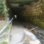
We then had an exciting detour through the tunnel at Gordon Creek. This would be impassable in rain but the water level was fine. Luckily there was a handrail to guide us! After exiting, a last uphill track before getting back to the road at Lindfield Station where we all dashed off after a hot but enjoyable day. On the walk, ably lead by Leah, were Dee, Francoise, Linda, Steve, Len, Tricia, Helen, Bryan, Richard, Molly, Connie, Geraldine, Elaine and Daniel.
Come and explore the wonderful Australian bush with All Nations Bushwalkers. The Club visits beautiful national parks and wilderness areas around Sydney and further afield and has a graded series of walks, bike rides and water-based activities.
Most activities involve bushwalking in national parks within 100km of Sydney, including Blue Mountains, Ku-ring-gai Chase, Royal, Wollemi, Bouddi, Brisbane Waters, Dharug, Marramarra and Sydney Harbour national parks, or the parks and reserves of the NSW Southern Highlands and Illawarra regions.
All Nations Bushwalkers activities suit a wide range of fitness and experience levels. Most activities are day walks, ranging from easy to rather hard. There are also overnight camping trips and longer expeditions to destinations across Australia – bushwalking by day, enjoying the companionship of the campfire gathering at night! Club members also organise social activities, such as restaurant nights, cinema and art gallery visits, Christmas parties and various special outings.
Getting to club activities is easy – they generally meet at a train station and then car pool to the walking track. You won’t get lost and don’t need your own transport! Club members are men and women of all ages and nationalities from across the Sydney area. You are welcome try a bushwalk walk first – choose a walk then contact the organiser for details. Visitors can try one walk for free before they’re expected to join. Membership starts from only $30 a year (for 3 years). Learn more
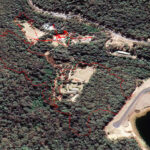
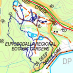
A recent Dalmeny Narooma Bushwalkers Club walk was an easy 6kms in Eurobodalla Regional Botanical Gardens. The Eurobodalla Regional Botanical Gardens are set on 42 hectares of Mogo State Forest, adjacent to Deep Creek Dam. The site has not been logged since the early years of the twentieth century and visitors can appreciate many of the region’s plants in a natural setting. The Gardens has 8kms of beautiful public walking tracks which vary in length and gradient to cater for individual requirements and limitations.
It was a perfect day for the Club’s walk during which Margaret Lynch explained what was happening in the Gardens. After the recent bushfires a lot of work has been completed and more is planned. The walkers were delighted to see the Gardens regrowth including many young green wattles which protect the undergrowth floor and let other native plants thrive.
The Club members walked 5.5km and had a look at Deep Creek Dam, for which a new lookout is planned. At the end of the walk Bev Brazel thanked Margaret for the walk on our behalf. Some walkers enjoyed lunch at the Cafe, some bought plants, and others had their lunch in the grounds. Overall all participants agreed that it was a very pleasant day.
Our club of the month is Dalmeny-Narooma Bushwalkers who have been walking for 35 years. The Club meet at the Red Tractor, George Noble Park, Dalmeny, with a plywood tractor now used to represent the original to honour the Club’s history.
Dalmeny Narooma Bushwalkers was established in May 1986 to encourage bushwalking as a pleasant group activity. The Club welcomes new walkers to join in and enjoy the beautiful bush and coastal environments of the far south coast of NSW.
Volunteer walk leaders offer various grade bushwalks twice a week around the local area of Eurobodalla and Bega Valley, as well as club camps in other localities and some social activities. The Club aims to keep its procedures as simple and as affordable as possible but also has a few rules to keep all walkers safe in the bush. Walks are grouped into 3 programs a year – Autumn, Winter and Spring – and are published on the Club’s website.
The Walking Volunteers Inc. have been proof-walking, mapping and providing walking routes around Sydney to walkers for 17 years. They now have over 1,300 kilometres of walking routes on their map and hope to add another 200 kilometres in the next month after approval has been granted by various land managers.
However, keeping track of changes on the walking routes is becoming more of a challenge as the network increases. The Walking Volunteers want to thank the walkers and land managers (e.g. Councils, National Parks & Wildlife Service, Western Sydney Parklands Trust, etc.) who often advise them of new and changed paths and tracks. However, tracks and paths are often closed for essential infrastructure (e.g. sewage pumping stations, light rail, etc.) or damage from natural events. It may take several months before the Walking Volunteers find out about these closures and when they do, they are able to liaise with land managers and establish alternative routes which are immediately updated on their maps and, via the magic of the Internet, updated on walkers’ smartphones, tablets or PCs. However, finding out about changes may take months and, in the meantime, walkers find it very frustrating to find a walking route on the maps has been closed.
So, the Walking Volunteers are introducing a program called Sydney Trackwatch to discover any changes or closures to the walking routes on their maps as soon as possible. It is very simple and does not require filling out complicated forms. Just let the Walking Volunteers know (Email: info@walkingvolunteers.org.au or Phone: 4784 2002) immediately of any changes or closures on the walking routes shown on any of their maps (Sydney Walking Tracks, Walking Coastal Sydney, Great West Walk). Also, let them know of any alternative routes you used to bypass the problem area. They will immediately re-walk, re-map and put the alternative routes on their maps as well as follow up the organisation responsible to find out when the walking route will be re-opened. When it is re-opened, they will immediately re-walk the route and change it back to the original course.
A good example of this is North Head, where the Walking Volunteers changed the route on their maps after the intensive bushfire in October 2020 and are now liaising with Sydney Harbour National Park and Sydney Harbour Federation Trust to change back to the original route when the fire-damaged areas are re-opened to the public.
All it takes is a quick phone call or email to assist the Walking Volunteers and your fellow-walkers!
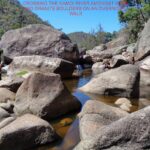
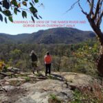
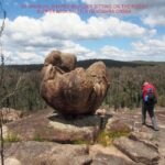
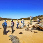
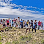
Patoneys A Different Way, Capertee Valley, NSW, 19-20 Sept 2020 by Rachel Grindlay
Given how much of my time I spend looking at National Parks alerts and advising other people about closures it is somewhat ironic I failed to check all of the relevant closures information for a trip I had on the Spring Program. A couple of weeks before the trip was scheduled we drove past the access road I was planning on using. There were “STOP, CLOSED” signs – it looked like I might have a problem. At home I looked at the map to find that the road access and part of my walk were in Ben Bullen and Wolgan State Forests. Both had been closed since December so the chances of them reopening in the next two weeks were remote.
Somewhat despondent, my initial reaction was to cancel the walk. But then I felt guilty for the people who had signed up. Scouring the map I was surprised to see how many different directions Pantoneys Crown could be accessed from. Point Cameron was definitely out of the picture since Mt Jamison and McLeans Pass are in Wolgan State Forest. But a new route started to form before me, taking in some map features which had caught my attention in the past – Tarpeian Rock and Moffitts Pagodas.
The new route had the definite advantage that I didn’t need to worry about the condition of the road, and the associated issues with carpooling and Covid. The party composition changed a little with the change of route but eventually six of us convened at the start of the Moffitt Trail bright and early on Saturday morning.
A quick survey confirmed no one was a sadist with the desire to walk an extra 2km of fire trail at the start and end of the trip. We piled into two cars for a quick drive along Moffitt Trail to cut off some walking. Parking where we planned to pop out at the end left us 3km of fire trail before we left any semblance of a trail behind for the rest of the trip.
The ridge towards Tarpeian Rock was a maze of pagodas. We took some of our navigation from Beyonce (“To the left, to the left”), though at one point we were pushed quite a way right before we found a way up through the fortress of pagodas. Finding our way back to the western cliff line, a bit of exposed scrambling and a jump got us onto Tarpeian Rock for morning tea. It was a sunny, still day, warmer than most of us had expected. The next point north had an impressive rock outcrop at the end which gave plenty more photo opportunities before we hit a flat, open section of ridge to take us quickly towards Baal Bone Point.
Our lunch spot had impressive views of Pantoneys Crown and the Red Rocks – where two-thirds of the party had walked only two weeks earlier. We marvelled at the patchwork nature of the fire patterns – some sections in the valley looked like a blowtorch had been put to them, yet they were surrounded by areas where the canopy hadn’t burnt.
After lunch was where the real fun started – the scramble off Baal Bone Point – I feel like the same logs have been in place for many years to assist with the descent – luckily unburnt. There were plenty of orchids in flower to slow the botanists down, but we eventually got to the base of the South Pass onto Pantoneys.
Only one member of the party hadn’t been to Pantoneys previously, though it was the first time going up the South Pass for two in the group. We made short work of it with everyone scrambling up without issue – other than a couple of frights from a Blue-Tongue Lizard sitting in a wedge we wanted to use as a handhold! We hauled packs at the top of the lower section and then squeezed around to the left avoiding the final awkward chimney climbs.
After setting up camp most of us went looking for the fabled water source. I had some vague directions, and indications from looking at the aerials, and with the amount of rain there had been in the last few months I figured if we didn’t find water this trip it probably didn’t exist. Tom led us straight into a little canyon which had flowing water and a small pool! This was great news as I think the hot day had caught most of us a little short on the water front. After filling up we squeezed down the canyon to the cliff edge where we took in the views.
The colour palette of grey was used for sunset, but the views were still impressive. Our earlier rehab work on the fire ring had shrunk it to about a quarter of its original size, which still gave us a very cheery fire for the evening. The knowledge of a water source made us profligate with the water we had. Two party members carelessly tipped their boiling billies on the ground – fortunately only one billy also contained dinner. Right on 9pm the first spots of rain started which seemed like a good cue to head for bed.
The weather forecast was pretty accurate; we woke to a steady downpour which meant breakfast was a solitary affair as everyone huddled in their shelters. Fortunately at about 8am it eased off and we all leapt out and with amazing timing were ready to go right on 8:30am.
The views as we traversed Pantoneys were non-existent as we wandered along in the mist. Tom initially wouldn’t believe me when I said we were at the northern point! I said he was welcome to keep walking if he could find some ground to continue on – fortunately he decided I was probably right and didn’t walk off the edge of a cliff.
The top of the North Pass was located without difficulty. The collective memories of the 5 of us who’d been there before were found wanting. No one could really remember the middle scramble of the North Pass. To the extent that there was some accusations of us not being on the normal route! Everything was wet which upped the difficulty level and we used the tape on both the middle and lower scrambles. Our memories returned on the lower scramble – it was indeed the normal route.
The rest of the day we would be in the realm of exploratory adventuring. Following the cliffline of the western side of the Crown proved relatively straight-forward. The visibility was still low so we couldn’t see anything except the impressive cliff lines looming into the mist above us. By late morning we were back where we were early afternoon the day before – below the southern pass.
Opting against a second lap we descended to the saddle and then had to work out how best to negotiate the myriad spurs and creek lines which would lead us to Coco Creek. I opted for a ‘straight line’ approach rather than trying to contour. As usual 20m contours hide a wealth of lumps and bumps and we were surprised as the rock turned from sandstone to quartzite. It felt like we’d been transported to Kanangra rather than Gardens of Stone.
The minor creeks were steep enough that we had to work a bit to get across them, but Coco Creek was the biggest surprise. A rocky narrow quartzite spine led us down just above a roaring waterfall. Jon appeared to be a little disappointed we didn’t have to swim across the large pool at the bottom instead conveniently being able to rock hop across at the bottom of the spur. It’s not many Pantoneys walks which feature a waterfall!
From there we had a couple of steep climbs to get us onto to the Moffitts Pagoda ridge. It was an impressive ridge line, with equally impressive views. The weather cleared as we got near the top and so it was a slow meander along the ridge as every few hundred metres there was another view, different light on Pantoneys and we spent time savouring it all.
Once we got to Moffitts Pagodas some of the party climbed on top, while others walked out to the point to take in our final views of this amazing part of NSW. From there it was just a few hundred metres back to our cars. The drive out had a couple of nervous sections – where rain and traffic had caused some slush to form and we weren’t exactly in control as we slid down the hill back to the rest of the cars.
Everyone was very complimentary on my replacement route – I’d like to take the credit but while there’s some skill picking a route on the map, there’s also a lot of luck in how things pan out on the ground. Be assured it’s not every exploratory trip where everything goes pretty much perfectly! Always come armed with a sense of adventure (and a well charged torch).
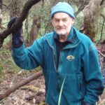
Many gathered to pay their respects to and celebrate a most remarkable person who made a sizeable contribution to our community, Wayne David Atkins, fondly known as Akky by many. David had a life-long keen interest in bushwalking and skiing and, more latterly, bicycling as well as caving and conservation in his earlier years. He greatly enjoyed these and generously put considerable effort into serving the community to foster, share and protect these interests.
David joined the Launceston Walking Club (LWC) when 16 years old. I first met him about 50 years ago when encountering an LWC walk at Lake Promontory in poor weather. There he was helping cut wood for a fire to make his party more comfortable; it was obvious he had come well prepared for the conditions. Later I spent many years working closely with him on behalf ofTasmania’s peak bushwalking body, and the national bushwalking body. I found David utterly dedicated to protecting bushwalking in Tasmania, and nationally. He was always reliable, supportive and helpful. During that time I never heard him grumble about the work involved, even if he did about some wanting to cull some aspect of customary bushwalking.
Apart from David’s greatly valued efforts for the Launceston Walking Club (LWC), who awarded him Life Membership in 1980, there is his huge service to the wider community stemming from his appointment as a Delegate of that Club to the Federation of Tasmanian Bushwalking Clubs (FTBC), which has since transformed itself into Bushwalking Tasmania (BWT), to represent all Tasmanian bushwalkers. As a well engaged and valued member of the two State bushwalking organisations, David was soon appointed to key roles, and held important roles for many years; at least 21 years. At various times he was elected President or Secretary.
David was very active representing both the LWC and the wider Tasmanian bushwalking community through his actions and words. David had some particularly useful attributes for such key positions. He was prepared to take on roles and duties that others shied from. Whether a key role or not, David was always prepared to stand up to the unreasonable and stubborn who acted against Tasmanian walker interests. David was persistent when merited. Sometimes David showed quite a sense of humour in adverse situations – usually dry, so not recognized by all. On the odd occasion he would deliberately show emotive anger to a Minister of the head of PWS. This sometimes put them on the back-foot.
David was unafraid to speak bluntly or write a blunt letter when he disagreed with something. There was a decisive late letter sent to the then Nomenclature Board when Parks wanted to delist two used tracks, that would have the consequence of barring anyone marking or maintaining the tracks. The Board thought it wise to have a recreation person on their body. Delegates to Bushwalking Tasmania very much appreciated David’s dedication, work and passion, and felt comfortable about his representingtheir views, even if not some of his spelling.
When a national bushwalker body was to be formed, David attended the inaugural meeting and joined the inaugural governing body. He served on that Bushwalking Australia Council for 18 years, including as the national Secretary from 2016 to 2019, leaving just over a year ago when Genevieve, his wife, took up a position in Queensland. When national bushwalker conferences were to be held in Tasmania. David took care of the local logistics, accommodation and eating arrangements for all attendees. He certainly made sure of good value without things being scrappy – well done David! He even went out of his way to do airport pickups, apparently most at his own expense. This is the kind of thing that is invaluable to volunteer organisations who have limited funds.
David cared about how walkers and volunteers were treated. For instance, he put effort into arranging facilities and some nibbles for volunteers when re-establishing the Cuvier Track. This included free shelter, showers and kitchen facilities. This kind of effort helps attract volunteers, and shows appreciation. In recognition of his lengthy, broad and deep service, Bushwalking Tasmania has received emails of condolence from all over Australia, as well as diverse places and people in Tasmania. A rare honour!
David’s love of the bush and his passion to ensure that bushwalkers retain rights of access to all areas of the bush is one of his many enduring legacies. During his service for Bushwalking Tasmania, at various times, a Minister of the day appointed him and another BWT person to an additional body to deal with particular issues. A key group was the Track Assessment Group that eventually overturned a plan for an expensive booking system for all overnight walking in the Tasmanian
Wilderness World Heritage Area. That would have seen a major decline in our ability to walk in the TWWHA due to unreasonably low walker quotas. The Track Assessment Group met for two days a month over three years, often with considerable pre-meeting material to read – it required considerable effort and dedication.
Many remember David’s determination and fight to ensure bushwalkers would continue to have access to the Cape Pillar area. It was intended that we walkers would no longer be able to do overnight walks in the area unless doing an expensive hut to hut walk, although Tasmanian bushwalkers had put in thousands of man-days to make the first tracks and campsites to establish the great coastal bushwalking there.
After petitioning and meeting the Minister about our concerns, we were appointed to the Three Capes Reference Group. David & I did several trips to the Cape Pillar/Three Capes area to plot all the campsites then ask we retain only three existing sites as formal sites to continue our customary use of the area. At his own initiative, David saw the local council and promptly got them on side. After three years pushing to retain customary access and use, the goal was achieved.
During our efforts to reach the goal, David & I spent two days hiding from helicopters that were carrying building materials for the 3CT. That trip was to inspect and map all sites with evidence of camping. At the time, the whole 3CT area was actually closed to walkers, but we needed the data to argue our position to retain the most suitable campsites for Tasmanian walkers. Should we have been sprung, I suppose we could have said we were doing it for the Minister.
In general, David spoke strongly on behalf of walkers whenever he saw unreasonable encroachments on walkers’ customary use. For instance, we made many representations and wrote several submissions to stop over-zealous constraints on walkers doing their well-established overnight walks that use part of Overland Track. Some of the constraints had put walkers in danger. David also spoke publicly strongly against the upmarket commercial development of Lake Malbena in the TWWHA. David saw the rationale for these as commercialism displacing customary use for the benefit of the wealthier. Something many more now recognize as happening more generally. David was so strongly opposed to the Overland Track constraints, he attended many a meeting in Hobart and elsewhere to help loosen the constraints.
David helped write countless other submissions on behalf of Tasmanian bushwalkers over many years with BWT & FTBC. It can take considerable effort to write submissions that have to research then articulate and justify the walker position when plans are based on opposing values.
David was so committed to seeing walkers maintain their ability to communicate their issues, that for the first half of 2020, he voluntarily filled in as Secretary for BWT while in Queensland. Thus, David is one of the very few to receive a certificate of award from Bushwalking Tasmania to recognize his outstanding service to bushwalking. The award is so well deserved. He held BWT together at one time when all other delegates would have BWT serve them; quite a responsibility for him.
I also met David at Ben Lomond associated with skiing and skiing races. There he belonged to a neat lodge, Ben Bullen along the Carr Villa Track to Legges Tor. At Ben Lomond David often appeared early in the day to help set up and run skiing races for a number of years where I was able to help him carry the considerable equipment using an oversnow vehicle.
These few examples of what David willingly did, demonstrate the community-minded effort David was prepared to make on behalf of all Tasmanians, many of whom remain unaware of the efforts that are required to maintain our way of life.
Of course David & I did a few walks. These mainly in his later years where we often had to talk about and resolve walking issues. In his positions with Bushwalking Tasmania, he was a gracious host in order to facilitate meetings and discussions. I was privileged to stay at his and Genevieve’s home and beach house many times to facilitate bushwalking business. David was also prepared to drive from one end of the State to another to get bushwalking business done. On many occasions he drove to the south or far south to meet Ministers, the head of PWS, other PWS staff or myself. One time he drove all the way to Strathgordon just to have a brief meeting with an HEC officer to pursue access over the Gordon Dam. It was such selfless effort!
David will be remembered and appreciated by the LWC, BWT, BAI and others for the dedicated passionate person he was and for his enormous contribution towards making LWC & BWT what they are today. He will be honoured and remembered at the Tasmanian Arboretum, as his name W. David Atkins will be added to the LWC Deceased Life Members tree.
David’s main recreational legacy additional to the achievements mentioned, is that more Government Authorities now realise that Tasmanian walkers are keen to have their customary recreation and traditional uses protected. Most Authorities have, and are taking more action to aid this. There is also the legacy of the conservationmovement in Tasmanian that David helped initiate, stemming from the flooding of Lake Peddar. Many individuals benefitted by learning about how to handle themselves well in the bush or on snow via Scouting, club and family events that David coordinated or was heavily involved in. …
It was such an unexpected loss of so remarkable a person. David will be hard to replace, and much missed. We are privileged to have known him. His was a life well lived. I for one will miss David greatly – and wish that he may enjoy great walking throughout eternity.
On behalf of Bushwalking Tasmania, Bushwalking Australia, Bushwalking Queensland, Bushwalking NSW Inc., Walking SA, Hobart Walking Club, Circular Head Walking Club, Launceston Ramblers Club, HikeWest (formerly Bushwalking Western Australia), Bushwalking Victoria and personally I extend my deepest sympathy and best wishes to Genevieve, David’s children, grandchildren, siblings and other relatives, and all of his friends.
Ray Bulmer originally conceived the idea of the annual trip to Bunya Mountains and Girraween National Parks for our bushwalking holiday. He put in a huge amount of preparation and drew up a great itinerary with a good mix of walking and sightseeing with some wonderful places to stay. Unfortunately he was not able to come on the trip due to ill health and we missed him greatly.
The group consisted of Michael, Christine, Steve, Moira, Joan, Jan, Stephanie, Kent, Narelle, Stuart. We set off on Saturday September 7th. As we left our area in Gulmarrad we remarked on how much the Shark Creek fire had grown in the last day and then we drove off towards Grafton, never guessing the fire would grow so big in the next few days whilst we were away. Fires were starting up all over the valley and throughout NSW and this was to be a constant theme throughout the holiday. We packed our car up in 35 deg heat, with the sky turning orange and filling with smoke.
We consulted the night before on the best route to avoid fires and some of us kept to Ray’s original route via Glen Innes. We stopped off for the obligatory coffee break at McDonald’s in Glen Innes and a second breakfast. Others travelled via Kyogle. We passed through Stanthorpe and Tenterfield, witnessing the burnt areas from their bushfires only the day before. They had burnt both sides of the road in some places up to people’s garden fences so it was a sobering reminder of our vulnerability. We were all able to meet up at Warwick for a late lunch. Then we pressed on to our first overnight destination, Jondaryan Woolshed. We were saddened to see how dry the countryside was along the way. We set up camp in their campground and hunkered down for our first dinner in an increasing wind.
The next day we explored the extensive historic site at Jondaryan and there was certainly a lot to see. But first we had to have a hearty breakfast at their café. This was bushwalking in style. Then we visited the many historic buildings, the largest being their magnificent Woolshed itself. Many of the historic buildings had museum displays inside them. The school was one of the most interest.
The next day we set off for the short distance to Maidenwell which we were going to use as a base for our first set of walks in the Bunya Mountains National Park. The camping areas in the National Park were not accessible for some of the group so we had opted for the comforts of Maidenwell Pub.
We arrived at the camping grounds in the Showground at the rear of the pub and set up. The wind had increased even more and Michael had to secure the tent to the car with 3 ropes to ensure it did not blow away. Most of the group went for a preliminary walk to Coomba Falls which was a steep and interesting walk but little water. Later on we availed ourselves of a welcome dinner at the pub and a game of pool, hoping the wind would abate, but it did not. That night we fell asleep listening to the wind gusts.
The next day we set off on the 25k trip to Bunya Mountains National Park and were amply rewarded by the display of wildlife as we had morning coffees at the cafe. The wallabies and birds were very tame, no doubt owing to the proximity of the café. Bushwalking in style yet again. But the coffees at the end of the second day’s walking were very welcome.
We set off, stopping first for a view from the high point of Mt Mowbullan which had an extensive panorama but a lot of smoke haze.
We set off on our first walk along the Scenic Circuit and walked through beautiful rainforest areas with abundant bunya and hoop pines. It was a welcome change from the dry landscape we had travelled through to arrive there. There were many other sights to see such as extensive strangler figs, stinging trees (look but don’t touch!), bird’s nest ferns and staghorns. Unfortunately the many waterfalls were nearly all dry. Two of the group elected to return to the starting point by a shorter route where we saw a red bellied black snake and many different species of beautiful trees whilst most of the group carried on to Big Falls and Barker Creek Lookouts. …….
It had been arranged that a car pick up would take place at Paradise Park but through mis-communication this did not happen so some members got a longer walk than they bargained for. This emphasised the need for clear communication on walks. But we all reconvened at the end for some much needed bunya nut ice-cream in the café.
That night we indulged in another meal at the Maidenwell Pub.
The next day we set off to the National Park again and walked the Westcliff Lookout walk. The northern walks were partly escarpment walks and we had some good views from the lookout and along the way, although they were not at their best because of the smoke from the extensive bushfires. We stopped temporarily at Westcott and then all but one continued on along the Koodaii Circuit loop walk.
Our final walk of the day was to the highest point of the National Park, the Mt Kiangarow track to the summit and back. It was a short but lovely walk through the scrubby bush with smatterings of rainforest. We admired the extensive arch of grass trees and wildflowers with an extensive view of the valley below at the end.
After coffee once again we returned to camp and decided to tough it out and actually cook for ourselves like real bushwalkers should. We fortified ourselves with Happy Hour first though. Up until that point Happy Hour had not been that happy or extensive, downright non-existent owing to the strong, cold winds. The winds had dropped a little and a welcome use was made of the awning of Stuart’s caravan for a few drinks and nibbles. We had a discussion in which we confirmed that unfortunately Girraween National Park, our next walking destination was closed due to the threat of bushfires. Some fires were still active in the area and some were growing, including the large one near Drake and the Bruxner Highway on the way home.
All this while Michael and Christine had been monitoring the ever increasing Shark Creek fire near our home via the RFS website and wondering if there would be anything left of Yurygir National Park at home for future walks. What had started out as a tiny fire weeks ago had grown to threaten Woolaweyah, Angourie and Yamba.
The next day we changed our plans and spent the day in Toowoomba sightseeing. We enjoyed the wonderful flower displays at the Queens Park Botanic Gardens, where we were lucky enough to see their preparations for the Flower Festival in a few weeks’ time, followed by lunch at the Cobb & Co Museum and a look at the extensive displays there.
After that we headed south to our planned camp at Sommerville Tourist Park. This had been planned as our base for walking in Girraween National Park as that has been closed for a while due to water shortages in the park. It was now also closed due to bushfire risk so we stayed for only one night there and enjoyed their lovely facilities but once again braving cold weather of about zero degrees. We set off home the next day by mutual agreement, cutting the trip short. Some took advantage of the shortened trip to go their separate ways and do other activities but walking trails in National Parks seemed to be in short supply.
We travelled south again and most stopped at our planned lunch break at the Standing Stones Cottage where Ray had thoughtfully booked a surprise birthday tea for one of the group. We procured two cakes and a candle as there were two birthdays to celebrate. We then headed down the range to arrive home.
Clarence Valley Bushwalkers Inc. was founded in 1997 by a small Group of interested bushwalkers. Since then membership has grown to approximately 90 members.
Walks are held in a range of beautiful areas including New England National Park (including Cathedral Rocks, Woolpack Rocks, Point Lookout), Washpool National Park and Gibraltar Range National Park (including Anvil Rock and Dandahra Crags). The Club also canoes and kayaks local rivers and holds relaxing bicycle rides around Clarence Valley.
There are up to 5 scheduled club activities per month. These can include bushwalking of varying levels of difficulty, terrain and duration; kayaking/canoeing trips and overnight car-camps; full-pack weekend walks, social outings, and bicycle rides. The Group also undertakes interstate and overseas adventures. Activities that are dependent on suitable weather or tidal conditions can also be added to the program at short notice to take advantage of favourable conditions.

 David’s main recreational legacy additional to the achievements mentioned, is that more Government Authorities now realise that Tasmanian walkers are keen to have their customary recreation and traditional uses protected. Most Authorities have, and are taking more action to aid this. There is also the legacy of the conservation