main

Archive | Bushwalking safety

Kelgoola to Widden Valley Walk Via Mt Corigudgy the Hunter Main Trail and Blackwater Creek, Easter 2023

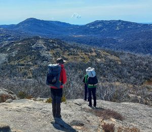
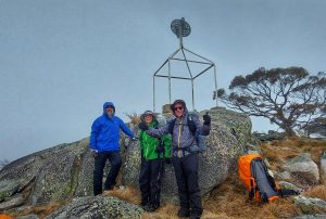
On Friday ‘Good’ there we stood with the Coricudgy in far sight.
With final tweaks to the packs on our backs – a slight heave left & right.
We bid farewell with a nod and a wink, we’ve got this – you’ll see.
We’re off then – our lungs ‘chock-a-block’ – a rhythmic stride us three.
The grade got steeper, our gait shortened up – we’ve now hit reality.
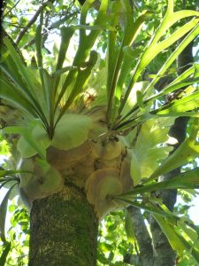
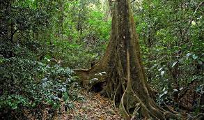
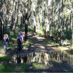
Saplings appeared, undergrowth thickened and fallen trees hindered the ways.
Firm in our mind the known fact – stored water must last two days.
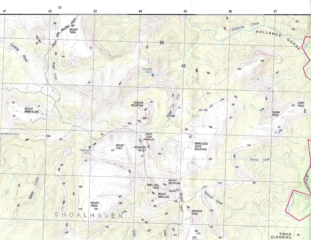
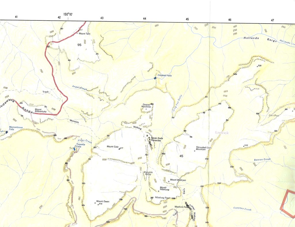
Then out of the bracken a sign post appeared – Coricudgy or Hunter Main Trail
Swift choice, Hunter Main Trail – we’ll walk the planned distance without fail.
But fail we did with the weight of the carry and our bodies seemly weary.
Shoulder to shoulder saplings now rise from a trail – once compacted and dreary.
The wreckage of fires, storms and land slips resulted in trail passage – a farce.
To think one could walk without blundering step – was knowledge that’s simply sparse.
Short of our target with a great threat of rain ‘n’ the wind with a blistering throe.
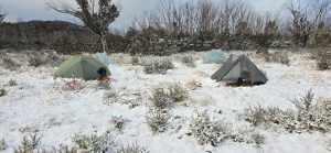
Rain it did with the push of time, we were sure our tents would go.
The camp was established at an opportune site, sheltered by a Rocky Bluff.
‘Save for’ an anchor to peg rock or tree – proved our tethering was made of good stuff.
With laboured yawn, quick rub of eyes – our bodies still seemingly aching.
The crisp breath of dawn accompanied our yawn to start our bodies a shaking.
The shrill from the dawn bird gave call to rise and welcome a brand new day.
We crawl from tents onto wet sodden ground, muttering ‘four letter words’ on the way.
Oh Saturday’s rise to bitter blue skies and rain mist that’s already proved dreary.
We stretched and nodded with circular gaze and cursed like Farther O’Leary.
We scoffed some breakfast we stuffed soggy packs, at last we’re ready to ‘roll’.
But delay to the start further stifled our heart and surely did sodden our soul.
Intent on regaining lost time, we now fixed on a better day’s sum.
But there at the ready were trail statuettes – of Myrtle and Wattle and Gum.
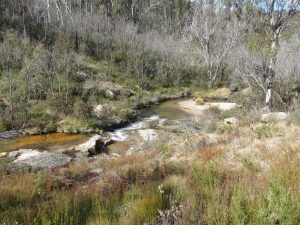
T’was fresh water we seek from Coachwood Gully, a spring, 12k’s down the track.
The pace was slowed the further we go‘d – thru vine ‘n’ thistle ‘n’ fern we’d hack.
Now the spilling of ‘springs’ gave joy to our ears as we approached the Coachwood seep.
The joy was short lived – as the water ‘let fall’ was from a level – too distant – too steep.
We scooped trickling water from the trail’s sullied surface – yet not a welcoming blend.
We topped reserves, quenched our thirst – allowing our worries to mend.

With dimming skies/stumbling feet – realising the target – we’d fail.
Oh’ for a camp site that’s rock free & level – we’d raise our arms and hail.
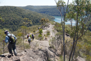
There we stood, peering ahead as much as the landscape allowed.
But no such site availed itself, aside from the Hunter Main Trail, whose timbered
growth would stand steadfast and form a protective shroud.
By torchlight that night we circled the ‘wagons’ and discussed our ambitious campaign.
The first to wake would summon the ‘rally’ – without further voice of disdain.
While agreement was made to break camp early – before the hint of ‘first light’.
The Moon’s outstretched fingers, had traced on the ground – Easter Sunday’s delight.
In respect of belief we paused to give thanks then shared our eggs around.
But we refrained from tradition to hide the eggs, simply placing them on a mound.
Breaking camp, quick check of the map to ensure matching numbers we yearn.
Off we strode thru the eerie blue light – towards the ‘point of no return’.
With reserved excitement, quick glance around, we gave the Garmin a check.
A tentative voice was heard to say, not far, just up ahead, I think we’ve got it by heck.
The point to exit the Hunter Main Trail into a gully – so timbered – oh so steep.
A route devoid of direction – down to the banks of Blackwater Creek.
Marking our exit with a ribbon or two we also recorded, grid reference.
Over the ledge us – one two three, to centre the gully was preference.
We gazed around and then looked down to see what we had encountered.
Confirming the grade that we would battle was not one, for the fainthearted.
Many trees had fallen due to rot and decay, thus exposing Tuff’s Rock and grass.
But the rocks were loose and the grass was slippery – we promptly fell onto our brass.
To slow down descent we used our packs to drag tracks and act as a temporary brake.
At each opportune moment we’d slowly rise (some tears in our eyes) – to pluck the burrs
from our arse.
With a grade 1 in 6 and narrowing rock shelves the pace slowed to just a dawdle.
The descriptive expression of some sections to pass – shall remain for all time inaudible.
There lying in wait was a silent bait, covering ground and rock and tree.
Discreet by nature, grey green lichen was defying the eyes to see.
Just add moisture nature declared – to find how slippery it be.
Down we went like bags of spuds to injure, a shoulder, a cheek, a knee.
Counting our blessings we assembled again and continued to the rocky ledge,
A quick ‘memory refresh’ of an abseil book, a plan was hatched, with a ‘sign of the cross’
and a pledge.

Ropes were produced to conquer the ledge, first lowering each backpack down.
Two sets of eyes then gazed on me; I stuttered and agreed with a frown.
We will let you go first, the lightest you be, best to test our knot.
I swung like a pendulum in a grandfather’s clock, when all the slack was got.
The ropes a ‘bit short’ was my retort, realising my feet hadn’t reached the ground.
A quick adjust that saved the day and a bit of a thud when my feet were finally found.
The lasting sweep towards Blackwater Creek was slow but worthy of ‘thy’.
Giant sandstone boulders, long narrow crevasse and a rock face seeking the sky.
With gully bed seemingly narrow, while bordered with sickening vine.
Backpacks required removal, with body and shoulders aligned.
Water increased around our feet that flowed with gathering tempo.
The gully meandered around every bend and dropped into every hollow.
We pushed and shoved dead branches, we skidded on rolling rocks.
The gully bed slowly widened, in short – we had smiles like Goldilocks.
Then was heard the rigorous churning of water flowing afore us.
The mountains sent streams into Blackwater Creek; in parts – nearing ‘full flush’.
Wounded bodies with tempered minds, we finally broke vision upon her, where
time stood still, as we endorsed our will – for the past 3 k’s were tough.
The joy of our meeting enormous, emotions running high, us three blokes in the rough.
She looked so sleek in her movement, her swish ‘n’ sway, with very impressive sass.
While her stream was wide, her banks either side were narrow and tricky to pass.
Again time was against us, we simply failed to complete – the best of a good days walk.
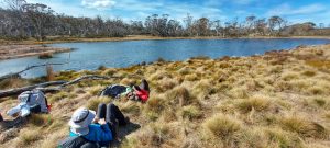
We elected to camp ‘on a snug little spot’ as there was nothing, elsewhere we’d gawked.
Around camp that night we discussed our plight with concerns of what lay before us.
Day 3’s poor achievement, 4k’s out of 9, gave cause for a curse and a cuss.
We rested that night the best we could, with a sloping site and our bodies worse for wear.
At dawn’s first light we peered down the stream and lamented the scene awaiting us there.
Oh blackwater creek you’re coursing’s unique, befitting the terrain that surrounds yee.
The carving you trace over each rapid’s race makes us proud to have finally found thee.
Fallen trees of ancient descent, once so grand ‘n’ noble, are now strewn across your way.
Large battered boulders embedding the sand like warriors defying the fray.
Your carry of water was swift and deep with bottomless pools in the hiding.
To conquer your route, one could not walk your bed, as the sand defied solid striding.
Your banks were steep with toes in the creek and access either side, concealing.
Straddling of boulders, clinging to branches proved clear-cut approach unappealing.

Blackwater Creek ‘oh’ Black water creek what is it from us that you seek.
We pursue you with kindness, we treat you with care, we wonder at your mystique.
Oh you treat us so cruelly, we think you unfair and sometimes you don’t really care.
Is this your true nature or healing you seek from treatment of our forebears.
Why is your water so black so bleak are you bleeding from what lies beneath.
Your name is befitting of the stealth you display, with the obstacles you bequeath.
You flow at will, with regular spill around hazards that are well connected.
You flow thru the groin of thighs, so high, so steep; your secrets are well protected.
Over three days we criss-crossed your flows with varying degrees of success.
On one occasion my legs disappeared into a seemingly sandy abyss.
I eagerly called for assistance, exclaiming I think I’ve got troubles – and
If you don’t pull me out any time soon I think you’ll be looking for bubbles.
Time after time we climbed your slopes to conquer the obstacles bestowed us.
The slopes themselves were a footprint to hell with a view that certainly feared thus.
With thickets of vine grass as high as our thigh and dense scrub obstructing our eye.
Walking was clumsy and hindered by holes and rocks and stumps and logs that lie.
Progress around and along your slopes was agonising and deliberate
Each step performed like a Kremlin guard, lift, stretch, place, transfer the weight
Lift, stretch, place, transfer the weight to stamp ‘n’ pack – swards of vine and grass.
Sweat drips, shirt rips, spill of blood running in silence – an unbearable way to pass.
Lawyer Vine – Oh Lawyer Vine I never knew you existed.
You lay in wait for each weary step with a plan that is utterly twisted.
You run at length upon the ground, hidden in bracken and grass.
You flourish on shrubs with low hanging branches thus blocking our chances to pass.
You invade the canopy of your surrounds and cling with fishhook fingers.
You have no place in this garden of lace – better suited where the Devil lingers.
You’d grab our ankles you’d grab our arms you’d noose our neck our packs.
You let us stride till the tension applied – then you jerked our bodies back.
Step by step we’d fight you off with an angst we failed to surmount.
Over & over we’d tumble & fall into a drunken sprawl – t’was too many times to account.
Ah – quick thoughts of ‘tracks’ with mown grass, all edged with a border of fern.
The weight on our hearts could not be defined on approach round every turn.
The burden on body – the burden on mind – a torment from nature herself.
For the realisation of any such ‘track’ – was ephemeral fiction with stealth.

Over the next three days we battled the maze, with our supplies now running low.
3k’s a day was the best we could make – on the map, really nothing to show.
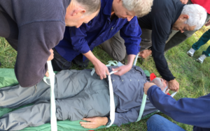
Our last camp was kind‘a solemn, with pain of injuries that may long-term affect us.
We opened our tents, dragged our bodies thru, and managed to gain Homo Erectus.
Microwaves up and microwaves down – the heavens abuzz with concern.
The message of reply to our welfare – gave no confidence of an upturn.
The garmin seekers, still wearing sneakers, squirmed with disbelief.
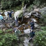
Authorities of high degree were let know and offered standby relief.
On the seventh day we were advised we’d be met by a welcoming party.
Quick thoughts of the words, we’ve got your back, felt warm and kind of hearty.
The welcoming team arrived, to our surprise having drinks and food and face washers.
We shook hands and hugged the bad things we shrugged and continued in boots, with the
sound of wet galoshes.
In our quest for success there was never a ‘wrong’ decision made, but one must say, some
were more character building than others.
For must I declare, the days of steep climb, the days of wet clothes, the days of lawyer vine,
were likened to – ’10 rounds’- with Jimmy Carruthers.
In agreeing to walk Blackwater Creek I couldn’t tell if I’ve opened the door to heaven or hell.
If there’s a God in heaven then I’m fairly sure he’s got it in for me, right now I think I can tell
Memories – Oh Memories of events that were bestowed us
I remember the washed out drains that prevented car access at start
I remember first sight with some delight when we first encountered Hunter main
I remember the regrowth that nature provided to recover from the human zoo
I remember first night at the camping site, the blistering wind and the rain
I remember the end of each walking day to feel defeat in one’s toiling heart
I remember the leadership when moods were low, ‘triangular method’ as we all had a go
I remember the moments on Easter Sunday as we gave thanks in a personal way
I remember the scents and the sounds that enlivened true enjoyment in me
I remember descent into Blackwater Creek the experience beggars’ belief
I remember the slips, trips and falls and consoling laughter that fell upon deaf ears
I remember the ‘labels’ we each had carried, like “three points” “wombat” and “stirrer”
I remember the eerie calls at night, not knowing on foot or by flight – and
I remember at night the perils encountered – just for the need to pee,
I remember each morning the shock on my feet, when sliding into – sandy wet socks
I remember the sheer frustration on faces of those with lingering pain
I remember no ill word was ever spoken, just a need to grin and refrain – and
I remember the flak, that I got back, on saying – “just follow the water/ just follow the water”,
whenever the garmin was showed

They say good friends are made in times when the going gets tough
They say good friends are made of, generally bloody good stuff
They say good friends can see through the limits and faults of others
I ask you then, who you think will remain good friends if ‘dark fortune’ should shine upon us
In the safeguarding of pride, real names I would hide, as the intent was not to claim fame.
But for the sake of this story, if you must apply glory, then refer to Eric & Wayne & Graham
While feeling pretty chuffed and proud that we had walked, from where we once started,
came a whispering voice from the cool of the creek, “I warned you it was not for the faint
hearted”.
We thank those who assisted, we thank those who collected and we thank those waiting at
home.
With apprehension, a little tension, we thank Mother Nature herself, in a kind’a guarded tone.
When describing to others the thrill of the walk they listened with a sense of boon.
Then befalls the age old question, – now that you’ve done it, would you do it again.
Well….with a lingering breath and a laboured sigh, I proclaim with this reply!

Hell Yes…..that was only the RECCY!!

The Bush Club

Hidden Sydney – Balmain, Monday 18 July 2022, Col Prentice and Trevor McAlister

A total of 25 Bush Club participants discovered Hidden Sydney while walking from Circular Quay to Circular Quay via Balmain and the ferry. Participants benefited from the combined expertise of two experienced leaders/historians while walking around this most interesting of Sydney’s suburbs. Col Prentice lead the morning session and Trevor McAlister lead after lunch.

Our walk was mostly on pavement and explored places in Balmain that we probably hadn’t been to before while alerting us to traces of history that still remain visible today. There was a brief commentary and plenty of opportunity to stroll and reflect on Sydney’s past.

Highlights of the walk included a widows’ walk, a tram drivers’ dunny, a policeman’s out-house, a house of a former NSW Premier (he sired 17 children and married at 80; can you guess who?), a cross harbour tunnel built in 1924, a place celebrated for the first game of Rugby League played, a spectacularly fine day, a sea voyage, a bus ride and a happy, outgoing and generous group of people. All this and more could have been yours if you had taken the opportunity to join us. And remember, twelve panes of glass equals one Georgian cottage and regular exercise equals longevity. We all look forward to seeing you next time!

Our August Club: The Bush Club

The Bush Club started on 19th September 1939, mainly as a result of the initiative of Marie Byles and Paddy Pallin. Marie was concerned that the rather rigorous tests to obtain entry to bush walking clubs existing at the time excluded genuine lovers of the bush who were unwilling or unable to pack walk and camp out overnight. Marie believed that the essential qualifications for members should be a genuine love of the bush, a desire to protect it and a willingness to extend the hand of friendship to other bushwalkers.

Paddy had similar motivation in joining with Marie to form the club. He hoped the club would comprise walkers of moderate ability who would not be forced to indulge in camping if they had no wish to do so. Paddy was also strongly of the view that if people became bushwalkers they would also become lovers of the bush and would join the ranks of the conservationists seeking its protection. These thoughts remain the main aim of the Bush Club.

Today The Bush Club organises fun activities in the outdoors. From easy strolls to the adrenaline tough walks; from lakes to mountains; and from the city to the magical bush. The Club believes that getting outdoors and enjoying the wonderful bush around us is a great boost for the body and soul.

Joining The Bush Club is a great way to meet new people and make great friends. Club members are a diverse and friendly bunch who share experiences, learn new things and help each other along the way.


Blue Mountains Kanangra-Boyd National Parks – Planning Workshop Outcomes

NSW NATIONAL PARKS & WILDLIFE SERVICE

Summary of workshop outcomes June 2021,

Blue Mountains National Park & Kanangra-Boyd National Park Draft Plan of Management

Background

The NSW National Parks and Wildlife Service (NPWS) is developing a new plan of management for Blue Mountains National Park and Kanangra-Boyd National Park to set long term directions for the management of these national parks.

NPWS facilitated 4 workshops between 4 and 6 June 2021 to elicit stakeholder views and feedback on a range of matters, including:
• management of adventure recreation activities, including abseiling, canyoning, rock
climbing and slacklining
• management of recreation in wilderness areas
• management of key visitor sites.

Feedback on each of these discussion themes and other issues is summarised below. In this document, NPWS has endeavoured to reflect the feedback provided by workshop participants as accurately as possible. The points listed below do not necessarily reflect the views of all workshop participants.
2
Adventure recreation
General
• NPWS should use existing user groups to reach out and educate new users – e.g.
climbing gyms, outdoor clubs, university clubs, education groups.
• Visitors to the parks value the experience of being in the park and are concerned about
their own safety.
• Environmental sustainability and visitor safety are often compromised when large
groups are involved in adventure recreational activities.
• The focus of management should be on proper risk management and auditing, rather
than exclusively on limiting group size.
• The Australian Adventure Activity Standards (AASs) represent significant work and
thought by industry professionals. As such, NPWS group size limits should align with
these as much possible. Activity-specific Good Practice Guides (GPG) provide
recommendations about group sizes.
• One organisation represented at the workshop highlighted that compulsory adoption of
AAS standards and the GPG was not supported.
• Clubs are generally well managed and concerned about risk. They rely on selfregulation because they are not sufficiently resourced to adopt additional responsibilities
for the management of their members.
• A participant described the group size limits set by NPWS as generous.
• One business highlighted that they may use smaller groups than allowed.
• Improved communication methods are required to disseminate information about the
rules for each activity (e.g. a broader range of social media platforms, different
languages etc.).
Abseiling
• Maintaining a group size limit of 8 participants (and one guide) was appropriate.
• For multi-pitch abseiling, a reduced group size limit of 4 participants (and one guide)
was more appropriate.
• Larger group sizes were generally not appropriate but could be feasible at specific sites.
Canyoning
• The ‘canyoning community’ is working on a best practice document that addresses
environmental risk, cultural risk, and safety risks. This document can be provided to
NPWS.
• Maintaining group size limits was necessary to maintain individual and group safety and
to minimise any environmental impacts.
• Social media is motivating participants with insufficient skills to undertake the activity.
There may be opportunities to utilise social media to promote safety messages.
• Some people are attempting canyoning with limited experience and without the support
of a club.
• Group size limits should be conservative and appropriate for the canyon. A group size
of 10-12 was considered too high.
3
• Use of a booking system was supported at popular sites.
• Group size limits should apply to both commercial and non-commercial groups. Guides
help to reduce impacts and therefore should be allowed as an addition to the group size
limit.
• There should be a cap on total group numbers (commercial and non-commercial) per
canyon, per day, to manage current and future use.
• NPWS should consider adopting management strategies like those used by the US
National Parks Service.
• Education providers could benefit if they were licensed as commercial tour operators.
This would enable them to access improved operating arrangements including use of
the DigiRez booking system.
Rock climbing
• Top-rope climbing should have the same group size limit as applies to abseiling.
• A group size limit should be 4 or 5 participants per roped party.
• Bolting in the parks is an ongoing issue of concern. It was suggested that an updated
bolting policy and/or further discussion with NPWS is required. It was recommended that
the QLD Government’s approach to management should be considered.
• There have been some changes in group behaviours in recent years (for example,
visitors playing music when out in the parks).
• Group size limits should apply to both commercial and non-commercial groups. As
guides help to reduce impacts, they should be allowed as an addition to the group size
limit.
• The current approach to managing bolting/anchor points is not working. Further
engagement is needed to increase self-regulation, minimise impacts and maximise
safety.
• It was acknowledged that risk management was a complex issue and beyond the scope
of the plan of management to resolve.
• Australian Climbing Association has a climbing database (The Crag) that could be
utilised to improve communication with climbers about specific sites.
• Rock climbers should not be a source of revenue.
• Any plans to apply zoning for different types of climbing will require further consultation
with climbers.
• Education is needed for rock climbers on how to manage their waste.
Slacklining
• Slacklining was defined as the temporary use of trees in disturbed areas such as visitor
precincts (camping areas or day use areas where there isn’t high visitor traffic)
• Highlining was defined as the temporary use of cliff features and existing anchors/bolts
(rock climbing) for traversing on a safety line across airspace.
• There is interest in both recreational-based slacklining and event-based slacklining.
• The Australian Slacklining Association has established a code of conduct, fixed anchors
guidelines and guidelines regarding airspace safety. There is also an Adventure Activity
Standard in place.
4
• Slacklining is an emerging, legitimate adventure activity both in Australia and
internationally and it is therefore appropriate that NPWS makes provision for the activity
in the plan of management.
• Issues include impact on ecologically sensitive sites, the potential for noise pollution
(from webbing), air space /aviation safety, impact on scenic values and damage to
trees.
• Limits should apply on the duration of slacklines (e.g. 1 day).
• Variations of the activity include water-lining, yoga-lining, and trick-lining. Parks are not
a major focus for these activities.
• The strategies used by NPWS to manage other adventure recreational activities should
be sufficient to provide for the safe and sustainable authorisation of slacklining.
Recreation in wilderness
General
• A group size limit of 8 should be retained.
• Guides actively manage group behaviour. For this reason, the allowance of 2 guides for
commercial tour operators should be extended to educational groups.
• There is a need for active management in response to degradation around Burra Korain,
Dex Creek and Mobbs Swamp camping areas.
• Divergent views were expressed about the introduction of toilets and other infrastructure
to manage impacts. Most participants were supportive of the establishment of minimalist
and carefully designed infrastructure (including toilets), provided this was part of a more
holistic strategy which sought to avoid infrastructure development wherever possible.
Several participants highlighted the need for sound evidence before infrastructure
development in Wilderness areas is considered.
• The requirement to book all camping areas limits the freedom of individual choice and
requires all camping to become a pre-planned activity (rather than a spontaneous one).
• Designation of campsites and access via a booking system may be necessary.
However, the designation of campsites should not restrict options for walkers that still
wanted to enjoy dispersed bush camping.
• Information and education should be retained as the primary strategies for preserving
wilderness values.
• Information for walkers about wilderness boundaries should be improved as many
visitors don’t know when they were entering a wilderness area.
• The risk of exceeding the carrying capacity of wilderness areas was a major theme of
discussion. It was highlighted that social media and the promotion of wilderness
experiences (especially during peak visitation periods) presented a risk to wilderness
values.
• Marketing should avoid promotion of wilderness experiences during periods of peak
visitation.
• The parks are significant for the preservation of wilderness values, and the unique
experiences that these wilderness areas provide.
• The plan of management should include strategies to retain opportunities for people to
enjoy true wilderness experiences in the long-term and that these strategies should
seek to prevent the application of more interventionist strategies (e.g. toilets) in the long
term.
5
• More active wilderness preservation strategies (e.g. toilets) would be more appropriate
in areas that were of lower wilderness quality such as the Grose Valley.
• There is a concern that people may become lost following incorrect trails that have
developed through use. Remedial work, consistent with the retention of wilderness
values (including vegetation management and track works) was supported.
Visitor facilities
General
• The current event application process is overly onerous for small smaller organisations
conducting small scale events.
• The factors involved in providing a sound rationale for visitor facility investment (and
disinvestment) should include visitor demographics and demand.
• There are opportunities to work cooperatively with Blue Mountains City Council and
private sector partners, across tenure and on private property to address visitor facility
needs.
• Facilities (including campsites) need to cater for a broad range of abilities and
experiences. There should be areas designated for caravans, walkers, and car-based
visitors.
• Visitors are also looking for shorter walks and picnics in natural settings.
• Strategies to address carrying capacity and spread visitation onto other areas (and to
undertake other activities) need to be developed.
• Degradation of some camping areas was noted. Some should remain undeveloped and
unregulated while it may be appropriate at others to manage impacts and level of use
through improved facilities and bookings.
• The scale-up and scale-down of campsites were raised as an option to facilitate
recovery of impacted sites.
• Consider a classification system for campsites to ensure that visitors have clear
expectations about levels of service.
• Some climbers would appreciate having access to climber-only camping sites.
• Some campgrounds are currently used by caravaners and camper-trailer campers (e.g.
Dunphy’s, Green Gully & Boyd River).
• The facilities required for caravan and camper-trailer camping (electricity supply, areas
for generators, waste dump points etc.) were discussed. Concerns were raised about
the impact of these facilities on the park experience.
• Participants opposed caravans and camper-trailers being used in the park as there are
sufficient alternatives for these styles of camping outside the park.
• The use of camping areas by commercial operators needs to be appropriately managed
to ensure access by other visitors is not compromised.
• Permanent camping should not be allowed.
• Visitor safety, access and environmental protection should be considered during
detailed design for visitor sites.
• Some improvements are required to facilities that are causing adverse impacts on
environmental values (sedimentation from trails, roads and carparks, toilets etc.).
• Improvements are required to soft infrastructure (online information, maps etc.).
6
• The role of site design in managing visitor expectations and in offering a range of high
quality experiences was a focus of discussion.
Access to visitor sites
• Private tourism developments within the parks including luxury lodges and glamping
within existing campsites was opposed.
• There are not enough places to provide accessible adventure activities for people living
with disability. Modified gates to provide access could be utilised. An accessible ‘great
walk’ could be considered.
• Arrangements for access to the park through private property (and access to private
inholdings) requires clarification in the plan. Private landholders often do not allow
access across their land to the parks because they are concerned about public liability.
• Providing access could create camping opportunities at sites including Kedumba Valley
(larger groups), Pack Saddles (small groups) and Canyon Colliery.
• Opportunities for camping at Green Gully should be considered during development of
the precinct plan for that site.
• There is demand for campsites that cater for larger groups. This may take pressure off
smaller sites.
• Access at Dunphy’s requires resolution.
• Yerranderie and Wolongambe have opportunities for camping but access issues would
require resolution. Ingar also has great opportunities for camping however restrictions
with access would require resolution.
• Cross-tenure arrangements need to be considered at Ingar to allow access to NPWS
assets.
• Perry’s Lookdown does not offer a quality camping experience. This requires resolution.
• There was a recommendation that the Blue Labyrinth should be managed as a remote
natural area. The last plan of management recommended sealing the road to Nepean
Lookout. This is not appropriate for tradition and history reasons.
Online booking
• The pros and cons of bookings systems were discussed. There are challenges
associated with booking groups however a booking system can help to change
behaviour, cap numbers, and generate improved experiences.
• Bookings need to be easy, flexible for groups, allow for spontaneity, and consider safety
and park management needs. The system needs regular review to ensure functionality
and effectiveness.
• Maintaining records of trip intentions is another way of monitoring visitor numbers.
• Sydney people are getting used to online booking for campsites. This system could be
expanded to encompass booking for day trip experiences.
• There is support for bookings and revenue collection where revenue can be reinvested
into the park.
• There have been instances where people have booked campsites and have then not
utilised their booking. This is a problem with the online booking system because it has
potential to restrict access for campers and could encourage larger groups and illegal
party’s that could impact on other campers.
• Booking platform (Digirez) needs to recognise a diversity of sites to match the type of
experiences and people that are booking. Currently it is too restrictive.
7
• To plan their camping trip, people need to access information about campsite sizes and
numbers group sizes before they access the Digirez platform.
Potential improvements to visitor sites
• Schools use the parks for multi day walks (with self-sufficient camping) and school
camps. School camps require larger campgrounds, toilets, and vehicle access. Sites like
Mount Wilson and Newnes are important. There may also be opportunities at Euroka
and Green Gully.
• Green Gully Cabins are currently under-utilised, and consideration should be given to
better manage the site and its future use.
• It was suggested that camp hosts could be better utilised.
• Hanging Rock needs implementation of a site management plan.
• NPWS maintenance and upgrades of existing tracks (including Grand Canyon) were
commended. Providing good quality tracks in popular areas attracts novice bush
walkers and leaves more difficult walks for those with more experience.
• Govetts Leap upgrades were discussed. It was acknowledged that, while improvements
seemed logical, residents may have strong views about things that affect them directly.
• The following areas within and outside the parks could be considered for improved
access and facilities: Narrow Neck, Wolgan, Victoria Falls Road, Evans Lookout,
Kedumba, Greens Gully, Mt Banks, Wolongambe, Bells Line Road, Acacia Flat
campground, Wentworth Falls, Conservation hut, Copeland Pass and Yerranderie.
• Upgrade is required for the Copeland Pass Track.
• The K2K walk experience should be supported.
• Upgrades are required at trail heads to provide toilet facilities and improved information.
• Facilities at popular climbing areas should be upgraded to include toilet facilities.
• A walking loop from Turras Ladders east to Kedumba River, K2K to Solitary was
suggested. Catchment restrictions were acknowledged.
Other issues
Information
• Online communication about park access requires improvement. Alerts are not updated
often enough.
• Visitors need better information from utilities when they close tracks to undertake work.
It is hard to determine if whole or part of a track is closed and whether you can walk
around the closure.
• Strategies are required to communicate the boundaries between the parks and council
land.
• Bushwalking NSW are seeking more engagement with NPWS on matters of mutual
interest.
• Recreational organisations provide opportunities for improved communication about
park management (e.g. Bushwalking NSW newsletter).
• Communication to visitors could be improved through the application of consistent
signage across tenures.
8
Visitor management
• Increased visitation (and the resultant pressures on the park and the visitor experience)
is an issue that needs to be addressed at a strategic infrastructure planning level, and
through marketing and information.
• The lack of park entry fees was questioned, with some support for fees in areas with
facilities. The application of fees within wilderness areas was not supported.
• Increased visitation is restricting carparks for some residents. It was suggested that
NPWS should cooperate more with local government to improve carparking adjacent to
the parks.
• Strategies for the management of visitors and tourists should be consistent.
Plan of management
• The plan should integrate with other relevant planning documents including special
areas plans for catchments, world heritage plans, indigenous land use agreements,
heritage plans, tourism plans, plans for adjacent parks and precinct plans.
• Some people would like to see what actions have been completed in the current plan of
management.
• NPWS needs to allow adequate time for groups/stakeholder to consider information
when consulting.
• Climate change impacts on park values, use and management (including park closures,
fire, water, pest management and changing visitor use patterns) need to be addressed
in the plan.
• Plan needs to provide scope to respond to unforeseen or emerging issues (e.g.
birdwatchers following honeyeater migration, changed flight paths with the new airport
and dam development proposals).
• Pest plant and animal management should be a focus for the plan of management.
• The plan of management should seek to improve the interpretation of Aboriginal cultural
heritage and non-Aboriginal cultural heritage within the parks.
• The plan of management should provide scope for the application of Aboriginal names
in the parks.
Fire management
• Increased burning in wilderness areas should not be to be used to achieve prescribed
burns targets.
• Fire management should be ecologically based– with specific assets targeted for fire
protection.
World heritage
• A consistent approach to management and improved communication about the World
Heritage Area is required.
• The World Heritage Working Group should engage more broadly with the community.
Drones
• Drones are now common within the escarpment including at lookouts.
9
• Concerns were raised about the safety of drones and disturbance to visitors.
• Support was expressed to exclude drones from the parks

Canberra Bushwalking Club – Safe River Crossings Training

River Safety Training, Cotter River, February 2021, Canberra Bushwalking Club

At the start of 2021 Canberra Bushwalking Club held a challenging and interesting activity for members – a river-crossing training exercise. Held in the clear waters of the Cotter River, 26 club members attended keen to learn how to cross rivers safely.

The training was recommended for leaders and anyone contemplating walking in New Zealand or Tasmania. The course covered teaching participants how to assess a river, identify the safest crossing place and solo and team crossing techniques. Participants practiced these techniques in water up to thigh deep and also had the opportunity to practice swimming with a pack.

The day was highly successful with all participants agreeing that the course helped them to learn these essential life-saving skills. Watch more here to learn more about river safety.

Our Club of the Month: Canberra Bushwalking Club

Canberra Bushwalking Club was founded in 1961 and currently has over 400 members. While the Club’s main activity is bushwalking it also offers canoeing, canyoning, caving, conservation work parties, cross-country skiing, cycling, geocaching, liloing and social activities. Check out the Club’s Facebook page to see more.

Features of the Canberra Bushwalking Club include:

  • A range of activities – from easy urban rambles and walks suitable for families with toddlers, to multi-day expeditions in rough and remote areas
  • Training programs in navigation and other topics
  • Strong emphasis on safety
  • Modest annual membership fees (currently $40)
  • Non-members welcome on activities, with agreement of walk leader (up to 3 activities)
  • Participants covered by public liability insurance
  • Monthly meetings with guest speakers

St John Ambulance First Aid Course Updates

Volunteer St John Ambulance trainer, Belinda Keir, has been instructing First Aid at Senior level since before 2000. Belinda’s practical teaching methods have helped to raise the level of First Aid knowledge within bushwalking clubs. Belinda was recently awarded the Bushwalking NSW 2020 Chardon Award.

St John Ambulance first aid courses have recently changed so it is recommended that Clubs check course codes on the Bushwalking NSW First Aid Training page. The course code for Provide First Aid is now HLTAID011 instead of HLTAID003 and for Provide First Aid in a Remote or Isolated Situation is now HLTAID013 instead of HLTAID005. The change in course codes mean that all class ID numbers have been revised. You will need to quote the correct class ID to book any course. As our next Remote course is only a few weeks away, we would be grateful if this could be done as soon as possible.

People who have a less than 12 months old HLTAID003 or HLTAID011 Provide First Aid certificate can request a credit transfer for Provide First Aid in a Remote or Isolated Situation. This gets a discount in time (you don’t need to attend day one) but not a price discount. Credit transfers can take time to arrange and need to be organised well before the course. Please request a credit transfer form when you enrol and return it with evidence of your current HLTAID003 or HLTAID011 certificate. This will be verified by St John and if a credit transfer is granted it will be attached to the class roll.

Please note that while class size limits are currently 18, this could change due to COVID. While the two remote courses are put on our calendar for bushwalkers, there is usually space in other Provide First Aid courses which are offered to members of Scouts NSW.

In 2022 it is anticipated that Provide First Aid in a Remote or Isolated Situation HLTAID013 courses for bushwalkers and Scouts will run at Barra Brui (St Ives) over two weekends in February, July and November.

Keith Maxwell has stated:

“I have always thought that an important role for Search and Rescue/Bushwalking NSW was to encourage the spread of First Aid knowledge throughout the bushwalking clubs. For example, the Bush Club runs its own stream of First Aid training. Training for their Club walks leaders is fully subsidised by the club”.

Kirsten Mayer, Executive Officer of Bushwalking NSW Inc said:

“First Aid training is important for our clubs and we are so grateful to the entire team of Scouts and St John Ambulance volunteers who facilitate and deliver this training. All of this volunteer effort keeps the price very low for our bushwalkers. We encourage our club members to undertake this training. We also encourage our clubs to consider subsidising First Aid training for walks’ leaders.”

Paddle NSW Training

Paddle NSW is currently offering Flatwater Leadership skills training with reduced prices for successful applicants!

The Paddle NSW Flatwater Leadership Course is being held on March 28-29 at Lake Parramatta, Sydney and on 4 April in Dubbo Central Western NSW. This two day training course is sufficient for a teacher or Sport & Recreation leader to take kids out on flat water so extensive.

The Dubbo course is heavily subsidised and costs only $150 per participant!

Click here to register for both courses.

Paddle NSW can also design tailored courses for 6 to 8 people in locations across NSW to upskill club members in basic whitewater skills or to upskill club paddle leaders. Contact Paddle NSW here for more information.

Contacting Emergency Services

with the Emergency+ smart phone app

Some advice to consider regarding contacting Emergency Services from an experienced bushwalker and engineer.

The Emergency+ app is highly recommended for bushwalkers. It lists all the important emergency phone numbers – 000 (triple zero) of course; but also, the SES, Police assistance line, poisons information and many others. It also has a simple clear display of your location as a latitude/longitude which can identify your position anywhere in the world, which is of course important for bushwalkers as the usual “street and nearest cross street” location is not useful in the bush.

But there are some limitations and misconceptions about the Emergency+ app you should be aware of.​

​Firstly, in an emergency, if you dial 000 (triple zero) using the Emergency+ app it is no different to dialling 000 from a normal phone. It does not send any special information and it does not send your position to the 000 operator. You will still have to tell the operator your position, and that can be the GPS coordinates from the Emergency+ app if that is the best way to do it. On the Emergency+ app it gives your GPS coordinates in a box titled “Tell the operator your location” – you have to tell the operator your position as the operator cannot read it from the phone directly.​

​Secondly, the Emergency+ app uses the GPS (or GNSS system to be more precise) in your phone to get your position. If the GPS is having difficulty in getting a position – maybe you are in a damp area, under a thick tree canopy or near cliffs – then the GPS will return the last position it got a fix on the position until a new fix is determined. This old fix could be anywhere you have been recently; maybe at home before you left, maybe on the drive to the start of your walk; but this fix will be displayed until a new fix is determined. The old fix could be wrong by kilometres, or even in the wrong country if you have just done an international flight!​

​To make sure the location fix it is displaying is a current fix and not an old fix there are two things to look at. The simplest is the little map next to the position. Check the maps shown is correct for where you are. But as this is a street map it is not very helpful in remote areas as there might not be any streets nearby so nothing will be shown.

Page 2 or “+” page of app

A better way to check your fix is a current one is to go to the second page of the Emergency+ app (the “+” with a circle around it on the top or bottom bar) and in the red box at the bottom it says “GPS COORDINATES (Address updated XX secs ago)”. Make sure your address has been updated in the time you have been at your current location, and preferably only a few seconds ago. If it shows that your address has only been updated hours or days ago you should be cautious that the position it will display will be an old position which could be miles away.


Finally, remember that the position displayed on the Emergency+ app is just one way to give your position. If you know your position as a grid reference from a map, another GPS, a street address or even some nearby landmark then feel free to use that to give your position to the 000 operator. Speak slowly but remember that all calls to 000 are recorded. Any position reference is acceptable, just make sure it is accurate.

Get the Emergency+ App here now

Adapting to climate change

Our changing climate is bringing new risks which bushwalkers and outdoor adventure enthusiasts should keep in mind whenever planning trips, and whenever we head out on our adventures.

This page gives a quick summary of what to consider. Click through to the relevant authority for detailed information, alerts and to subscribe to alerts and news from each authority.

Extreme weather

The consequences of our changing weather are:

  • More National Park/State Forest/etc closures + more track closures – due to:
    • Threat of fire
    • Damage from fire/flood making tracks unsafe and/or impassable
  • Dehydration & heat stroke of greater concern in hot summer days
  • Increased chance of flooding
  • Poor air quality making prolonged exercise inadvisable (see below)
  • A new Fire Danger Rating

That is why it is important for you to check conditions before you head out. Also monitor conditions for rapid changes. For example, on high fire danger periods/days, or during extreme rainfall, etc.

Avoid remote areas during bushfire conditions. Look at the forward forecast fire ratings and weather before multi-day trips and err on the side of caution.

National Parks closed and damaged by fire

Air quality & health

Air pollutants, including smoke from bush fires, can be harmful to our health and so check air quality forecasts before you head out.

NSW Department of Planning, Industry and Environment states that we should all reduce heavy or prolonged exercise when the Air Quality Index (AQI) is >150.

However, The Climate and Health Alliance have now declared: “There is no safe level of air pollution. The higher the level of pollution, the more hazardous the risks to health. Bushfire smoke is particularly hazardous because of the high levels of tiny particles (PM2.5).”

You can check the current and forecast air quality here: https://www.environment.nsw.gov.au/aqms/aqi.htm

And find out what the AQI colours mean for your activity here:

https://www.health.nsw.gov.au/environment/air/Pages/aqi.aspx

Leaders should cancel activities to areas likely to be affected by poor air quality.

Fire Ratings

Note that a new Bush Fire Danger Rating exists called “Catastrophic”. If a Catastrophic warning is issued when and where you are planing to be in the bush, you should cancel your planned activities and move to a place of safety.

A “Catastrophic” rating may be issued in advance so always check the forecast if you are planning/heading out to a multi-day activity.

The current RFS advice for what you should do if the Bush Fire Danger Rating is “Catastrophic” is:

  • For your survival, leaving [the area to be affected] early is the only option.
  • Leave bush fire prone areas the night before or early in the day – do not just wait and see what happens.
  • Make a decision about when you will leave, where you will go, how you will get there and when you will return.
  • Homes are not designed to withstand fires in catastrophic conditions so you should leave early.

See the RFS for full details of Bush Fire Danger Ratings including “Catastrophic”: http://www.rfs.nsw.gov.au/fire-information/fdr-and-tobans?a=1421

Learn more about Bush Fire Danger Ratings and Total Fire Bans here: https://www.rfs.nsw.gov.au/fire-information/fdr-and-tobans

Fire damage

Every time you head out – check:

To manage these hazards always check before you head out:

Hot Spots

These new tools may indicate fire activity, however the site creators say they are “not to be used for safety of life decisions. For local updates and alerts, please refer to your state emergency or fire service.”

Always remember, that this information is only as updated when a satellite passes over the location you are viewing. IE: not that often.

https://firewatch-pro.landgate.wa.gov.au/ (seems to be more current just from our casual observation)

https://hotspots.dea.ga.gov.au/

Alerts

  • Bushwalking NSW does not pass on alerts. Instead, we recommend you sign up for alerts directly with the relevant authority
  • Bushwalking NSW periodically remind our newsletter subscribers that people and clubs should check for alerts:
    • In anticipation for activities
    • Before they head out
  • Sign up to our newsletter at the bottom of this page and here

Subscribe to updates

  • We encourage all people engaged in outdoor adventure to sign up to receive alerts from the relevant authorities.

Clubs

  • We suggest clubs consider how they are communicating with their members when conditions become hazardous or extreme.


We hope this brief guide helps you all to continue to enjoy safe and successful outdoor adventure in our beautiful natural places!

A bushwalker’s two day crawl before rescue

In kindly and candidly sharing a very painful and harrowing ordeal, a club leader has given us some important points to reflect upon. Every time we head out.

In mid-September, Neil Parker (54), an experienced leader for Brisbane Bushwalkers, was conducting a solo recce (reconnaissance walk) of Cabbage Tree Creek near Brisbane, Queensland.

While alone, Neil fell down a 6-metre waterfall, fracturing both his leg and wrist. He then crawled for two days, to reach a clearing, in the hope of a search team finding him. Excruciating.

He did not have a PLB*, and did not leave trip intentions.

It is rare, but sometimes things go wrong.

This article describes the incident: https://www.abc.net.au/news/2019-09-18/mt-nebo-bushwalker-crawls-to-safety-after-fracturing-leg-wrist/11522794

Neil’s personal account is well worth a listen:

https://www.facebook.com/ABCSunshineCoast/videos/2434513696831834/

We encourage you to reflect on Neil’s experiences.


Some of our reflections are:

  • Take a PLB*, especially when going solo. Even for short walks. Register it with AMSA.
  • Always Leave Trip Intentions with a reliable person.
    • That means telling someone your detailed trip plans, and when you are due to return. Plus it means that person calling the police if you haven’t returned at the time you said you would. Always call your responsible person on your safe return.
  • Neil is saying the right things in his interview so he is clearly very knowledgeable and experienced. This helped him save himself. So:
    • Join a bushwalking club to learn a wealth of invaluable knowledge and experience in all kinds of adventure. For a very low cost! Have a great time discovering new places. and new types of adventure activities.
  • Neil didn’t panic and had a good first aid kit.
    • He could have also included a sam splint in his kit – it is a much better for dealing with a fracture than walking poles or tree branches.
  • Neil demonstrates how important it is to take first aid kits seriously and keep them well-stocked. Even for a short, familiar walk.
  • Neil took warm clothes and a space blanket on a short, local walk, in a warm climate. And needed them.
    • Consider also a cashmere beanie – superb warmth-to-weight ratio.
    • The space blanket kept him warm and could help rescuers see him.
    • Regularly replace your space blanket – they can de-laminate over time.
  • Neil also took a head torch, his mobile phone and energy-packed snacks. He needed all of these too.


If you haven’t watched it yet, do watch Neil’s personal account:

https://www.facebook.com/ABCSunshineCoast/videos/2434513696831834/

Pass it on

All outdoor adventures can benefit from Neil Parker’s experience, so please pass this onto them.

For Clubs

We’d also recommend that club committees devote some time to discussing Neil Parker’s experience and insights, and the implications for each club’s risk management.

We advise all club members to put all exploratory (recce) trips on their activities program. This is the minimum requirement for an activity to be covered by our Bushwalking Australia Insurance.

We also recommend all clubs have: (1) a way of recording trip intentions for all activities, (2) a way of checking that all participants have returned from their activities when they said they would, and (3) a person who will call the police if a person/party haven’t returned when they said they would.


We wish you all the best out there. And we wish Neil Parker a rapid and full recovery.


*PLB = Personal Locator Beacon

Change in search and rescue over time

The history of Bush Search and Rescue NSW (BSAR) shows how remote area search and rescue in NSW has changed since 1936 when it was established as the “Search and Rescue Section of the NSW Federation of Bushwalking Clubs” (S&R).  In 1936 a team of bushwalkers informally assisted NSW Police in the search for four young men missing in the Grose Valley.  After this search Paddy Pallin, among others, approached NSW Police to formalise arrangements to assist NSW Police in the future.

The model of BSAR has always been to use bushwalkers skilled in remote area navigation to travel independently in National Park type country to aid NSW Police as required.  Mostly, BSAR has been involved in searching for missing persons.

The first “Director” of S&R was Paddy Pallin (founder of the well-known bushwalking shop).

In these early days a telephone tree was used to contact bushwalkers as required.  The S&R Committee would contact a particular “Club Phone Contact” to ‘callout’ club members.  In the very early days search teams would travel by train to an incident.

Sgt Ray Tyson of NSW Police Rescue Squad would often rely on S&R Secretary, Heather White (1959 – 1975) who he thought had an uncanny knowledge of the Blue Mountains.

The “Field Officer” is in control of S&R field operations.  Ninian Melville was appointed as S&R Field Officer in 1961 and replaced Paddy as Director in 1970.  Also, in May 1970 S&R joined the  Volunteer Rescue Association of NSW (VRA) at their first Mid-Year Conference.

HF radio was introduced to S&R by Bob Mead during the 1960’s.  Dick Smith, then a member of Sydney Bush Walkers, assisted in the purchase of the first generation of AM field radios.  In 1979 the second generation of field radios moved to FM SSB.  The ‘QMac’ fourth generation of field radio has given outstanding service for many years as smaller, lighter and more powerful than all previous radios.  BSAR now uses a mix of VHF / UHF radios with these HF radios.

Robert Pallin, son of Paddy took over as Director in October 1971 when Ninian stood down.  Vertical rescue for S&R at this time was done by members of the Sydney Rock Climbing Club (SRC) with Fergus Bell was the “Rock Rescue Officer”.

Fergus Bell worked closely with Robert until he became Director in September 1980. Later, in July 1984 the author moved from Field Officer to Director.

NavShield was set up in 1989 by Secretary, John Tonitto (1987 – 2012) so 2018 was the 30th NavShield.

A major change occurred in 2001 when S&R became a fixed membership squad since it was no longer acceptable to ‘just’ callout club bushwalkers.  S&R incorporated as “Bushwalkers Wilderness Rescue Squad” (BWRS – later to become BSAR) to formalise its training and member skills through CBT (Competency Based Training).  BWRS separated from “Federation” with the author its first President.

Overtime, remote area search and rescue has changed further.  In 2018, after much consideration, BSAR reluctantly left the VRA and moved to NSW SES (from 1 May) as a better place to fulfil this role.

Within SES the most senior person in SES BSAR now is its Controller, currently Paul Campbell-Allen.

Since 1936 BSAR has been involved in many incidents occasionally multiday.  Some high profile searches have included an injured person below Narrow Neck, near Katoomba (1949), schoolgirls Monica Schofield (1963) & Vicki Barton (1969), Scout Leader lost in the flooded Shoalhaven River (1977), Trudie Adams (1978 – see 2018 ABC TV investigation), three young men lost in Kangaroo Valley (1987), lost plane and pilots at Kanangra Walls (1993), lost plane in Barrington Tops (1981; an ongoing mystery), David Iredale, near Mt Solitary of the Blue Mtns (2006), deceased person on Mt Cloudmaker (2007 – see VRA Journal Volume 2.3) and Sevak Simonian at Kanangra Walls (2014)

Technology has improved outdoors safety.  The latest field radios can give continuous GPS location of BSAR search teams.  Mobile phones now have better coverage and distress beacons (PLB and EPIRB) can send an emergency signal far more quickly for a person in distress.  However, many people don’t have access to these devices which are yet to be 100% effective.   Experienced ground searchers like SES BSAR are still essential.

Further history of BSAR can be found in a Google drive folder at https://drive.google.com/drive/folders/1cSOMp9zsdYCFG7qbtHrrSQ2-i36U64Pz

Keith Maxwell

President BSAR