Kimberley Wilderness Expedition by Stephen Millard
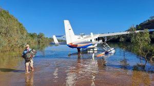
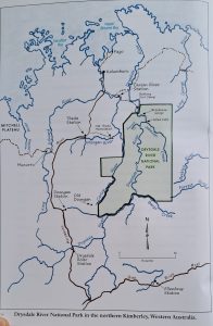
Imagine a National Park that is so remote that it has no signage or roads, but has books published about its trove of unique and ancient rock art: think of Drysdale River National Park in East Kimberly. Last June we were invited by fellow Byron Hikers Club members on a 12 day commercial adventure so inaccessible that we had to fly there in a float plane and land on the Drysdale River.
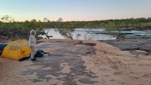
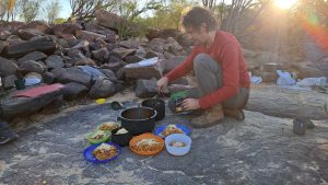
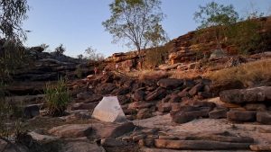
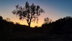
After landing next to a shallow sandy beach and unloading our packs and the food, we set off on an easy 7 kilometre walk through tall grass along the river bank. After several cooling-off swims and lunch, we arrived at our first camp which was on an expanse of smooth rock right beside the river. Our guide, Sebastian, soon had a 3 course dinner prepared for us. It started out with a first-day luxury; perfectly ripe Haas avocados with Seb’s own vinaigrette dressing, rice crackers with re-hydrated hummus and beetroot dips followed by pasta with lots of veggie chunks that Seb had dried himself. All the other evening meals were amazing and featured treats such as creme brolee with rehydrated mango cheeks.
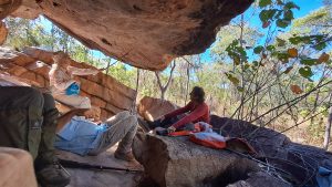
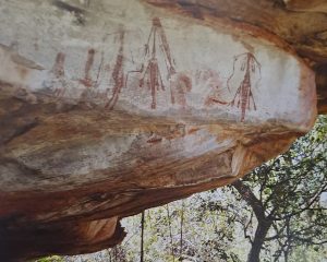
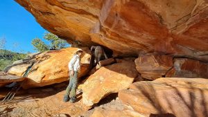
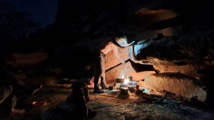
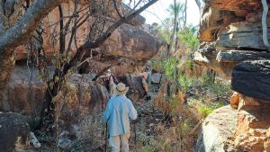
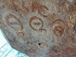
We visited the first of many rock art galleries the next day, not far from our river camp. The paintings included figures that had been termed ‘Bradshaw’ and are now known as Gwion Gwion. They are very fine-lined pictures, often of dancers in elaborate regalia that had been recorded in early photographs of local Aborigines as well as animals like the extinct thylacene and ghostly Wandjina figures. Ochre has been colonised by cyanobacteria to make indelible ‘paint’ that even survives galleries that are flooded during each wet season. The only reliable way of dating these works is analysing wasp nests that may have been built over a painting. The oldest such nest goes back 24,500 years! And that might only be a fraction of their age! As we visited gallery after gallery we kept thinking about what was happening in other parts of the world back then, tens of thousands of years before the advent of agriculture in the Middle East or the pharaohs on the Nile. It is mindboggling.
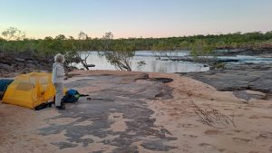
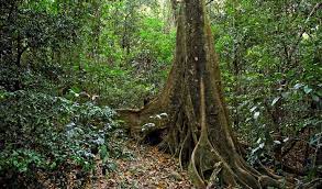
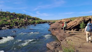
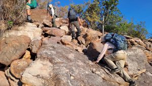
We followed the river downstream for the next few days visiting art sites in shady rock overhangs and camping on stunning river beaches. The river diverted to the east, swung north, then west around three sides of a giant square shape. We walked away from the river through lightly timbered dry savannah in a northerly direction along the fourth, ‘western side’, using one of many fault lines in this plateau of rock to descend a rocky escarpment back to the river. Salt water crocs potentially inhabit this section of the river, even though it is about 100km upstream. Hence we were careful not to swim in the main stream.

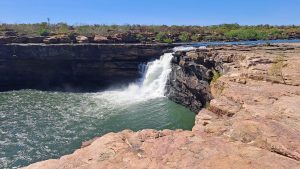
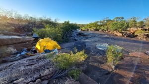
After several more days exploring the terrain and more art whilst moving upriver, we scrambled around the 30 metre high Solea Falls which prevent crocs going upstream. It was relaxing to know that we could swim safely again. After 9 days we were back at our first camp site where we picked up a stash of more food that enabled us to do a final 3 day loop up Planigale Creek. We camped on two different ‘quiet’ cascades, this being a much smaller watercourse than the Drysdale. At the second camp the stream slid about 5 metres over a waterfall into a rock pool as big as several tennis courts. Seb had observed freshwater croc tracks on our way in but we didn’t see any crocs despite much swimming. The next day we had 5 brolgas flying above us as we explored more creekside galleries. They eventually landed just downstream from where we stopped for lunch.
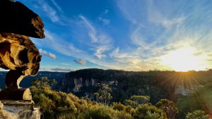
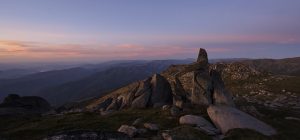
Although every camp on the hike was different, every one was a ‘to die for’ location. On the last day we used another faultline to break out of our ‘continent’ of rock that prevents any vehicle access to this whole area. We were then in an island of savannah that contained a number of small wetlands until we reached the original plane landing site. Here we swam and camped for the last night. The float plane picked us up the next morning as planned. As it droned over the rocky landscape back to Kununurra, I kept thinking about the land below that was so full of rock art and so empty of people. Black fellas moved into a mission to the north a century ago and have never gone back. Only a few of us white fellas have ever visited this magic land. Only a handful of people like our guide have made the effort to explore this remote wonderland.
Initially I couldn’t get my head around the cost of $6000 for this trip because I’m a do-it-yourself hiker who had never paid for a guided trip. Turns out it is quite reasonable considering the first plane airfare is a large part of the cost and that Sebastian is a legend as a guide in the Top End. For me it was a trip of a lifetime and worth every cent. We are recommending it to our Club members for this June.
We used the ‘Mount Connelly’ map on Avenza. Search Gwion Gwion in Wikipedia for rock art references. See here for details of this June’s expedition.