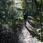
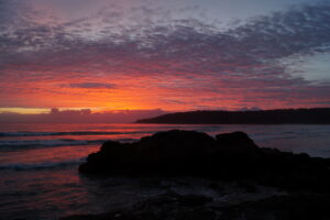
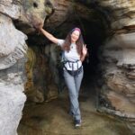
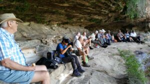
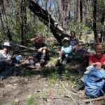
A typical lunch break, sitting under an overhang enjoying the view. This particular walk was on the Undercliff Track Wentworth Falls which is often done as a circuit with the Charles Darwin Walk and the Conservation Hut.
The Grand Canyon Circuit is a very popular family walk. If you only have time for one walk, this one is a good choice for a classic Blue Mountains experience.
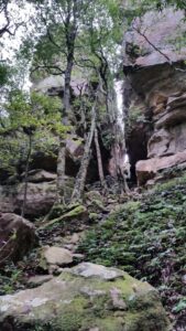
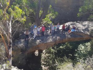
Dargan Arch in the upper Blue Mountains is an amazing natural sandstone arch in a gorge and an easy walk from carparking. To get to the bottom and under the Arch requires a little more effort but is well worth it.
Our November Club: Blue Mountains Conservation Society
The Blue Mountains Conservation Society (BMCS) has 330 bushwalking members who enjoy walking in amazing locations in the Blue Mountains and surroundings.
Blue Mountains Conservation Society has weekly bushwalks to suit a range of abilities held on Saturday, Monday, Tuesday and Thursday. The Club’s walk details can be found on the BMCS website where the activity subsection will invite new walkers. BMCS also has a monthly Plant Study Group.
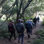
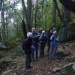
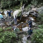
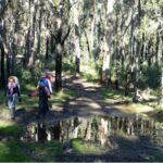
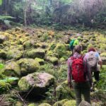
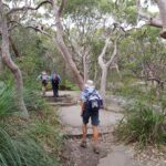
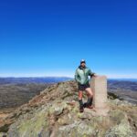
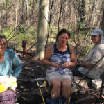
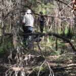
Comerang Mountain, Dampier State Forest, Sunday 21 February 2021, Walk Report by Rob Lees, Batemans Bay Bushwalkers
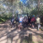
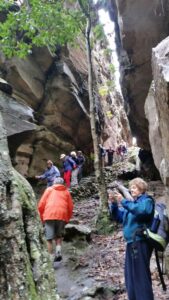
Seven hikers from Batemans Bay Bushwalkers set off on an exploratory walk to visit interesting geology seen on aerial photography in the creeks downslope from Comerang Mountain.
By definition an exploratory walk has not been reccied. However, we do examine topographic maps beforehand to evaluate terrain and access roads and to estimate a walk time and route. This is very important so club members can decide if this walk is compatible with their abilities and expectations.
Notwithstanding our best efforts, the reality once on the walk can often be very different!
The first thing we discovered was that B-Travers road (a well-used mountain bike road before the 2020 bushfires) had not been cleared of fallen trees. As we had hoped to drive our vehicles along this road, our walk was increased by 2km just to get to the starting point.
I had also proposed to use a number of other logging roads to get best access to the creeks. However we also found out once on site that these roads had not been used in decades. This made navigation difficult due to the forest regrowth and fire damage.
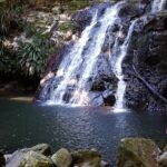
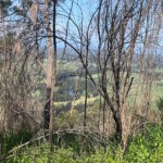
However once we finally made it to the creeks it was worth the effort as everyone was pleased with the spectacular geology, waterfalls and ponds. We noticed that the ancient volcanic rocks were highly fractured and very resistant to erosion which created the spectacular scenery. To our delight, in one pool we saw an eel and many small fish.
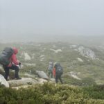
As walk leader I quickly realised we were not going to be able to visit all the outcrops that I had hoped to see and so we headed back upslope to Comerang Mountain. We knew the climb was going to be tough given the high humidity and temperatures that exceeded all projections. After the ascent, and with only 3kms remaining down a flat trail, we seven weary hikers were happy but also very glad that we would soon see our cars!
I will plan another exploratory walk in the winter that will go straight to the larger outcrops via a different route. I am hopeful that the scenery will be even more spectacular than what we experienced on the Comerang Mountain walk today.
Our club of the month Batemans Bay Bushwalkers are a crew of around 200 members, who have the shared goal of finding, exploring and enjoying the natural secrets of the national parks and forests of the NSW South Coast. First formed in 1985, Batemans Bay Bushwalkers are not-for-profit and run by volunteers.
Batemans Bay Bushwalkers publishes 4 Walks Programs per year, with 2 walks a week of varying grades. Visitors are covered by insurance for 3 walks each financial year to allow them to come and try Club walks. Walks are led by volunteer Walk Leaders, who carry a GPS, topographic map, and when appropriate, a safety beacon. Walk are graded according to difficulty so members can choose walks to suit their level of ability.
Batemans Bay Bushwalkers club members also get together for a variety of social activities and camps.
Blue Mountains National Park & Kanangra-Boyd National Park Draft Plan of Management
Background
The NSW National Parks and Wildlife Service (NPWS) is developing a new plan of management for Blue Mountains National Park and Kanangra-Boyd National Park to set long term directions for the management of these national parks.
NPWS facilitated 4 workshops between 4 and 6 June 2021 to elicit stakeholder views and feedback on a range of matters, including:
• management of adventure recreation activities, including abseiling, canyoning, rock
climbing and slacklining
• management of recreation in wilderness areas
• management of key visitor sites.
Feedback on each of these discussion themes and other issues is summarised below. In this document, NPWS has endeavoured to reflect the feedback provided by workshop participants as accurately as possible. The points listed below do not necessarily reflect the views of all workshop participants.
2
Adventure recreation
General
• NPWS should use existing user groups to reach out and educate new users – e.g.
climbing gyms, outdoor clubs, university clubs, education groups.
• Visitors to the parks value the experience of being in the park and are concerned about
their own safety.
• Environmental sustainability and visitor safety are often compromised when large
groups are involved in adventure recreational activities.
• The focus of management should be on proper risk management and auditing, rather
than exclusively on limiting group size.
• The Australian Adventure Activity Standards (AASs) represent significant work and
thought by industry professionals. As such, NPWS group size limits should align with
these as much possible. Activity-specific Good Practice Guides (GPG) provide
recommendations about group sizes.
• One organisation represented at the workshop highlighted that compulsory adoption of
AAS standards and the GPG was not supported.
• Clubs are generally well managed and concerned about risk. They rely on selfregulation because they are not sufficiently resourced to adopt additional responsibilities
for the management of their members.
• A participant described the group size limits set by NPWS as generous.
• One business highlighted that they may use smaller groups than allowed.
• Improved communication methods are required to disseminate information about the
rules for each activity (e.g. a broader range of social media platforms, different
languages etc.).
Abseiling
• Maintaining a group size limit of 8 participants (and one guide) was appropriate.
• For multi-pitch abseiling, a reduced group size limit of 4 participants (and one guide)
was more appropriate.
• Larger group sizes were generally not appropriate but could be feasible at specific sites.
Canyoning
• The ‘canyoning community’ is working on a best practice document that addresses
environmental risk, cultural risk, and safety risks. This document can be provided to
NPWS.
• Maintaining group size limits was necessary to maintain individual and group safety and
to minimise any environmental impacts.
• Social media is motivating participants with insufficient skills to undertake the activity.
There may be opportunities to utilise social media to promote safety messages.
• Some people are attempting canyoning with limited experience and without the support
of a club.
• Group size limits should be conservative and appropriate for the canyon. A group size
of 10-12 was considered too high.
3
• Use of a booking system was supported at popular sites.
• Group size limits should apply to both commercial and non-commercial groups. Guides
help to reduce impacts and therefore should be allowed as an addition to the group size
limit.
• There should be a cap on total group numbers (commercial and non-commercial) per
canyon, per day, to manage current and future use.
• NPWS should consider adopting management strategies like those used by the US
National Parks Service.
• Education providers could benefit if they were licensed as commercial tour operators.
This would enable them to access improved operating arrangements including use of
the DigiRez booking system.
Rock climbing
• Top-rope climbing should have the same group size limit as applies to abseiling.
• A group size limit should be 4 or 5 participants per roped party.
• Bolting in the parks is an ongoing issue of concern. It was suggested that an updated
bolting policy and/or further discussion with NPWS is required. It was recommended that
the QLD Government’s approach to management should be considered.
• There have been some changes in group behaviours in recent years (for example,
visitors playing music when out in the parks).
• Group size limits should apply to both commercial and non-commercial groups. As
guides help to reduce impacts, they should be allowed as an addition to the group size
limit.
• The current approach to managing bolting/anchor points is not working. Further
engagement is needed to increase self-regulation, minimise impacts and maximise
safety.
• It was acknowledged that risk management was a complex issue and beyond the scope
of the plan of management to resolve.
• Australian Climbing Association has a climbing database (The Crag) that could be
utilised to improve communication with climbers about specific sites.
• Rock climbers should not be a source of revenue.
• Any plans to apply zoning for different types of climbing will require further consultation
with climbers.
• Education is needed for rock climbers on how to manage their waste.
Slacklining
• Slacklining was defined as the temporary use of trees in disturbed areas such as visitor
precincts (camping areas or day use areas where there isn’t high visitor traffic)
• Highlining was defined as the temporary use of cliff features and existing anchors/bolts
(rock climbing) for traversing on a safety line across airspace.
• There is interest in both recreational-based slacklining and event-based slacklining.
• The Australian Slacklining Association has established a code of conduct, fixed anchors
guidelines and guidelines regarding airspace safety. There is also an Adventure Activity
Standard in place.
4
• Slacklining is an emerging, legitimate adventure activity both in Australia and
internationally and it is therefore appropriate that NPWS makes provision for the activity
in the plan of management.
• Issues include impact on ecologically sensitive sites, the potential for noise pollution
(from webbing), air space /aviation safety, impact on scenic values and damage to
trees.
• Limits should apply on the duration of slacklines (e.g. 1 day).
• Variations of the activity include water-lining, yoga-lining, and trick-lining. Parks are not
a major focus for these activities.
• The strategies used by NPWS to manage other adventure recreational activities should
be sufficient to provide for the safe and sustainable authorisation of slacklining.
Recreation in wilderness
General
• A group size limit of 8 should be retained.
• Guides actively manage group behaviour. For this reason, the allowance of 2 guides for
commercial tour operators should be extended to educational groups.
• There is a need for active management in response to degradation around Burra Korain,
Dex Creek and Mobbs Swamp camping areas.
• Divergent views were expressed about the introduction of toilets and other infrastructure
to manage impacts. Most participants were supportive of the establishment of minimalist
and carefully designed infrastructure (including toilets), provided this was part of a more
holistic strategy which sought to avoid infrastructure development wherever possible.
Several participants highlighted the need for sound evidence before infrastructure
development in Wilderness areas is considered.
• The requirement to book all camping areas limits the freedom of individual choice and
requires all camping to become a pre-planned activity (rather than a spontaneous one).
• Designation of campsites and access via a booking system may be necessary.
However, the designation of campsites should not restrict options for walkers that still
wanted to enjoy dispersed bush camping.
• Information and education should be retained as the primary strategies for preserving
wilderness values.
• Information for walkers about wilderness boundaries should be improved as many
visitors don’t know when they were entering a wilderness area.
• The risk of exceeding the carrying capacity of wilderness areas was a major theme of
discussion. It was highlighted that social media and the promotion of wilderness
experiences (especially during peak visitation periods) presented a risk to wilderness
values.
• Marketing should avoid promotion of wilderness experiences during periods of peak
visitation.
• The parks are significant for the preservation of wilderness values, and the unique
experiences that these wilderness areas provide.
• The plan of management should include strategies to retain opportunities for people to
enjoy true wilderness experiences in the long-term and that these strategies should
seek to prevent the application of more interventionist strategies (e.g. toilets) in the long
term.
5
• More active wilderness preservation strategies (e.g. toilets) would be more appropriate
in areas that were of lower wilderness quality such as the Grose Valley.
• There is a concern that people may become lost following incorrect trails that have
developed through use. Remedial work, consistent with the retention of wilderness
values (including vegetation management and track works) was supported.
Visitor facilities
General
• The current event application process is overly onerous for small smaller organisations
conducting small scale events.
• The factors involved in providing a sound rationale for visitor facility investment (and
disinvestment) should include visitor demographics and demand.
• There are opportunities to work cooperatively with Blue Mountains City Council and
private sector partners, across tenure and on private property to address visitor facility
needs.
• Facilities (including campsites) need to cater for a broad range of abilities and
experiences. There should be areas designated for caravans, walkers, and car-based
visitors.
• Visitors are also looking for shorter walks and picnics in natural settings.
• Strategies to address carrying capacity and spread visitation onto other areas (and to
undertake other activities) need to be developed.
• Degradation of some camping areas was noted. Some should remain undeveloped and
unregulated while it may be appropriate at others to manage impacts and level of use
through improved facilities and bookings.
• The scale-up and scale-down of campsites were raised as an option to facilitate
recovery of impacted sites.
• Consider a classification system for campsites to ensure that visitors have clear
expectations about levels of service.
• Some climbers would appreciate having access to climber-only camping sites.
• Some campgrounds are currently used by caravaners and camper-trailer campers (e.g.
Dunphy’s, Green Gully & Boyd River).
• The facilities required for caravan and camper-trailer camping (electricity supply, areas
for generators, waste dump points etc.) were discussed. Concerns were raised about
the impact of these facilities on the park experience.
• Participants opposed caravans and camper-trailers being used in the park as there are
sufficient alternatives for these styles of camping outside the park.
• The use of camping areas by commercial operators needs to be appropriately managed
to ensure access by other visitors is not compromised.
• Permanent camping should not be allowed.
• Visitor safety, access and environmental protection should be considered during
detailed design for visitor sites.
• Some improvements are required to facilities that are causing adverse impacts on
environmental values (sedimentation from trails, roads and carparks, toilets etc.).
• Improvements are required to soft infrastructure (online information, maps etc.).
6
• The role of site design in managing visitor expectations and in offering a range of high
quality experiences was a focus of discussion.
Access to visitor sites
• Private tourism developments within the parks including luxury lodges and glamping
within existing campsites was opposed.
• There are not enough places to provide accessible adventure activities for people living
with disability. Modified gates to provide access could be utilised. An accessible ‘great
walk’ could be considered.
• Arrangements for access to the park through private property (and access to private
inholdings) requires clarification in the plan. Private landholders often do not allow
access across their land to the parks because they are concerned about public liability.
• Providing access could create camping opportunities at sites including Kedumba Valley
(larger groups), Pack Saddles (small groups) and Canyon Colliery.
• Opportunities for camping at Green Gully should be considered during development of
the precinct plan for that site.
• There is demand for campsites that cater for larger groups. This may take pressure off
smaller sites.
• Access at Dunphy’s requires resolution.
• Yerranderie and Wolongambe have opportunities for camping but access issues would
require resolution. Ingar also has great opportunities for camping however restrictions
with access would require resolution.
• Cross-tenure arrangements need to be considered at Ingar to allow access to NPWS
assets.
• Perry’s Lookdown does not offer a quality camping experience. This requires resolution.
• There was a recommendation that the Blue Labyrinth should be managed as a remote
natural area. The last plan of management recommended sealing the road to Nepean
Lookout. This is not appropriate for tradition and history reasons.
Online booking
• The pros and cons of bookings systems were discussed. There are challenges
associated with booking groups however a booking system can help to change
behaviour, cap numbers, and generate improved experiences.
• Bookings need to be easy, flexible for groups, allow for spontaneity, and consider safety
and park management needs. The system needs regular review to ensure functionality
and effectiveness.
• Maintaining records of trip intentions is another way of monitoring visitor numbers.
• Sydney people are getting used to online booking for campsites. This system could be
expanded to encompass booking for day trip experiences.
• There is support for bookings and revenue collection where revenue can be reinvested
into the park.
• There have been instances where people have booked campsites and have then not
utilised their booking. This is a problem with the online booking system because it has
potential to restrict access for campers and could encourage larger groups and illegal
party’s that could impact on other campers.
• Booking platform (Digirez) needs to recognise a diversity of sites to match the type of
experiences and people that are booking. Currently it is too restrictive.
7
• To plan their camping trip, people need to access information about campsite sizes and
numbers group sizes before they access the Digirez platform.
Potential improvements to visitor sites
• Schools use the parks for multi day walks (with self-sufficient camping) and school
camps. School camps require larger campgrounds, toilets, and vehicle access. Sites like
Mount Wilson and Newnes are important. There may also be opportunities at Euroka
and Green Gully.
• Green Gully Cabins are currently under-utilised, and consideration should be given to
better manage the site and its future use.
• It was suggested that camp hosts could be better utilised.
• Hanging Rock needs implementation of a site management plan.
• NPWS maintenance and upgrades of existing tracks (including Grand Canyon) were
commended. Providing good quality tracks in popular areas attracts novice bush
walkers and leaves more difficult walks for those with more experience.
• Govetts Leap upgrades were discussed. It was acknowledged that, while improvements
seemed logical, residents may have strong views about things that affect them directly.
• The following areas within and outside the parks could be considered for improved
access and facilities: Narrow Neck, Wolgan, Victoria Falls Road, Evans Lookout,
Kedumba, Greens Gully, Mt Banks, Wolongambe, Bells Line Road, Acacia Flat
campground, Wentworth Falls, Conservation hut, Copeland Pass and Yerranderie.
• Upgrade is required for the Copeland Pass Track.
• The K2K walk experience should be supported.
• Upgrades are required at trail heads to provide toilet facilities and improved information.
• Facilities at popular climbing areas should be upgraded to include toilet facilities.
• A walking loop from Turras Ladders east to Kedumba River, K2K to Solitary was
suggested. Catchment restrictions were acknowledged.
Other issues
Information
• Online communication about park access requires improvement. Alerts are not updated
often enough.
• Visitors need better information from utilities when they close tracks to undertake work.
It is hard to determine if whole or part of a track is closed and whether you can walk
around the closure.
• Strategies are required to communicate the boundaries between the parks and council
land.
• Bushwalking NSW are seeking more engagement with NPWS on matters of mutual
interest.
• Recreational organisations provide opportunities for improved communication about
park management (e.g. Bushwalking NSW newsletter).
• Communication to visitors could be improved through the application of consistent
signage across tenures.
8
Visitor management
• Increased visitation (and the resultant pressures on the park and the visitor experience)
is an issue that needs to be addressed at a strategic infrastructure planning level, and
through marketing and information.
• The lack of park entry fees was questioned, with some support for fees in areas with
facilities. The application of fees within wilderness areas was not supported.
• Increased visitation is restricting carparks for some residents. It was suggested that
NPWS should cooperate more with local government to improve carparking adjacent to
the parks.
• Strategies for the management of visitors and tourists should be consistent.
Plan of management
• The plan should integrate with other relevant planning documents including special
areas plans for catchments, world heritage plans, indigenous land use agreements,
heritage plans, tourism plans, plans for adjacent parks and precinct plans.
• Some people would like to see what actions have been completed in the current plan of
management.
• NPWS needs to allow adequate time for groups/stakeholder to consider information
when consulting.
• Climate change impacts on park values, use and management (including park closures,
fire, water, pest management and changing visitor use patterns) need to be addressed
in the plan.
• Plan needs to provide scope to respond to unforeseen or emerging issues (e.g.
birdwatchers following honeyeater migration, changed flight paths with the new airport
and dam development proposals).
• Pest plant and animal management should be a focus for the plan of management.
• The plan of management should seek to improve the interpretation of Aboriginal cultural
heritage and non-Aboriginal cultural heritage within the parks.
• The plan of management should provide scope for the application of Aboriginal names
in the parks.
Fire management
• Increased burning in wilderness areas should not be to be used to achieve prescribed
burns targets.
• Fire management should be ecologically based– with specific assets targeted for fire
protection.
World heritage
• A consistent approach to management and improved communication about the World
Heritage Area is required.
• The World Heritage Working Group should engage more broadly with the community.
Drones
• Drones are now common within the escarpment including at lookouts.
9
• Concerns were raised about the safety of drones and disturbance to visitors.
• Support was expressed to exclude drones from the parks
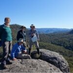
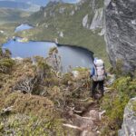
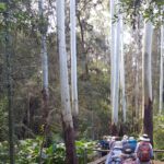
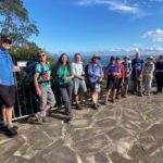
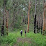
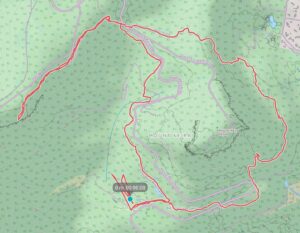
Mt Keira Ring Track plus Robertson’s Lookout, Illawarra Escarpment State Conservation Area 26 June 2021, Walk Report by Russell Verdon, Illawarra Ramblers Club
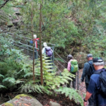
We walked Mt Keira ring track anticlockwise plus the extension to Robertson’s Lookout. There were hundreds of steps to negotiate. Total Distance: 8 Km, Duration: 4 Hr, Grade: 3 Moderate.
Record of the Walked Track
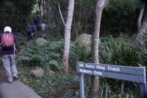
Eight Ramblers registered for the walk located at Wollongong’s prominent landmark Mt Keira.
We commenced walking at the civilised winter hour of 9am from Byarong Park. This park is on Mt Keira Road and adjacent to the Girl Guide Camp. The path leads up a short 300m stroll to meet with the ring track.
The cooler dryer conditions at this time of the year made for easy walking and minimal prospects for encountering leeches, often a feature in this area when the ground is damp.
Once at the ring track we took the right fork to commence our anticlockwise circuit of the mountain. A lot of track improvements such as boardwalk installation and repair of steps has been completed allowing reopening of the ring track after past rock slides.
Walking another 400m brought us back to Mt Keira Rd where we crossed 20 minutes into our walk, to continue the ring track on its southern side.
After another 400m the track touches the road again and we prepared to climb up the 100 odd steps to take us up to the next level section of the track through board walked rainforest then up another 296 steps where some nice views through the tree canopy to the north west were awaiting us, nearly an hour and a quarter into our walk.
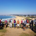
We continued roughly 700m along the ring track reaching the junction where the path to Robertson’s lookout commenced. Those still feeling energetic walked to the lookout and we enjoyed the views down the escarpment followed by some well earned morning tea.
Then we followed the ring track downhill glimpsing the archery range located across from Byarong Park.
Not a lot in flower close to the track at the moment, but the odd glimpse of colour, and always good to marvel at the figs as we made our way back to the start at Byarong Park about three and a half hours later.
Thanks Anne for leading another great local walk!
Our Club of the Month: Illawarra Ramblers Club
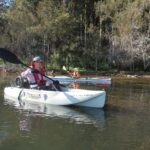
The Illawarra Ramblers Club is based at Wollongong and provides walking, kayaking, and cycling activities including trips away. We have a stable membership of around 250 friendly folk. Our activities are graded to suit members’ abilities and are spread throughout the whole week. Located in the Illawarra we are close to and frequently access National Parks, coastal regions, the Illawarra escarpment, rivers, lakes and and the Southern Highlands. Try a couple activities for free before joining – hope to see you soon!
Ben Boyd NP – Andrew ConnorLight to Light Walk, Ben Boyd National Park
Light to Light Walk, Ben Boyd National Park
In 2019 the NSW National Parks and Wildlife Service (NPWS) exhibited a draft Light to Light Walk Strategy along with amendments to the Ben Boyd NP Plan of Management. The draft Strategy proposed a signature multi-day coastal walk, transforming the existing campground walk experience with hut to hut and lighthouse style accommodation in addition to new walk-in campgrounds. There were also proposed realignments to the existing track. As well as forcing independent walkers and others into formal campgrounds, the draft Strategy also proposed the prohibition of bush camping along the walking route.
The public exhibition attracted over 200 submissions, including from Bushwalking NSW Inc and bushwalking clubs. NPWS has now released the final Strategy and Plan of Management Amendments along with a report on submissions made and responses. These documents can be accessed here.
The final Strategy delivers much of what was proposed in the draft, although changes have been made to address some of the concerns raised during the exhibition period.
Bush camping will be allowed at Mowarry Point although it is unclear if the existing area will need expansion over time. NPWS will not co-locate independent camping with accommodation at Hegartys Bay. Independent camping will be relocated from Hegartys Bay to purpose built walk-in only sites at Bittangabee Bay. A separate group camping area will also be developed at Bittangabee Bay. Given the new facilities proposed at Mowarry Point, NPWS will no longer construct purpose built walk-in only campsites at Saltwater Creek. Two new hut accommodation sites at Mowarry Point and Hegartys Bay are proposed to cater for a maximum of 36 walkers per night. The existing accommodation at Green Cape Lightstation will be reconfigured to accommodate 36 walkers.
The Strategy confirms that the new accommodation will be managed by NPWS rather than a commercial operator.
The proposed walk has been awarded $7.9 million funding by the Regional Growth – Environment and Tourism Fund program, an initiative of the NSW Department of Planning, Industry and Environment. Subject to approvals, work on the first stage was expected to commence in late 2021 and be completed in late 2022. Before work commenced, a Review of Environmental Factors was released for public comment.
To assist with the implementation of the Strategy, NPWS will be establishing a Light to Light Walk Stakeholder Reference Group. It is hoped that this group will include representation from the bushwalking community.
Review of Environmental Factors Released for Public Comment
NPWS has also released a Review of Environmental Factors (REF) to inform the proposed upgrades to the Light to Light Walk. The REF is open for consultation until 15 October 2021. BNSW Inc will be making a submission on the REF and affiliated clubs are encourage to do likewise. The REF and accompanying documentation can be found here.
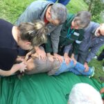
At the start of 2021 Canberra Bushwalking Club held a challenging and interesting activity for members – a river-crossing training exercise. Held in the clear waters of the Cotter River, 26 club members attended keen to learn how to cross rivers safely.
The training was recommended for leaders and anyone contemplating walking in New Zealand or Tasmania. The course covered teaching participants how to assess a river, identify the safest crossing place and solo and team crossing techniques. Participants practiced these techniques in water up to thigh deep and also had the opportunity to practice swimming with a pack.
The day was highly successful with all participants agreeing that the course helped them to learn these essential life-saving skills. Watch more here to learn more about river safety.
Canberra Bushwalking Club was founded in 1961 and currently has over 400 members. While the Club’s main activity is bushwalking it also offers canoeing, canyoning, caving, conservation work parties, cross-country skiing, cycling, geocaching, liloing and social activities. Check out the Club’s Facebook page to see more.
“When you go out there, you don’t get away from it all. You get back to it all. You come home to what’s important. You come home to yourself.”
Peter Dombrovkis
Tasmanian Wilderness Photographer, 1945 – 1996
Human beings have lost our connection to nature – and therefore ourselves. Convenience & consumerism has given us a taste for pleasure at the expense of deeper satisfaction. This has led to psychological issues, widespread environmental destruction and even more disconnection from nature. It’s a vicious circle.
There is significant scientific research that demonstrates the quantifiable, measurable benefits of spending time in nature: a reduction in negative thinking and mental illness, as well of course physical fitness and well-being. Interestingly however, this science often can’t explain why such benefits from spending time in nature have occurred, especially those relating to mental health. It’s very likely that human beings don’t fully understand our relationship to nature. However we know enough to know that it’s vital – literally indispensable to our existence.
The Deakin University Literature Review is a comprehensive review of the science that correlates spending time in nature with measurable mental health benefits. Some quick highlights:
“People possess an inherent inclination to affiliate with natural processes and diversity, and this affinity continues to be instrumental in humans’ physical and mental development.” Kellert & Derr 1988
“The manifold ways by which human beings are tied to the remainder of life is poorly understood.” Kellert 1993
“Scientists have found that merely being in an urban environment impairs our basic mental processes.” Lehrer 2009
“The authors concluded that neighbourhood greenness was more associated with mental health than physical health.” Sanesi & Chiarello 2006
“When compared with an urban scene and all its attendant features, natural settings with tree views and nature reserves with vegetation and wildlife reduced stress levels and blood pressure while improving mood and lowering anger and aggression in participants.” Laumann 2001
“Those closer to natural settings were more able to deal with important matters in their lives and felt more hopeful and less helpless about confronting life issues, whereas those living with minimal green or no green vegetation nearby had the opposite experience.” Kuo 2001
“Public housing residents whose nearby natural settings scored higher on the scale showed lower levels of mental fatigue and reported less aggression and violence than residents situated closer to the lower end of the scale.”
“Measures of salivary amylase activity (an indicator of sympathetic / stress response nervous system arousal) prior to and following a walk in an urban and forest environment individually, showed that salivary amylase activity of the subjects was reduced in the forest environment relative to the urban environment.” Yamaguchi 2006
“Nearly all of the subjects showed higher immune system activity after the three-day forest trip (about a 50 per cent increase) relative to before.” Li 2007
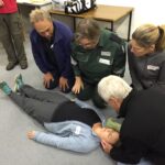
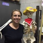
Volunteer St John Ambulance trainer, Belinda Keir, has been instructing First Aid at Senior level since before 2000. Belinda’s practical teaching methods have helped to raise the level of First Aid knowledge within bushwalking clubs. Belinda was recently awarded the Bushwalking NSW 2020 Chardon Award.
St John Ambulance first aid courses have recently changed so it is recommended that Clubs check course codes on the Bushwalking NSW First Aid Training page. The course code for Provide First Aid is now HLTAID011 instead of HLTAID003 and for Provide First Aid in a Remote or Isolated Situation is now HLTAID013 instead of HLTAID005. The change in course codes mean that all class ID numbers have been revised. You will need to quote the correct class ID to book any course. As our next Remote course is only a few weeks away, we would be grateful if this could be done as soon as possible.
People who have a less than 12 months old HLTAID003 or HLTAID011 Provide First Aid certificate can request a credit transfer for Provide First Aid in a Remote or Isolated Situation. This gets a discount in time (you don’t need to attend day one) but not a price discount. Credit transfers can take time to arrange and need to be organised well before the course. Please request a credit transfer form when you enrol and return it with evidence of your current HLTAID003 or HLTAID011 certificate. This will be verified by St John and if a credit transfer is granted it will be attached to the class roll.
Please note that while class size limits are currently 18, this could change due to COVID. While the two remote courses are put on our calendar for bushwalkers, there is usually space in other Provide First Aid courses which are offered to members of Scouts NSW.
In 2022 it is anticipated that Provide First Aid in a Remote or Isolated Situation HLTAID013 courses for bushwalkers and Scouts will run at Barra Brui (St Ives) over two weekends in February, July and November.
Keith Maxwell has stated:
“I have always thought that an important role for Search and Rescue/Bushwalking NSW was to encourage the spread of First Aid knowledge throughout the bushwalking clubs. For example, the Bush Club runs its own stream of First Aid training. Training for their Club walks leaders is fully subsidised by the club”.
Kirsten Mayer, Executive Officer of Bushwalking NSW Inc said:
“First Aid training is important for our clubs and we are so grateful to the entire team of Scouts and St John Ambulance volunteers who facilitate and deliver this training. All of this volunteer effort keeps the price very low for our bushwalkers. We encourage our club members to undertake this training. We also encourage our clubs to consider subsidising First Aid training for walks’ leaders.”
Marie Byles Commemorative Walks , The Bush Club, Walks Report by Astrid van Blerk & Kevin Yeats, Images by Astrid van Blerk and Ian Evans
The Bush Club is one of the major walking clubs in Sydney, which offers its currently over 850 members a huge variety of activities such as day and pack walks, cycles, and multi-day trips to explore areas further away. It is often referred to as “the friendly club” – its culture is supportive and inclusive, walks range from relatively easy to challenging and adventurous so everyone can find something that suits them individually, and there is a special focus on encouraging new leaders which allows interested members to try out new skills and share their favourite walks with others. Whenever you meet a Bush Club group on the track you will notice that the atmosphere is happy, open and relaxed – we sure have mastered the art of having fun outdoors! Another telltale sign that the club is healthy and thriving is how much resilience and optimism it showed in these challenging times of the pandemic. For example, during the 2019/20 financial year despite the Covid shutdown which prevented group walking for several weeks, the club managed to complete an astonishing 446 activities – predominantly weekday day walks with an average number of 9.5 paricipants each. What a wonderful way to keep moving and breathing fresh air, and to maintain one’s sanity and social contacts at the same time…!
One of the many interesting collaborative projects that the club offered to its members recently was created to commemorate its co-founder Marie Byles, who together with Paddy Pallin brought the club into existence in 1939.
Marie Byles (1900 – 1979) was the first woman to practice law in NSW, a mountaineer, explorer and avid bushwalker, a committed conservationist, feminist, author and an original member of the Buddhist Society in NSW. As a teenager at her parent’s holiday retreat at Palm Beach, she would look through her telescope across Broken Bay to the bushland on the Central Coast. She would later campaign successfully to place the former coal reserve on the Bouddi Peninsula under public ownership and in 1935 Bouddi Natural (later National) Park was formed, with Marie being elected a trustee of the board that managed the park. By 1938, she had built the house she called ‘Ahimsa’ (nonviolence), on her 3½ acre bushland property at Cheltenham, which she later bequeathed to the National Trust.
To honour Marie Byles’ achievements and contributions to the club, a series of 7 walks, ‘From Buddha to Bouddi’, were held, starting on Marie’s birthday (8th April), from ‘Ahimsa’, Cheltenham and finishing at Marie Byles Lookout in Bouddi. The walks passed through 5 National Parks, numerous council parks and reserves, as well as beaches and important wetlands, and all were suitable for public transport. Walks ranged from an ‘octogenarian friendly’ grade 2 to a more demanding grade 4, as follows:
1. Cheltenham to Lindfield via ‘Ahimsa’, GNW along Lane Cove River to Fullers Bridge, Little Blue Gum Creek, Primula Oval, Paddy Pallin Reserve, Lindfield (19km grade 3).
2. Lindfield to Seaforth Oval via Seven Little Australians Park, Two Creeks Track, Flat Rock Beach, Magazine Track, Natural Bridge, The Bluff and Bantry Bay (21km grade 4 – actual walk reversed for transport convenience).
3. Seaforth Oval to Manly via Manly Dam Reserve, Burnt Bridge Creek, Clontarf Beach, Harbour Walk to Manly (19km grade 3).
4. Manly to Collaroy via Queenscliff with side trip to the wormhole, Freshwater, Curl Curl, Dee Why, Long Reef (11km grade 2)
5. Collaroy to Avalon via Warriewood, Mona Vale, Newport, Crown of Newport Reserve, Bilgola and Avalon Beaches (17km grade 3).
6. Avalon to Palm Beach via Angophora Reserve, Clareville Beach, Bangalley, Whale Beach, Palm Beach and Barrenjoey Head (20km grade 3).
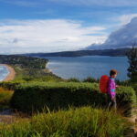
7. Palm Beach to Wagstaffe by ferry, then circuit walk in Bouddi NP visiting Hardy Bay, Allen Strom Lookout, Rocky Point trail, Mt Bouddi, Maitland Bay, Marie Byles Lookout and Pretty Beach (19km grade 3).
This walks series was a great success overall, and there are already calls to repeat the whole lot again next year. A special thanks goes to our wonderful thoughtful and innovative leaders who each led a section, in order: Jenny Donoghoe, Fiona Sonntag, John Hungerford, Bob Taffel, Astrid van Blerk, Joy Bell and Carole Beales-Evans. Also, to quote Carole, thanks to the amazing walkers who made it so special!
To find out more about the Bush Club, please see here. Membership is open to those over 18. To be part of The Bush Club, sign up as a prospective member. Our leaders will help you select activities which will suit you and your fitness. After completing three membership qualifying walks, you can apply to become a full member. We are always looking forward to welcome new members – see you on the track!
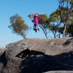
Notwithstanding reports that hiking and outdoor adventure has become fashionable for millennials, bushwalking clubs continue to seek ways to attract younger people. An experienced young bushwalker keen to help clubs address this issue is National Parks Association of the ACT Committee Member Stef De Montis – age 32. Stef bush camps regularly in Australia’s high country and is also a keen runner, cyclist, skier and photographer.
Stef is interviewed in the June 2021 NPA Bulletin. He is passionate about helping clubs to attract younger members and believes this is needed to provide future club leaders and members. He highlights the importance of attracting young people to clubs to gain valuable life skills and an awareness of the importance of environmental protection.
Stef feels that many young people may be missing a sense of community in our modern world and that building friendships in a group setting will enhance young people’s ability to maintain their commitment to important causes.
To attract younger people Stef suggests that clubs hold social events aimed at, and run by, younger people. Clubs can also harness the skills of experienced members by promoting informal mentorship programs to make young people feel welcome and develop their skills. He also believes that initiatives such as photography competitions and maintaining a strong online presence are ways clubs can encourage young people to get involved.
If you would like to read further, Bushwalking NSW has previously discussed similar ideas for clubs to consider, such as:
Consideration of the current average age of club members and if there is a need to appeal to a younger demographic
Identifying the potential reasons young people are not engaging with clubs
Identifying the skills and benefits clubs can provide to young people and the best way they can be be made aware of them
How to harness and pass on the skills of experienced members, for example, through mentoring opportunities
Consideration of how walks can be scheduled around young people’s work and or study commitments
Available opportunities to partner with local training organisations
What is the current demographic of your club and how successful have you been in attracting younger members? Let us know your experience and views – we would love to hear from you! – feel free to email Justine Bourke at newsletter@bushwalkingnsw.org.au
 Once at the ring track we took the right fork to commence our anticlockwise circuit of the mountain. A lot of track improvements such as boardwalk installation and repair of steps has been completed allowing reopening of the ring track after past rock slides.
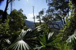 After another 400m the track touches the road again and we prepared to climb up the 100 odd steps to take us up to the next level section of the track through board walked rainforest then up another 296 steps where some nice views through the tree canopy to the north west were awaiting us, nearly an hour and a quarter into our walk.
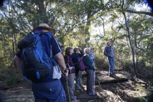 Then we followed the ring track downhill glimpsing the archery range located across from Byarong Park.