main

Young People in Bushwalking Clubs

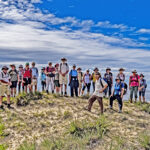
Notwithstanding reports that hiking and outdoor adventure has become fashionable for millennials, bushwalking clubs continue to seek ways to attract younger people.  An experienced young bushwalker keen to help clubs address this issue is National Parks Association of the ACT Committee Member Stef De Montis – age 32. Stef bush camps regularly in Australia’s high country and is also a keen runner, cyclist, skier and photographer.

Stef is interviewed in the June 2021 NPA Bulletin. He is passionate about helping clubs to attract younger members and believes this is needed to provide future club leaders and members. He highlights the importance of attracting young people to clubs to gain valuable life skills and an awareness of the importance of environmental protection.

Stef feels that many young people may be missing a sense of community in our modern world and that building friendships in a group setting will enhance young people’s ability to maintain their commitment to important causes.

To attract younger people Stef suggests that clubs hold social events aimed at, and run by, younger people.  Clubs can also harness the skills of experienced members by promoting informal mentorship programs to make young people feel welcome and develop their skills. He also believes that initiatives such as photography competitions and maintaining a strong online presence are ways clubs can encourage young people to get involved.

If you would like to read further, Bushwalking NSW has previously discussed similar ideas for clubs to consider, such as:

  • Consideration of the current average age of club members and if there is a need to appeal to a younger demographic
  • Identifying the potential reasons young people are not engaging with clubs
  • Identifying the skills and benefits clubs can provide to young people and the best way they can be be made aware of them
  • How to harness and pass on the skills of experienced members, for example, through mentoring opportunities
  • Consideration of how walks can be scheduled around young people’s work and or study commitments
  • Available opportunities to partner with local training organisations

What is the current demographic of your club and how successful have you been in attracting younger members? Let us know your experience and views – we would love to hear from you! – feel free to email Justine Bourke at newsletter@bushwalkingnsw.org.au

Armidale Bushwalkers – 2020 Walks Report (extract)

2020 WALKS REPORT (extract), Armidale Bushwalkers


Like many, Armidale Bushwalkers 2020 walks program got off to a very slow start.

The Club held a one day walk in January around Point Lookout with five members. The smoke from fires still lingered in the valley below Wrights Lookout although where we walked had not been burnt.

In February the Club held a one day walk in the Sunnyside area with five members present while the Secretary was away in Tasmania.

During March the Club had two day walks with dates swapped and the outcome that neither walk went ahead. A weekend walk was organized for a Friday and Saturday later in March which meant that a number of members including the Secretary were unable to participate in the walk. The walk was to be the last for many months as the COVID crisis forced everyone into lock down. Walks were cancelled and the garden never looked better when the lockdown ended in late May.

The Club got together at Gara Gorge at the end of May and discussed walks for the winter months. A short walk along the Threlfall Track helped everyone shake off the lockdown blues and get back into shape for the winter walks. The first walk for the winter was to the summit of Mount Duval and camping near the trig with twelve participants. A wet start on the Sunday meant we were back at the cars and home for lunch.

On the following Sunday twelve members enjoyed a day walk traversing the summit of Mount Yarrowyck.

July saw quite a few walks cancelled due to weather and leaders having other commitments. Four members joined an unscheduled half day walk on the first Sunday in July in the Long Point area. See remainder of walks report here.

Our Club of the Month: Armidale Bushwalking Club

Armidale Bushwalking Club was formed in late 2004 and has approximately 50 members. The Club run walks once a fortnight – usually there’s one or two day trips and a more challenging backpack walk once a month. The Club also brings people together to organise their own trips – from an afternoon stroll to extended overseas backpack trip.

The Club is developing a loose association between clubs surrounding Guy Fawkes river- a kind of “Fawkes Fraternity” to share programs, ideas and trips including with Inverell Bushwalking Club, Clarence Valley Bushwalkers and Ulitarra Conservation Society.

Joining a  group such as Armidale Bushwalking Club is a good way to get started in bushwalking as you can borrow gear from the Club’s store, find out about great places to walk, share costs and ideas and, most importantly, walk safely with experienced walkers.  Club membership gives you access to walks with all of the NSW Confederation of Bushwalking Clubs, and excellent Public Liability and Personal Accident insurance.

Armidale Bushwalkers welcome new members and hope to see you on the track!

All Nations Bushwalkers – Little Digger and Two Creeks Track Ramble

LITTLE DIGGER AND TWO CREEKS TRACK RAMBLE, 21 February 2021, Walk Report by Dee McCallum, All Nations Bushwalkers

Parts of this track were known to me but not all, so I was pleased Leah had put this walk on. We met at Roseville Station where several of the group started with a morning coffee, then headed off through the delightful Roseville streets with many fine Federation houses, beautifully renovated with lovely gardens. We got to our first stretch of bush at Little Digger Track, which was not so straight forward but we picked our way alongside houses and past the creek. After a short detour across the wrong bridge we came back onto the main track and were met by our wet weather friends the leeches! We eventually came out onto the fabulous Middle harbour track – easy walking with view through trees to the water. There is plenty of history in the area and lots of informative signs. After passing under Roseville Bridge, we stopped for morning tea at the picnic tables near Echo Point. It was good to be under shade as temperatures were rising!

We then backtracked along Middle Harbour before joining the Two Creeks track. Parts of the track were quite exposed, so we were getting hot and just in time we had our lunch break under the shade of the trees. More friendly leeches about, they seemed to be everywhere! The track continued along Middle Harbour with lovely water views.

Shortly after lunch, we got to the most attractive part of the track, well shaded with beautiful trees and overhangs.

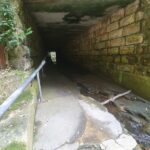
We then had an exciting detour through the tunnel at Gordon Creek. This would be impassable in rain but the water level was fine. Luckily there was a handrail to guide us! After exiting, a last uphill track before getting back to the road at Lindfield Station where we all dashed off after a hot but enjoyable day. On the walk, ably lead by Leah, were Dee, Francoise, Linda, Steve, Len, Tricia, Helen, Bryan, Richard, Molly, Connie, Geraldine, Elaine and Daniel.

Our Club for April 2021 is All Nations Bushwalkers

Come and explore the wonderful Australian bush with All Nations Bushwalkers. The Club visits beautiful national parks and wilderness areas around Sydney and further afield and has a graded series of walks, bike rides and water-based activities.

Most activities involve bushwalking in national parks within 100km of Sydney, including Blue Mountains, Ku-ring-gai Chase, Royal, Wollemi, Bouddi, Brisbane Waters, Dharug, Marramarra and Sydney Harbour national parks, or the parks and reserves of the NSW Southern Highlands and Illawarra regions.

All Nations Bushwalkers activities suit a wide range of fitness and experience levels. Most activities are day walks, ranging from easy to rather hard. There are also overnight camping trips and longer expeditions to destinations across Australia – bushwalking by day, enjoying the companionship of the campfire gathering at night! Club members also organise social activities, such as restaurant nights, cinema and art gallery visits, Christmas parties and various special outings.

Getting to club activities is easy – they generally meet at a train station and then car pool to the walking track. You won’t get lost and don’t need your own transport! Club members are men and women of all ages and nationalities from across the Sydney area.  You are welcome try a bushwalk walk first – choose a walk then contact the organiser for details. Visitors can try one walk for free before they’re expected to join. Membership starts from only $30 a year (for 3 years). Learn more


Floods Ignite Raising Warragamba Dam Wall Debate

In late March 2021 an extreme rain event on the Australian East Coast caused serious flooding which endangered people and property in many areas including the Hawkesbury-Nepean Valley on Sydney’s outskirts. The Hawkesbury-Nepean Valley flood highlighted the dangers of urban development in flood-prone areas given the high likelihood of more climate change-induced flood events in future.

The rain event and resulting floods have intensified debate on the controversial proposed 14 metre raising of Warragamba Dam Wall.  Many experts and conservationists contend that the most extreme floods are unlikely to be stopped by raising Warragamba Dam wall. Flooding in the Hawkesbury-Nepean Valley comes from other river/creek sources in addition to water flowing over Warragamba Dam wall. In addition the geography of the Hawkesbury-Nepean area restricts the amount of water that can flow out of the Valley.

The Colong Foundation for Wilderness states that the raised dam wall proposal is being driven by pressure from developers.  As part of the Warragamba Dam wall raising proposal, Infrastructure NSW plans to house an additional 134,000 people on the Hawkesbury-Nepean floodplain in coming decades. The Foundation states that people in new and existing residential developments in the Valley will not be safe from future extreme floods even if the Warragamba Dam wall were to be raised.

The Foundation states that the proposed dam wall raising will lead to flood water inundation of World Heritage listed Blue Mountains National Parks and wilderness streams and desecration of rare and ancient natural heritage and Indigenous cultural sites.

Adding weight to arguments against the raised dam wall proposal, the Australian Insurance Industry recently withdrew their support for the Proposal due to concerns over the probable loss of important cultural sites and natural habitat. The Industry suggested that the State Government should investigate alternative measures to mitigate flood risk in the Hawkesbury-Nepean Valley.

Alternative flood mitigation actions available to the State Government include improving floodplain evacuation routes such as the Castlereagh Connection, pre-emptive dam-water release water and relocating people in the most flood-prone areas. NSW Deputy Premier John Barilaro recently stated that alternatives to the dam wall raising need to be considered including lower water levels and building desalination plants for water supply.


0

Dalmeny-Narooma Bushwalkers – Eurobodalla Regional Botanical Gardens

Eurobodalla Regional Botanical Gardens Easy 6km walk, Dalmeny-Narooma Bushwalkers, Saturday 27th March 2021

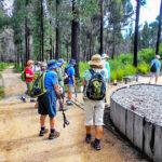
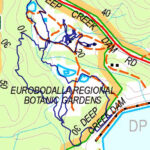
A recent Dalmeny Narooma Bushwalkers Club walk was an easy 6kms in Eurobodalla Regional Botanical Gardens. The Eurobodalla Regional Botanical Gardens are set on 42 hectares of Mogo State Forest, adjacent to Deep Creek Dam. The site has not been logged since the early years of the twentieth century and visitors can appreciate many of the region’s plants in a natural setting.  The Gardens has 8kms of beautiful public walking tracks which vary in length and gradient to cater for individual requirements and limitations.

It was a perfect day for the Club’s walk during which Margaret Lynch explained what was happening in the Gardens.  After the recent bushfires a lot of work has been completed and more is planned. The walkers were delighted to see the Gardens regrowth including many young green wattles which protect the undergrowth floor and let other native plants thrive.

The Club members walked 5.5km and had a look at Deep Creek Dam, for which a new lookout is planned. At the end of the walk Bev Brazel thanked Margaret for the walk on our behalf. Some walkers enjoyed lunch at the Cafe, some bought plants, and others had their lunch in the grounds. Overall all participants agreed that it was a very pleasant day.

Our Club of the Month for April 2021: Dalmeny-Narooma Bushwalkers

Our club of the month is Dalmeny-Narooma Bushwalkers who have been walking for 35 years. The Club meet at the Red Tractor, George Noble Park, Dalmeny, with a plywood tractor now used to represent the original to honour the Club’s history.

Dalmeny Narooma Bushwalkers was established in May 1986 to encourage bushwalking as a pleasant group activity. The Club welcomes new walkers to join in and enjoy the beautiful bush and coastal environments of the far south coast of NSW.

Volunteer walk leaders offer various grade bushwalks twice a week around the local area of Eurobodalla and Bega Valley, as well as club camps in other localities and some social activities. The Club aims to keep its procedures as simple and as affordable as possible but also has a few rules to keep all walkers safe in the bush. Walks are grouped into 3 programs a year – Autumn, Winter and Spring – and are published on the Club’s website.

0

A few words from the president – March 2021

As we head into what we all hope will be a better bushwalking year than 2020, I expect some of you are spending non-walking time pouring over maps, websites, books … making plans of hikes and trips that might or might not happen. There is a great joy in reading, thinking and planning about bushwalking and travelling, a joy only surpassed by actually getting out there and doing it!

I was recently browsing in my local bookshop when I stumbled (not a good bushwalker trait) upon a new book, The Ways of the Bushwalker. Something new, I pondered. No, I discovered, as I expect you already knew, that this is a 2020 update of the original 2007 book. Author Melissa Harper has done a marvellous job of updating her history of bushwalking in Australia. She helps us understand how bushwalking is the most popular way for Australians to engage with the bush. The book is a good reminder as to why so many people join bushwalking clubs and maintain their connection with the land. The core of this book, of course, are the people who make bushwalking what it is.

Also on my about-to-read pile is Kindred—A Cradle Mountain Love Story. Kate Legge’s account is of two early 20th century unconventional adventurers who, standing on top of Cradle Mountain, imagined a national park for all. They pioneered eco-tourism, probably long before such a word could even be conceived of, but never saw the vision completed. Their legacy is important, if for no more reason than the inspiration for generations after them to stand up and defend wilderness.

Talking of inspiration, anyone with an historic bent will delight in a book I got lost in last year. Dead Reckoning—Tales of the Great Explorers 1800-1900 brings the reader into the remarkable world of 19th century exploration and travel. Populated with characters undertaking truly mad enterprises, with varying degrees of success, the book reminds us just how unforgiving the world can be. Although our own bushwalking may seem rather tame in comparison to the travels of these explorers, any bushwalking reader will understand the drive behind these tales.

And to close, one final book to comment on, picked at random from my bookshelf: Barry Stone’s The 50 Greatest Walks of the World. This might be useful if you are heading to Britain to walk—fat chance this year—where it seems that most of the world’s greatest walks reside. Curiously, there are only two such walks in Australia: the Uluru Circuit and the Sydney Harbour Bridge Climb! At least New Zealand gets a true hike, the Milford Sound. All seems a bit minimalist compared to the seven-moth Appalachian Way and the thirty-five day Camino de Santiago. But then again, why complain when we all know that there are some of the greatest walks and hikes right here on our doorstep in New South Wales. Maybe we just keep the knowledge to ourselves?


Bill Boyd,

President

Bushwalking NSW Inc.

Keep exploring, be amazed!

The Walking Volunteers

Sydney Trackwatch

 The Walking Volunteers Inc. have been proof-walking, mapping and providing walking routes around Sydney to walkers for 17 years. They now have over 1,300 kilometres of walking routes on their map and hope to add another 200 kilometres in the next month after approval has been granted by various land managers.

However, keeping track of changes on the walking routes is becoming more of a challenge as the network increases. The Walking Volunteers want to thank the walkers and land managers (e.g. Councils, National Parks & Wildlife Service, Western Sydney Parklands Trust, etc.) who often advise them of new and changed paths and tracks. However, tracks and paths are often closed for essential infrastructure (e.g. sewage pumping stations, light rail, etc.) or damage from natural events. It may take several months before the Walking Volunteers find out about these closures and when they do, they are able to liaise with land managers and establish alternative routes which are immediately updated on their maps and, via the magic of the Internet, updated on walkers’ smartphones, tablets or PCs. However, finding out about changes may take months and, in the meantime, walkers find it very frustrating to find a walking route on the maps has been closed.

So, the Walking Volunteers are introducing a program called Sydney Trackwatch to discover any changes or closures to the walking routes on their maps as soon as possible. It is very simple and does not require filling out complicated forms. Just let the Walking Volunteers know (Email: info@walkingvolunteers.org.au or Phone: 4784 2002) immediately of any changes or closures on the walking routes shown on any of their maps (Sydney Walking Tracks, Walking Coastal Sydney, Great West Walk). Also, let them know of any alternative routes you used to bypass the problem area. They will immediately re-walk, re-map and put the alternative routes on their maps as well as follow up the organisation responsible to find out when the walking route will be re-opened. When it is re-opened, they will immediately re-walk the route and change it back to the original course.

A good example of this is North Head, where the Walking Volunteers changed the route on their maps after the intensive bushfire in October 2020 and are now liaising with Sydney Harbour National Park and Sydney Harbour Federation Trust to change back to the original route when the fire-damaged areas are re-opened to the public.

All it takes is a quick phone call or email to assist the Walking Volunteers and your fellow-walkers!


0

REMEMBRANCE at Splendour Rock 2021

At 6am on 25 April (ANZAC Day 2021) there will be a short ceremony of remembrance at Splendour Rock to recognise the thirteen fallen bushwalkers from WWII.  This will return the pattern of remembrance from at least 1992.  Every year since then (and perhaps even 1990 but there is insufficient evidence) on ANZAC Day there has been a Dawn Service of remembrance at Splendour Rock.  Naturally, due to the pandemic, there was no dawn service in 2020.

Bushwalkers who have previously been to Splendour Rock for ANZAC Day will know that Mt Dingo is a dry campsite that can be subject to high winds.  However, when the weather is right overnight camping on Mt Dingo can be an unforgettable experience.  Splendour Rock is in the Wild Dog Mountains whose nearest access is the Dunphy Carpark at the end of the Megalong Valley Road from Blackheath.

It is now an NP&WS requirement that you must REGISTER your intention to camp overnight in a National Park of NSW.  Please be COVID safe in your camping.  More information can be found here – camping 

The memorial plaque at Splendour Rock was installed in February 1948 by a combined group of Sydney Bush Walkers (SBW) and Coast & Mountain Walkers (CMW).  The plaque was dedicated on the following ANZAC Day.  Both clubs each lost four (4) members while the YMCA Ramblers Bushwalking Club lost two (2) members.  Three other bushwalking clubs each lost one member being the Campfire Club, Rucksack Club plus the Trampers Club.  Background details for all of these fallen service personnel can be found on the Bushwalking NSW (BNSW) website – here.

The Jack Mundey Spirit Lives On

Peter Stevens, a past President of the Wolli Creek Preservation Society, has been
honoured by Canterbury-Bankstown Council with its inaugural Jack Mundey Environment
and Heritage Award.


“This is recognition of Peter’s long-term commitment to the completion of the Wolli
Creek Regional Park, established and grown as the result of community pressure, led by
the Society, over several decades.’ said Gina Svolos, the present President of the Society.

“The Park is now nearing completion and Peter has renewed his commitment by
organising to protect the Wolli Creek Valley bushland and the Regional Park from the
proposed location of an industrial plant within the Park boundaries. The proposal would
have negative effects on both the natural environment and a heritage-listed structure,
the two things cited in the Award, and for which Jack Mundey as an initiator of Green
Bans is rightly famous.”

“There is a better alternative nearby: a vacant, government-owned, non-bushland site,
outside the Park boundaries that we want Sydney Water to use.” Ms Svolos emphasised.
Mr Stevens reports that, working with the Nature Conservation Council of NSW, the
Society’s petition to the Minister for Water, Melinda Payne, passed 3,000 signatures on
February 10 and is still growing.

“That is a thousand signatures a week since its launch,” Mr Stevens said, “and over 100
of these are from interstate and many more from regional NSW and urban areas remote
from the Wolli Creek Valley. Which goes to show that while people may leave the Valley,
the Valley does not leave their memory or their concern.”

See here to sign the petition.

Contact: Gina Svolos President 0431 308 303
Media Contact: Peter Stevens 0412 596 874

0

Patoneys A Different Way

Patoneys A Different Way, Capertee Valley, NSW, 19-20 Sept 2020 by Rachel Grindlay

Given how much of my time I spend looking at National Parks alerts and advising other people about closures it is somewhat ironic I failed to check all of the relevant closures information for a trip I had on the Spring Program. A couple of weeks before the trip was scheduled we drove past the access road I was planning on using. There were “STOP, CLOSED” signs – it looked like I might have a problem. At home I looked at the map to find that the road access and part of my walk were in Ben Bullen and Wolgan State Forests. Both had been closed since December so the chances of them reopening in the next two weeks were remote.

Somewhat despondent, my initial reaction was to cancel the walk. But then I felt guilty for the people who had signed up. Scouring the map I was surprised to see how many different directions Pantoneys Crown could be accessed from. Point Cameron was definitely out of the picture since Mt Jamison and McLeans Pass are in Wolgan State Forest. But a new route started to form before me, taking in some map features which had caught my attention in the past – Tarpeian Rock and Moffitts Pagodas.

The new route had the definite advantage that I didn’t need to worry about the condition of the road, and the associated issues with carpooling and Covid. The party composition changed a little with the change of route but eventually six of us convened at the start of the Moffitt Trail bright and early on Saturday morning.

A quick survey confirmed no one was a sadist with the desire to walk an extra 2km of fire trail at the start and end of the trip. We piled into two cars for a quick drive along Moffitt Trail to cut off some walking. Parking where we planned to pop out at the end left us 3km of fire trail before we left any semblance of a trail behind for the rest of the trip.

The ridge towards Tarpeian Rock was a maze of pagodas. We took some of our navigation from Beyonce (“To the left, to the left”), though at one point we were pushed quite a way right before we found a way up through the fortress of pagodas. Finding our way back to the western cliff line, a bit of exposed scrambling and a jump got us onto Tarpeian Rock for morning tea. It was a sunny, still day, warmer than most of us had expected. The next point north had an impressive rock outcrop at the end which gave plenty more photo opportunities before we hit a flat, open section of ridge to take us quickly towards Baal Bone Point.

Our lunch spot had impressive views of Pantoneys Crown and the Red Rocks – where two-thirds of the party had walked only two weeks earlier. We marvelled at the patchwork nature of the fire patterns – some sections in the valley looked like a blowtorch had been put to them, yet they were surrounded by areas where the canopy hadn’t burnt.

After lunch was where the real fun started – the scramble off Baal Bone Point – I feel like the same logs have been in place for many years to assist with the descent – luckily unburnt. There were plenty of orchids in flower to slow the botanists down, but we eventually got to the base of the South Pass onto Pantoneys.

Only one member of the party hadn’t been to Pantoneys previously, though it was the first time going up the South Pass for two in the group. We made short work of it with everyone scrambling up without issue – other than a couple of frights from a Blue-Tongue Lizard sitting in a wedge we wanted to use as a handhold! We hauled packs at the top of the lower section and then squeezed around to the left avoiding the final awkward chimney climbs.

After setting up camp most of us went looking for the fabled water source. I had some vague directions, and indications from looking at the aerials, and with the amount of rain there had been in the last few months I figured if we didn’t find water this trip it probably didn’t exist. Tom led us straight into a little canyon which had flowing water and a small pool! This was great news as I think the hot day had caught most of us a little short on the water front. After filling up we squeezed down the canyon to the cliff edge where we took in the views.

The colour palette of grey was used for sunset, but the views were still impressive. Our earlier rehab work on the fire ring had shrunk it to about a quarter of its original size, which still gave us a very cheery fire for the evening. The knowledge of a water source made us profligate with the water we had. Two party members carelessly tipped their boiling billies on the ground – fortunately only one billy also contained dinner. Right on 9pm the first spots of rain started which seemed like a good cue to head for bed.

The weather forecast was pretty accurate; we woke to a steady downpour which meant breakfast was a solitary affair as everyone huddled in their shelters. Fortunately at about 8am it eased off and we all leapt out and with amazing timing were ready to go right on 8:30am.

The views as we traversed Pantoneys were non-existent as we wandered along in the mist. Tom initially wouldn’t believe me when I said we were at the northern point! I said he was welcome to keep walking if he could find some ground to continue on – fortunately he decided I was probably right and didn’t walk off the edge of a cliff.

The top of the North Pass was located without difficulty. The collective memories of the 5 of us who’d been there before were found wanting. No one could really remember the middle scramble of the North Pass. To the extent that there was some accusations of us not being on the normal route! Everything was wet which upped the difficulty level and we used the tape on both the middle and lower scrambles. Our memories returned on the lower scramble – it was indeed the normal route.

The rest of the day we would be in the realm of exploratory adventuring. Following the cliffline of the western side of the Crown proved relatively straight-forward. The visibility was still low so we couldn’t see anything except the impressive cliff lines looming into the mist above us. By late morning we were back where we were early afternoon the day before – below the southern pass.

Opting against a second lap we descended to the saddle and then had to work out how best to negotiate the myriad spurs and creek lines which would lead us to Coco Creek. I opted for a ‘straight line’ approach rather than trying to contour. As usual 20m contours hide a wealth of lumps and bumps and we were surprised as the rock turned from sandstone to quartzite. It felt like we’d been transported to Kanangra rather than Gardens of Stone.

The minor creeks were steep enough that we had to work a bit to get across them, but Coco Creek was the biggest surprise. A rocky narrow quartzite spine led us down just above a roaring waterfall. Jon appeared to be a little disappointed we didn’t have to swim across the large pool at the bottom instead conveniently being able to rock hop across at the bottom of the spur. It’s not many Pantoneys walks which feature a waterfall!

From there we had a couple of steep climbs to get us onto to the Moffitts Pagoda ridge. It was an impressive ridge line, with equally impressive views. The weather cleared as we got near the top and so it was a slow meander along the ridge as every few hundred metres there was another view, different light on Pantoneys and we spent time savouring it all.

Once we got to Moffitts Pagodas some of the party climbed on top, while others walked out to the point to take in our final views of this amazing part of NSW. From there it was just a few hundred metres back to our cars. The drive out had a couple of nervous sections – where rain and traffic had caused some slush to form and we weren’t exactly in control as we slid down the hill back to the rest of the cars.

Everyone was very complimentary on my replacement route – I’d like to take the credit but while there’s some skill picking a route on the map, there’s also a lot of luck in how things pan out on the ground. Be assured it’s not every exploratory trip where everything goes pretty much perfectly! Always come armed with a sense of adventure (and a well charged torch).