Comerang Mountain, Dampier State Forest, Sunday 21 February 2021, Walk Report by Rob Lees, Batemans Bay Bushwalkers
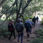
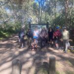
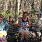
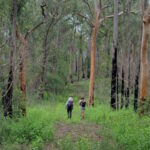
Seven hikers from Batemans Bay Bushwalkers set off on an exploratory walk to visit interesting geology seen on aerial photography in the creeks downslope from Comerang Mountain.
By definition an exploratory walk has not been reccied. However, we do examine topographic maps beforehand to evaluate terrain and access roads and to estimate a walk time and route. This is very important so club members can decide if this walk is compatible with their abilities and expectations.
Notwithstanding our best efforts, the reality once on the walk can often be very different!
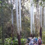
The first thing we discovered was that B-Travers road (a well-used mountain bike road before the 2020 bushfires) had not been cleared of fallen trees. As we had hoped to drive our vehicles along this road, our walk was increased by 2km just to get to the starting point.
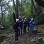
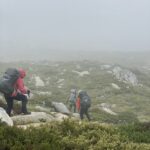
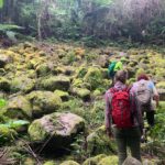
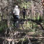
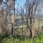
I had also proposed to use a number of other logging roads to get best access to the creeks. However we also found out once on site that these roads had not been used in decades. This made navigation difficult due to the forest regrowth and fire damage.
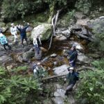
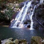
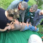
However once we finally made it to the creeks it was worth the effort as everyone was pleased with the spectacular geology, waterfalls and ponds. We noticed that the ancient volcanic rocks were highly fractured and very resistant to erosion which created the spectacular scenery. To our delight, in one pool we saw an eel and many small fish.
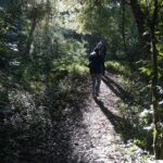
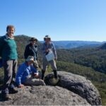
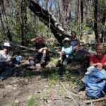
As walk leader I quickly realised we were not going to be able to visit all the outcrops that I had hoped to see and so we headed back upslope to Comerang Mountain. We knew the climb was going to be tough given the high humidity and temperatures that exceeded all projections. After the ascent, and with only 3kms remaining down a flat trail, we seven weary hikers were happy but also very glad that we would soon see our cars!
I will plan another exploratory walk in the winter that will go straight to the larger outcrops via a different route. I am hopeful that the scenery will be even more spectacular than what we experienced on the Comerang Mountain walk today.
Our Club of the Month: Batemans Bay Bushwalkers
Our club of the month Batemans Bay Bushwalkers are a crew of around 200 members, who have the shared goal of finding, exploring and enjoying the natural secrets of the national parks and forests of the NSW South Coast. First formed in 1985, Batemans Bay Bushwalkers are not-for-profit and run by volunteers.
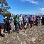
Batemans Bay Bushwalkers publishes 4 Walks Programs per year, with 2 walks a week of varying grades. Visitors are covered by insurance for 3 walks each financial year to allow them to come and try Club walks. Walks are led by volunteer Walk Leaders, who carry a GPS, topographic map, and when appropriate, a safety beacon. Walk are graded according to difficulty so members can choose walks to suit their level of ability.
Batemans Bay Bushwalkers club members also get together for a variety of social activities and camps.
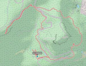
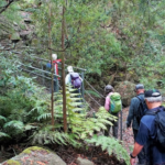
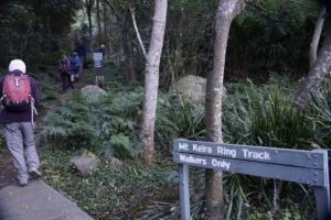 Once at the ring track we took the right fork to commence our anticlockwise circuit of the mountain. A lot of track improvements such as boardwalk installation and repair of steps has been completed allowing reopening of the ring track after past rock slides.
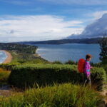
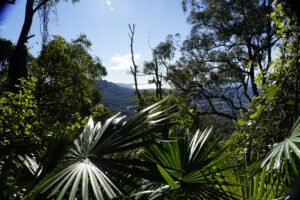 After another 400m the track touches the road again and we prepared to climb up the 100 odd steps to take us up to the next level section of the track through board walked rainforest then up another 296 steps where some nice views through the tree canopy to the north west were awaiting us, nearly an hour and a quarter into our walk.
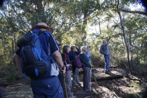 Then we followed the ring track downhill glimpsing the archery range located across from Byarong Park.